
|
At the Edge
- Click the image above for a larger view
- Full-Res JPEG (1167 x 2582) (249.6 kB)
- Full-Res TIFF (1167 x 2582) (2.5 MB)
Caption:
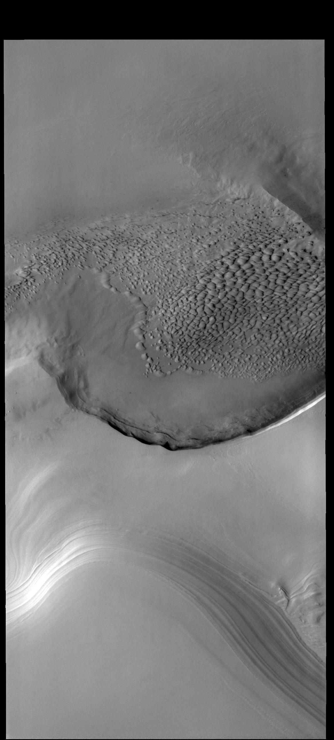
Context image
Today's VIS image is located on the edge of the polar cap. The ice is located at the bottom of the frame, with the surrounding plains at the top half. The circular indentation in the ice margin is affecting the local winds, creating an area of sand dunes.
Orbit Number: 77798 Latitude: 83.5651 Longitude: 119.91 Instrument: VIS Captured: 2019-06-29 05:11
Background Info:
Please see the THEMIS Data Citation Note for details on crediting THEMIS images.
NASA's Jet Propulsion Laboratory manages the 2001 Mars Odyssey mission for NASA's Science Mission Directorate, Washington, D.C. The Thermal Emission Imaging System (THEMIS) was developed by Arizona State University, Tempe, in collaboration with Raytheon Santa Barbara Remote Sensing. The THEMIS investigation is led by Dr. Philip Christensen at Arizona State University. Lockheed Martin Astronautics, Denver, is the prime contractor for the Odyssey project, and developed and built the orbiter. Mission operations are conducted jointly from Lockheed Martin and from JPL, a division of the California Institute of Technology in Pasadena.
Cataloging Keywords:
| Name | Value | Additional Values |
|---|---|---|
| Target | Mars | |
| System | ||
| Target Type | Planet | |
| Mission | 2001 Mars Odyssey | |
| Instrument Host | Mars Odyssey | |
| Host Type | Orbiter | |
| Instrument | Thermal Emission Imaging System (THEMIS) | |
| Detector | ||
| Extra Keywords | Dune, Grayscale, Thermal | |
| Acquisition Date | ||
| Release Date | 2019-08-07 | |
| Date in Caption | 2019-06-29 | |
| Image Credit | NASA/JPL-Caltech/ASU | |
| Source | photojournal.jpl.nasa.gov/catalog/PIA23383 | |
| Identifier | PIA23383 | |