|
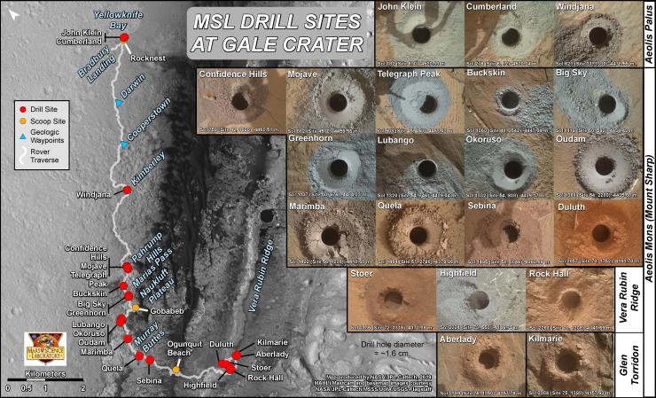
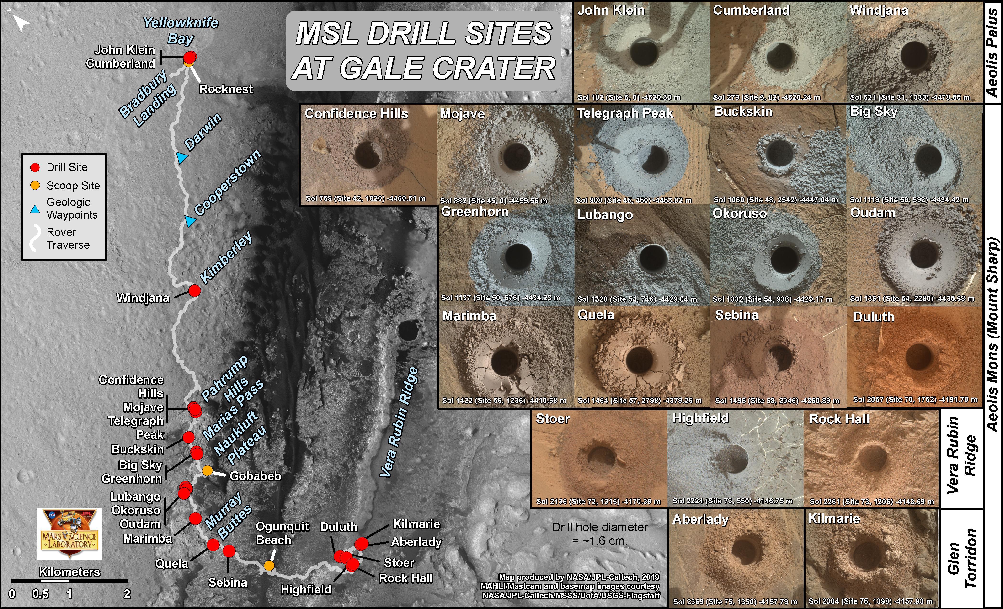
Curiosity’s 21 Drill Holes on Mars
- Click the image above for a larger view
- Full-Res JPEG (4200 x 2550) (2.6 MB)
- Full-Res TIFF (4200 x 2550) (25.5 MB)
Caption:
This graphic maps locations of the sites where NASA's Curiosity Mars rover collected its rock and soil samples for analysis by laboratory instruments inside the vehicle. It also presents images of the drilled holes where 21 rock-powder samples were acquired.
The diameter of each drill hole is about 0.6 inch (1.6 centimeters), slightly smaller than a U.S. dime. The images used here are raw color, as recorded by the rover's Mars Hand Lens Imager (MAHLI) camera. Notice the differences in color of the material at different drilling sites.
For the map, north is toward upper left corner. The scale bar represents 2 kilometers (1.2 miles). The base map is from the High Resolution Imaging Science Experiment (HiRISE) camera on NASA's Mars Reconnaissance Orbiter.
Background Info:
MAHLI was built by Malin Space Science Systems, San Diego. NASA's Jet Propulsion Laboratory, a division of Caltech Pasadena, California, manages the Mars Science Laboratory Project for the NASA Science Mission Directorate, Washington. JPL designed and built the project's Curiosity rover.
Cataloging Keywords:
| Name | Value | Additional Values |
|---|---|---|
| Target | Mars | |
| System | ||
| Target Type | Planet | |
| Mission | Mars Science Laboratory (MSL) | Mars Reconnaissance Orbiter (MRO) |
| Instrument Host | Curiosity Rover | Mars Reconnaissance Orbiter |
| Host Type | Rover | Orbiter |
| Instrument | High Resolution Imaging Science Experiment (HiRISE) | Mars Hand Lens Imager (MAHLI) |
| Detector | ||
| Extra Keywords | Color, Map | |
| Acquisition Date | ||
| Release Date | 2019-08-22 | |
| Date in Caption | ||
| Image Credit | NASA/JPL-Caltech/MSSS/Univ. of Arizona | |
| Source | photojournal.jpl.nasa.gov/catalog/PIA23413 | |
| Identifier | PIA23413 | |