|
The Bedrock Riddles of Nili Fossae
- Click the image above for a larger view
- Full-Res JPEG (2880 x 1800) (866.0 kB)
- Full-Res TIFF (2880 x 1800) (15.6 MB)
Caption:
Map Projected Browse Image
Click on image for larger version
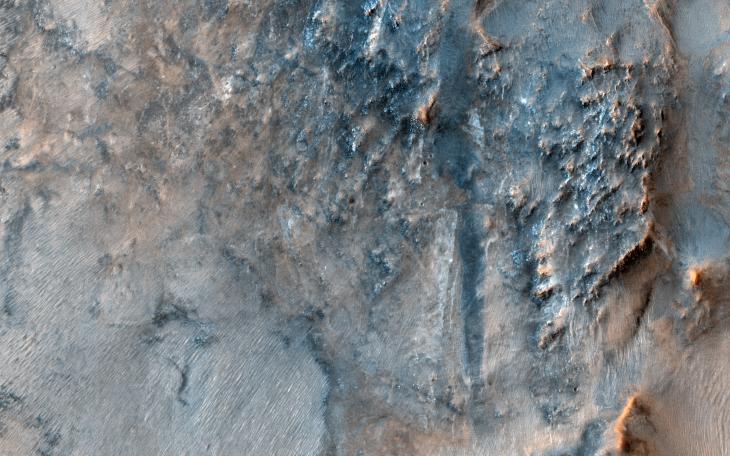
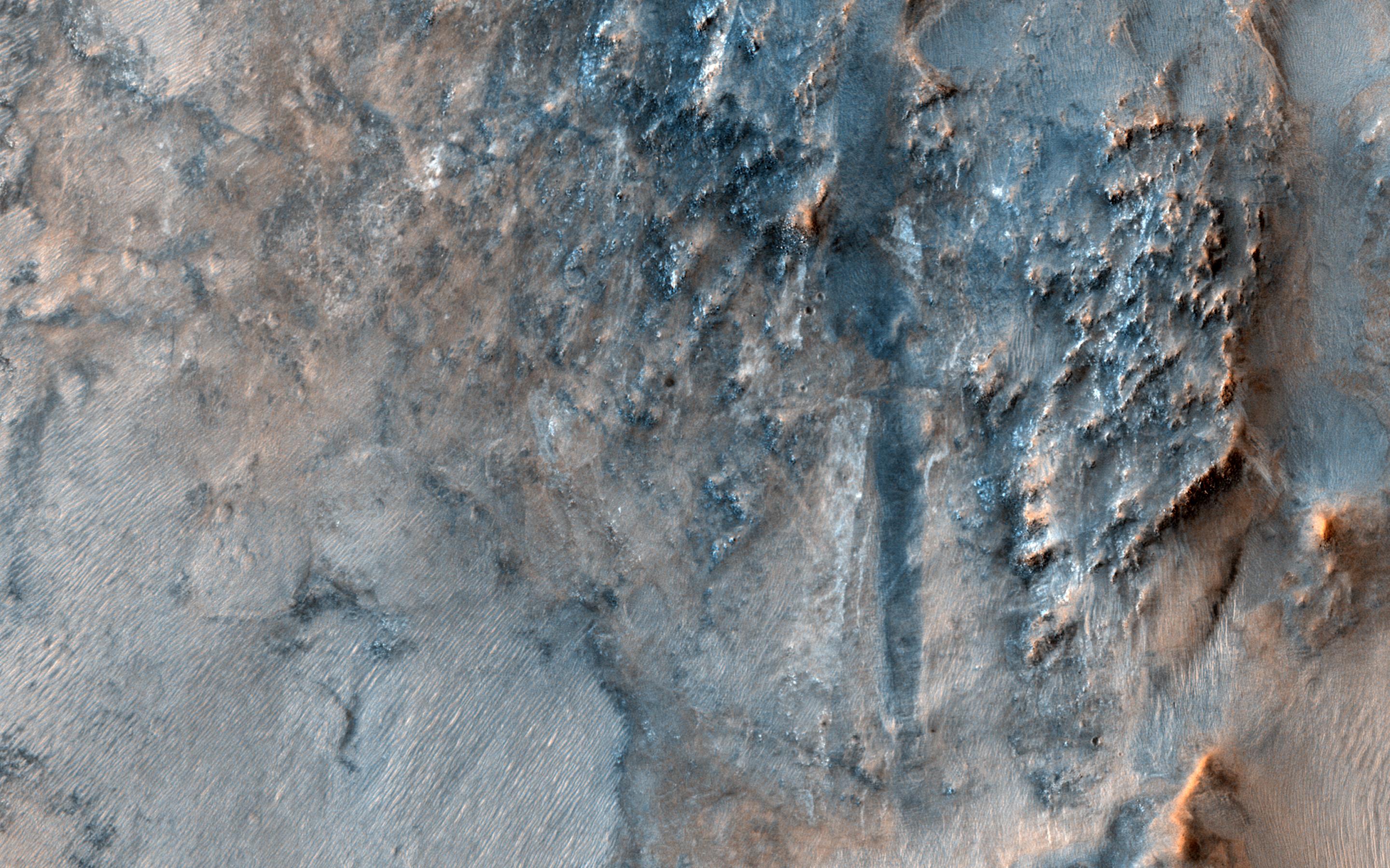
This image of the Nili Fossae region, to the west of the great Isidis basin, shows layered bedrock with many impact craters.
Nili Fossae is one of the most mineralogically important sites on Mars . Remote observations by the infrared spectrometer onboard MRO (called CRISM) suggest the layers in the ancient craters contain clays, carbonates, and iron oxides, perhaps due to hydrothermal alteration of the crust. However, the impact craters have been degraded by many millions of years of erosion so the original sedimentary, impact ejecta, or lava flows are hard to distinguish.
The bright linear features are sand dunes, also known as "transverse aeolian dunes," because the wind direction is at ninety degrees to their elongated orientation. This shows that the erosion of Nili Fossae continues to the present day with sand-sized particles broken off from the local rocks mobilized within the dunes.
The map is projected here at a scale of 50 centimeters (19.7 inches) per pixel. (The original image scale is 56.6 centimeters [22.3 inches] per pixel [with 2 x 2 binning]; objects on the order of 170 centimeters [66.9 inches] across are resolved.) North is up.
Background Info:
The University of Arizona, in Tucson, operates HiRISE, which was built by Ball Aerospace & Technologies Corp., in Boulder, Colorado. NASA's Jet Propulsion Laboratory, a division of Caltech in Pasadena, California, manages the Mars Reconnaissance Orbiter Project for NASA's Science Mission Directorate, Washington.
Cataloging Keywords:
| Name | Value | Additional Values |
|---|---|---|
| Target | Mars | |
| System | ||
| Target Type | Planet | |
| Mission | Mars Reconnaissance Orbiter (MRO) | |
| Instrument Host | Mars Reconnaissance Orbiter | |
| Host Type | Orbiter | |
| Instrument | High Resolution Imaging Science Experiment (HiRISE) | Compact Reconnaissance Imaging Spectrometer for Mars (CRISM) |
| Detector | ||
| Extra Keywords | Color, Crater, Dune, Impact, Infrared, Map, Thermal | |
| Acquisition Date | ||
| Release Date | 2019-09-05 | |
| Date in Caption | ||
| Image Credit | NASA/JPL-Caltech/University of Arizona | |
| Source | photojournal.jpl.nasa.gov/catalog/PIA23452 | |
| Identifier | PIA23452 | |