|
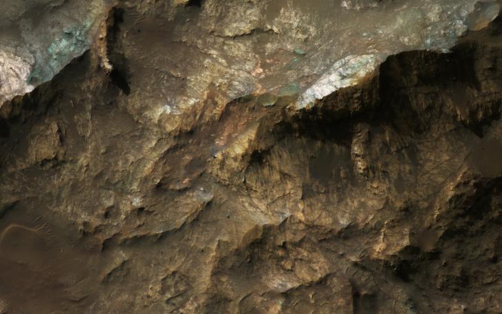
Mars Underground Exposed: The Central Peak of Alga Crater
- Click the image above for a larger view
- Full-Res JPEG (2880 x 1800) (658.9 kB)
- Full-Res TIFF (2880 x 1800) (15.3 MB)
Caption:
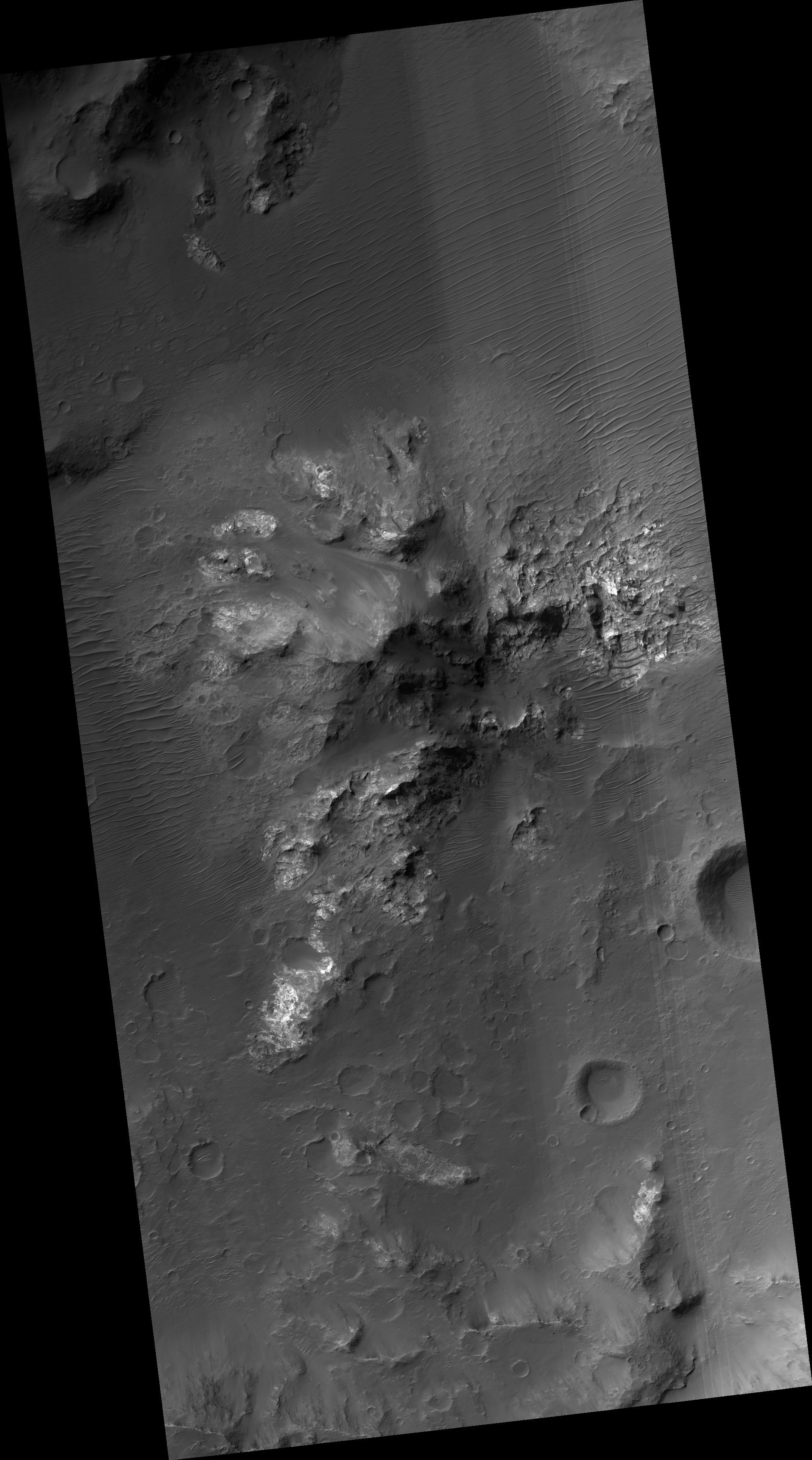
Map Projected Browse Image
Click on image for larger version
The most habitable places on Mars now and in the past are underground, where water is or was much more stable than at the surface and protected from energetic particle radiation.
Large impact craters have central rebounds that uplift buried strata from miles below the surface. Often these central uplifts reveal colorful rocks with diverse minerals, including ones altered by prolonged contact with water.
Alga Crater is located in the southern highlands near a large flood-channel called Ladon Valles. The image cutout shows enhanced (infrared-shifted) color .
The map is projected here at a scale of 25 centimeters (9.8 inches) per pixel. (The original image scale is 25.8 centimeters [10.2 inches] per pixel [with 1 x 1 binning]; objects on the order of 77 centimeters [30.3 inches] across are resolved.) North is up.
Background Info:
The University of Arizona, in Tucson, operates HiRISE, which was built by Ball Aerospace & Technologies Corp., in Boulder, Colorado. NASA's Jet Propulsion Laboratory, a division of Caltech in Pasadena, California, manages the Mars Reconnaissance Orbiter Project for NASA's Science Mission Directorate, Washington.
Cataloging Keywords:
| Name | Value | Additional Values |
|---|---|---|
| Target | Mars | |
| System | ||
| Target Type | Planet | |
| Mission | Mars Reconnaissance Orbiter (MRO) | |
| Instrument Host | Mars Reconnaissance Orbiter | |
| Host Type | Orbiter | |
| Instrument | High Resolution Imaging Science Experiment (HiRISE) | |
| Detector | ||
| Extra Keywords | Color, Crater, Impact, Infrared, Map, Water | |
| Acquisition Date | ||
| Release Date | 2019-09-19 | |
| Date in Caption | ||
| Image Credit | NASA/JPL-Caltech/University of Arizona | |
| Source | photojournal.jpl.nasa.gov/catalog/PIA23479 | |
| Identifier | PIA23479 | |