|
Looking for Slope Streaks
- Click the image above for a larger view
- Full-Res JPEG (2880 x 1800) (560.9 kB)
- Full-Res TIFF (2880 x 1800) (5.2 MB)
Caption:

Map Projected Browse Image
Click on image for larger version
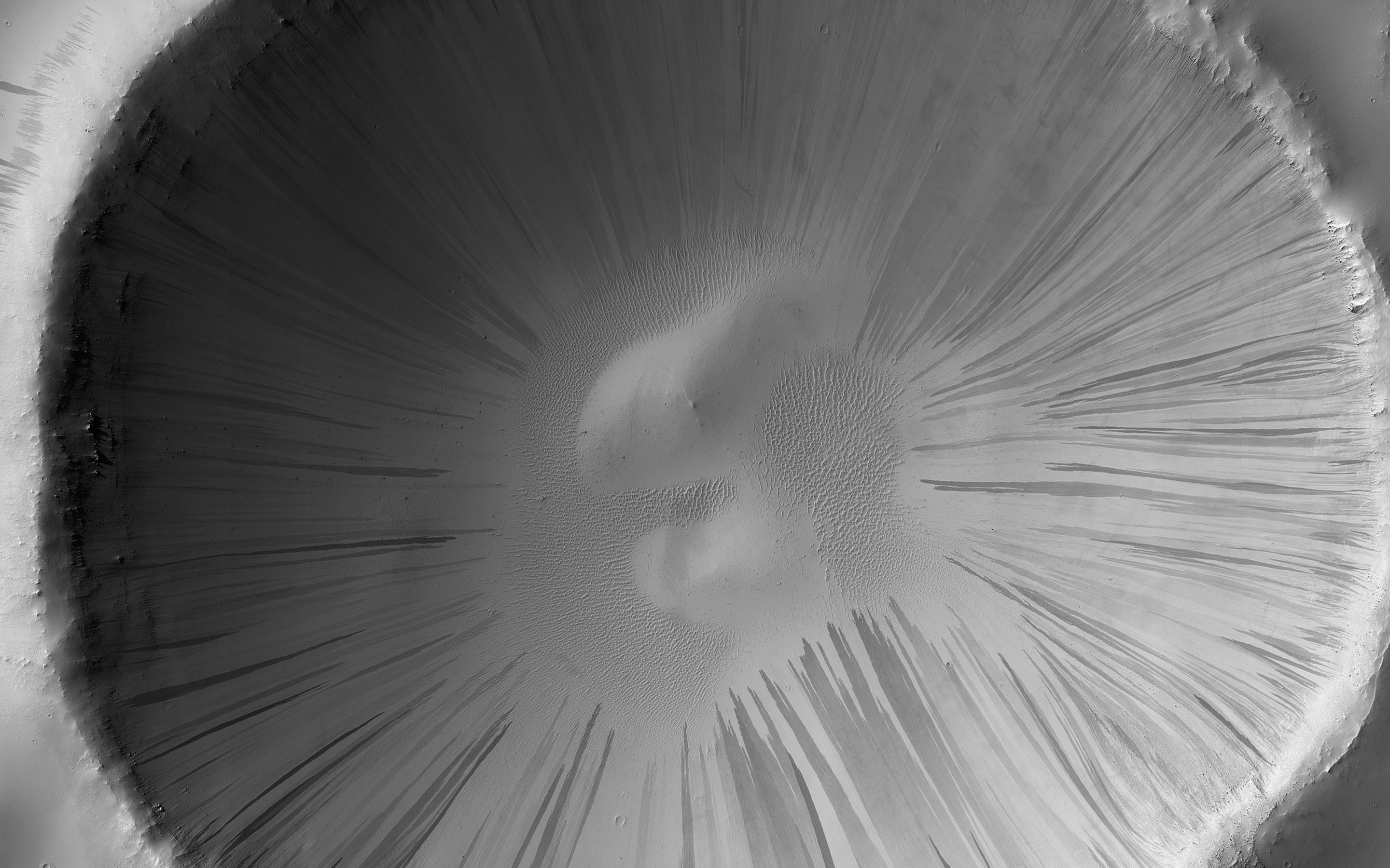
Dust and sand slide down slopes on Mars in little avalanches. Dark slope streaks are thought to be the result of the relatively bright colored dust avalanching down slopes, revealing the darker, coarser sand underneath.
This image is the latest in a sequence of images of this crater that started in 2013. The goal is to watch the dusty slopes, and try to understand more about the processes that drive these little avalanches.
An animation shows this sequence of 14 images taken over seven Earth years (about 3 and a half Mars years), and shows where new streaks have occurred on the slopes of this crater. The shape of the crater's rim appears to "wobble" because the spacecraft looks at the crater from slightly different directions. This could be corrected by creating a 3D terrain model and properly projecting each image onto it.
The map is projected here at a scale of 50 centimeters (19.7 inches) per pixel. (The original image scale is 54.0 centimeters [21.3 inches] per pixel [with 2 x 2 binning]; objects on the order of 162 centimeters [63.8 inches] across are resolved.) North is up.
Background Info:
The University of Arizona, in Tucson, operates HiRISE, which was built by Ball Aerospace & Technologies Corp., in Boulder, Colorado. NASA's Jet Propulsion Laboratory, a division of Caltech in Pasadena, California, manages the Mars Reconnaissance Orbiter Project for NASA's Science Mission Directorate, Washington.
Cataloging Keywords:
| Name | Value | Additional Values |
|---|---|---|
| Target | Mars | |
| System | ||
| Target Type | Planet | |
| Mission | Mars Reconnaissance Orbiter (MRO) | |
| Instrument Host | Mars Reconnaissance Orbiter | |
| Host Type | Orbiter | |
| Instrument | High Resolution Imaging Science Experiment (HiRISE) | |
| Detector | ||
| Extra Keywords | Color, Crater, Dust, Map | |
| Acquisition Date | ||
| Release Date | 2020-03-20 | |
| Date in Caption | ||
| Image Credit | NASA/JPL-Caltech/University of Arizona | |
| Source | photojournal.jpl.nasa.gov/catalog/PIA23757 | |
| Identifier | PIA23757 | |
