|
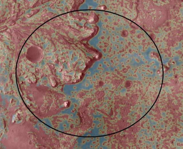
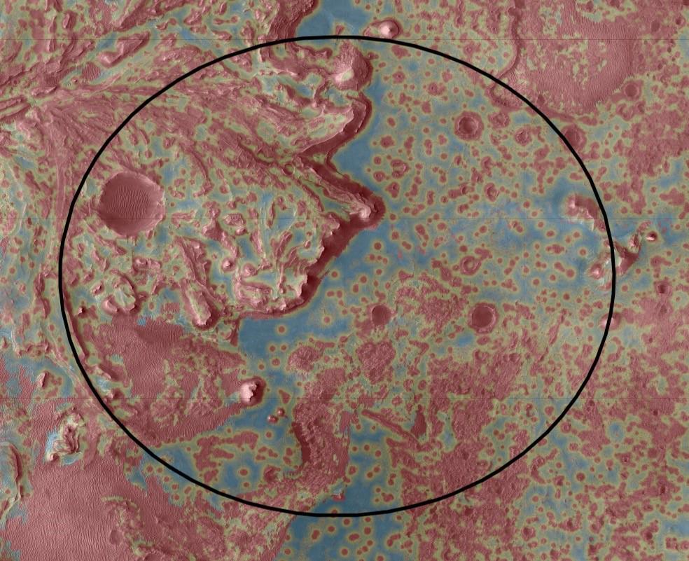
Jezero’s Hazard Map
- Click the image above for a larger view
- Full-Res JPEG (984 x 801) (152.2 kB)
- Full-Res TIFF (984 x 801) (2.4 MB)
Caption:
The Mars 2020 Perseverance rover will rely on data depicted in this Hazard Map to help guide it to a safe landing. Landing hazards are depicted in red; safer areas are colored blue and green. To select the best location to touch down while avoiding damage to the rover, the spacecraft's Terrain-Relative Navigation system will take images of the terrain below as Perseverance descends through the atmosphere. Computers aboard the rover will then compare these images with its onboard map — the best ever created for a space mission — and adjust course as needed.
Terrain-Relative Navigation has enabled the mission to select Jezero Crater as its landing site. Scientists believe an ancient river flowed into a lake there and deposited sediments in a fan shape known as a delta. Such an environment was likely to have preserved signs of any life that gained a foothold billions of years ago. But while the region has high astrobiological potential, it is also very hazardous, with dunes, cliffs and boulder-strewn areas that pose a huge challenge for landing.
Background Info:
NASA's Jet Propulsion Laboratory in Southern California built and manages operations of the Mars 2020 Perseverance rover for NASA.
For more information about the mission, go to https://mars.nasa.gov/mars2020/ .
Cataloging Keywords:
| Name | Value | Additional Values |
|---|---|---|
| Target | Mars | |
| System | ||
| Target Type | Planet | |
| Mission | Mars 2020 | |
| Instrument Host | Perseverance | |
| Host Type | Rover | |
| Instrument | ||
| Detector | ||
| Extra Keywords | Atmosphere, Color, Crater, Dune, Map | |
| Acquisition Date | ||
| Release Date | 2021-02-17 | |
| Date in Caption | ||
| Image Credit | NASA/JPL-Caltech | |
| Source | photojournal.jpl.nasa.gov/catalog/PIA24167 | |
| Identifier | PIA24167 | |