
|
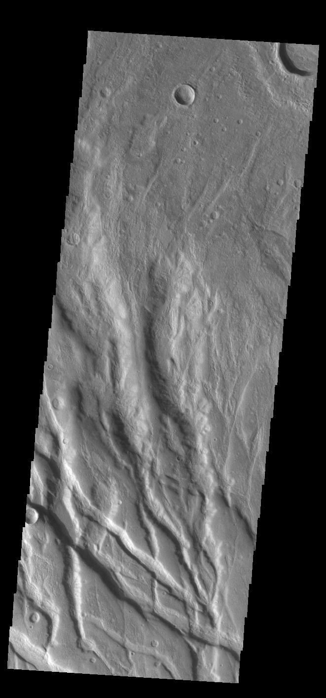
Claritas Fossae
- Click the image above for a larger view
- Full-Res JPEG (661 x 1414) (99.0 kB)
- Full-Res TIFF (661 x 1414) (713.1 kB)
Caption:
Context image
Today’s VIS image shows part of Claritas Fossae. These graben filled highlands are bounded by Solis Planum to the northeast and Icaria Planum to the southwest. The linear features (fossae) are graben, a tectonic feature created when blocks of material subside between paired faults. Extensional tectonic forces are responsible for graben formation. While close to the Tharsis region, it is thought that Claritas Fossae formed prior to the large lava flows located north of this image.
Orbit Number: 83503 Latitude: -40.434 Longitude: 274.364 Instrument: VIS Captured: 2020-10-10 22:06
Background Info:
Please see the THEMIS Data Citation Note for details on crediting THEMIS images.
NASA's Jet Propulsion Laboratory manages the 2001 Mars Odyssey mission for NASA's Science Mission Directorate, Washington, D.C. The Thermal Emission Imaging System (THEMIS) was developed by Arizona State University, Tempe, in collaboration with Raytheon Santa Barbara Remote Sensing. The THEMIS investigation is led by Dr. Philip Christensen at Arizona State University. Lockheed Martin Astronautics, Denver, is the prime contractor for the Odyssey project, and developed and built the orbiter. Mission operations are conducted jointly from Lockheed Martin and from JPL, a division of the California Institute of Technology in Pasadena.
Cataloging Keywords:
| Name | Value | Additional Values |
|---|---|---|
| Target | Mars | |
| System | ||
| Target Type | Planet | |
| Mission | 2001 Mars Odyssey | |
| Instrument Host | Mars Odyssey | |
| Host Type | Orbiter | |
| Instrument | Thermal Emission Imaging System (THEMIS) | |
| Detector | ||
| Extra Keywords | Grayscale, Thermal | |
| Acquisition Date | ||
| Release Date | 2020-12-03 | |
| Date in Caption | 2020-10-10 | |
| Image Credit | NASA/JPL-Caltech/ASU | |
| Source | photojournal.jpl.nasa.gov/catalog/PIA24259 | |
| Identifier | PIA24259 | |