
|
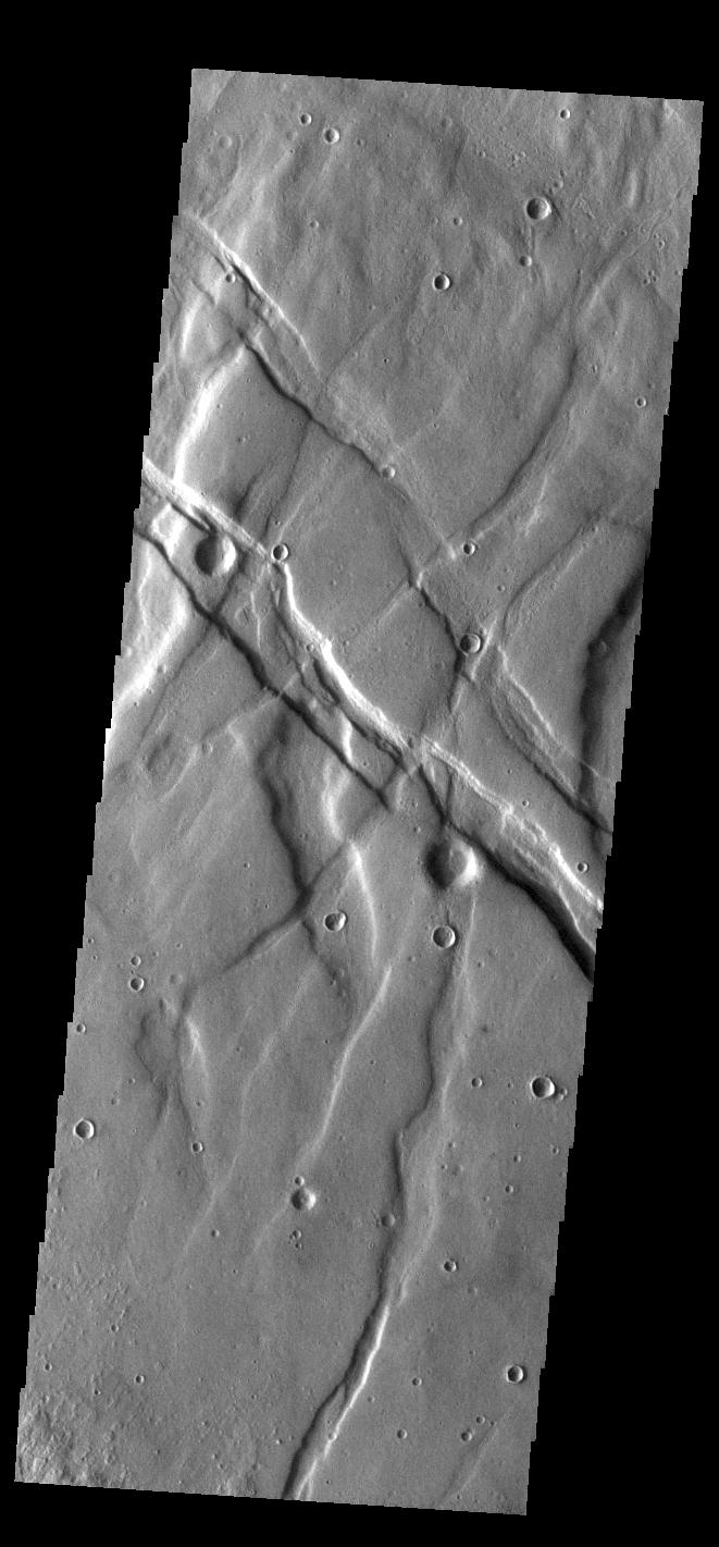
Claritas Fossae
- Click the image above for a larger view
- Full-Res JPEG (661 x 1421) (103.7 kB)
- Full-Res TIFF (661 x 1421) (714.1 kB)
Caption:
Context image
Located between the lava plains of Daedalia Planum and Solis Planum, Claritas Fossae is a graben filled highland. Graben are formed by tectonic activity, where extensional forces stretch the surface allowing blocks of material to slide down between paired faults. These linear grabens are termed fossae. This region of Mars had very active tectonism and volcanism, resulting in the huge volcanos like Arsia Mons and deep chasmata of Valles Marineris. Claritas Fossae was formed prior to the large lava flows of the Tharsis region.
Orbit Number: 84439 Latitude: -41.4956 Longitude: 272.168 Instrument: VIS Captured: 2020-12-26 23:43
Background Info:
Please see the THEMIS Data Citation Note for details on crediting THEMIS images.
NASA's Jet Propulsion Laboratory manages the 2001 Mars Odyssey mission for NASA's Science Mission Directorate, Washington, D.C. The Thermal Emission Imaging System (THEMIS) was developed by Arizona State University, Tempe, in collaboration with Raytheon Santa Barbara Remote Sensing. The THEMIS investigation is led by Dr. Philip Christensen at Arizona State University. Lockheed Martin Astronautics, Denver, is the prime contractor for the Odyssey project, and developed and built the orbiter. Mission operations are conducted jointly from Lockheed Martin and from JPL, a division of the California Institute of Technology in Pasadena.
Cataloging Keywords:
| Name | Value | Additional Values |
|---|---|---|
| Target | Mars | |
| System | ||
| Target Type | Planet | |
| Mission | 2001 Mars Odyssey | Mariner |
| Instrument Host | Mars Odyssey | |
| Host Type | Orbiter | Flyby Spacecraft |
| Instrument | Thermal Emission Imaging System (THEMIS) | |
| Detector | ||
| Extra Keywords | Grayscale, Mountain, Thermal, Volcano | |
| Acquisition Date | ||
| Release Date | 2021-02-09 | |
| Date in Caption | 2020-12-26 | |
| Image Credit | NASA/JPL-Caltech/ASU | |
| Source | photojournal.jpl.nasa.gov/catalog/PIA24402 | |
| Identifier | PIA24402 | |