
|
Eroding Sediments
- Click the image above for a larger view
- Full-Res JPEG (2880 x 1800) (816.1 kB)
- Full-Res TIFF (2880 x 1800) (5.2 MB)
Caption:
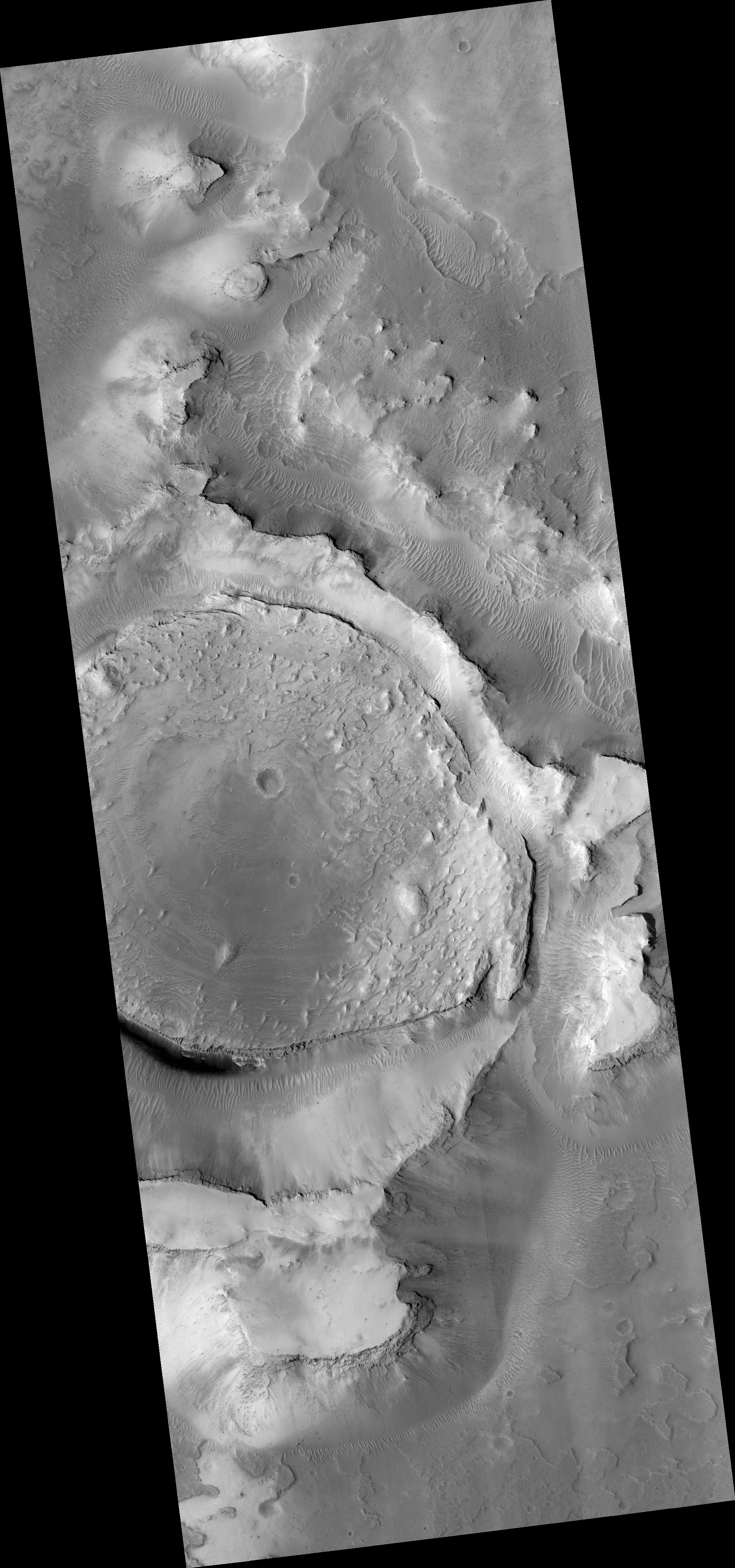
Map Projected Browse Image
Click on image for larger version
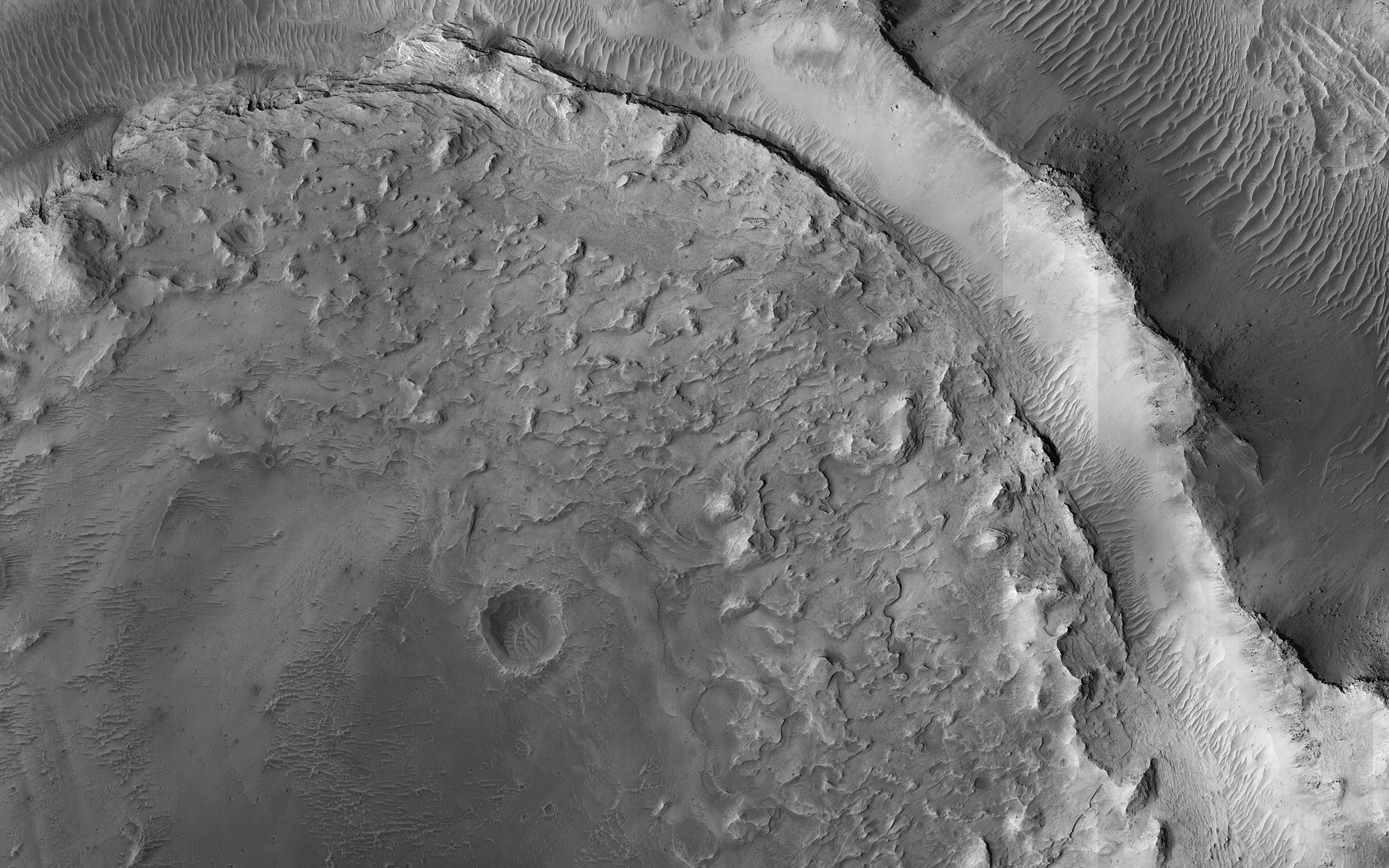
This image shows evidence of a complex cycle of cratering and erosion. The center of the image covers an old impact crater, roughly 6 to 7 kilometers in diameter. This can actually be easier to see in lower-resolution images that cover more area, like those from MRO's Context Camera . The crater was later filled by sediments.
Erosion then occurred across the region. The crater rim was left high-standing even though material outside the rim was eroded down to the level of the crater floor. The sediments filling the crater also eroded from the rim inwards, leaving a circular pancake of sedimentary rock. Similar "rim-inwards" erosion has been hypothesized for the (much larger) Gale Crater where the Curiosity rover is operating.
The map is projected here at a scale of 25 centimeters (9.8 inches) per pixel. (The original image scale is 27.4 centimeters [10.8 inches] per pixel [with 1 x 1 binning]; objects on the order of 82 centimeters [32.3 inches] across are resolved.) North is up.
Background Info:
The University of Arizona, in Tucson, operates HiRISE, which was built by Ball Aerospace & Technologies Corp., in Boulder, Colorado. NASA's Jet Propulsion Laboratory, a division of Caltech in Pasadena, California, manages the Mars Reconnaissance Orbiter Project for NASA's Science Mission Directorate, Washington.
Cataloging Keywords:
| Name | Value | Additional Values |
|---|---|---|
| Target | Mars | |
| System | ||
| Target Type | Planet | |
| Mission | Mars Reconnaissance Orbiter (MRO) | Mars Science Laboratory (MSL) |
| Instrument Host | Mars Reconnaissance Orbiter | Curiosity Rover |
| Host Type | Orbiter | Rover |
| Instrument | High Resolution Imaging Science Experiment (HiRISE) | |
| Detector | ||
| Extra Keywords | Color, Crater, Impact, Map | |
| Acquisition Date | ||
| Release Date | 2021-02-26 | |
| Date in Caption | ||
| Image Credit | NASA/JPL-Caltech/University of Arizona | |
| Source | photojournal.jpl.nasa.gov/catalog/PIA24462 | |
| Identifier | PIA24462 | |