
|
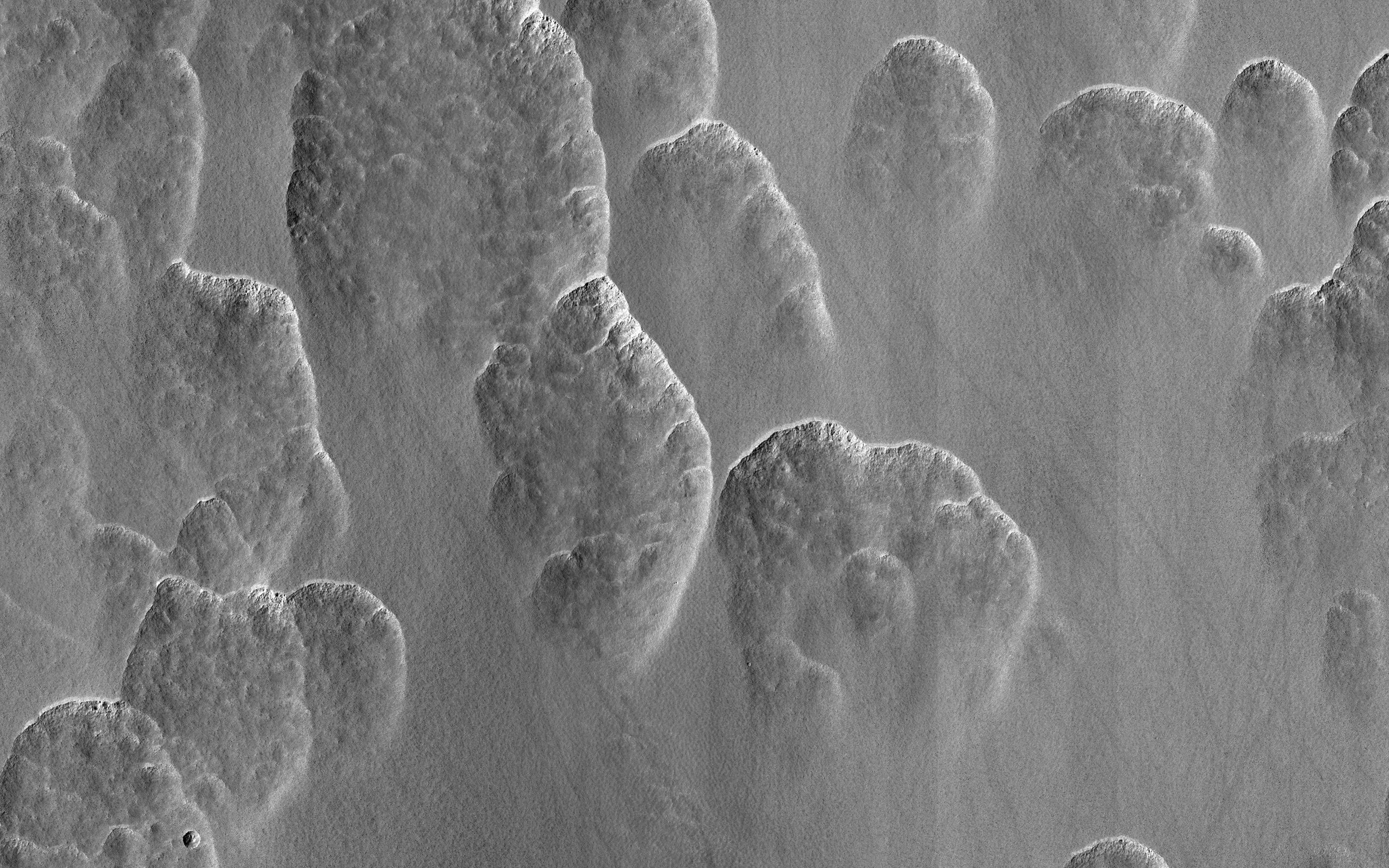
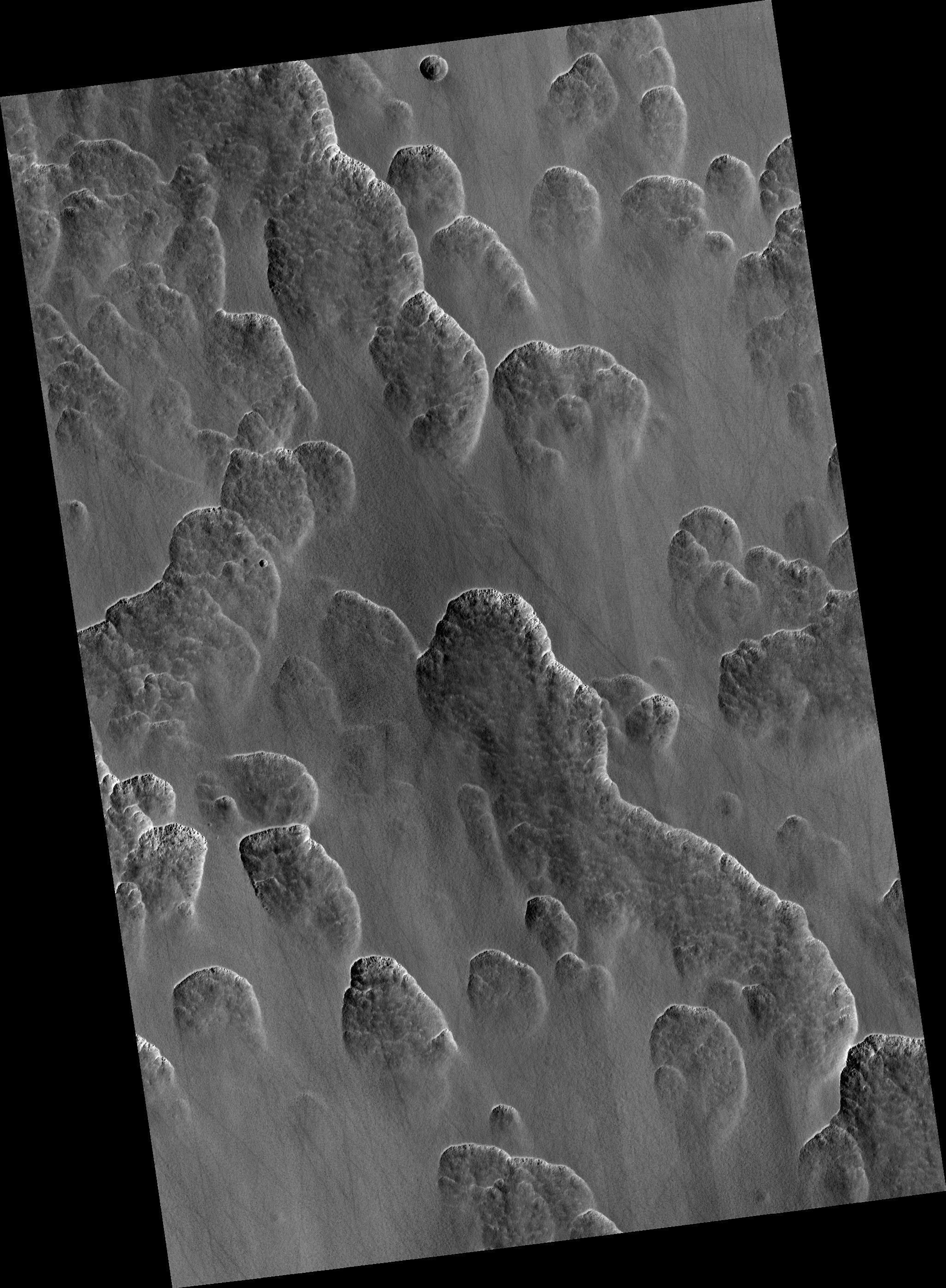
A Recipe for Martian Scallops
- Click the image above for a larger view
- Full-Res JPEG (2880 x 1800) (977.7 kB)
- Full-Res TIFF (2880 x 1800) (5.2 MB)
Caption:
Map Projected Browse Image
Click on image for larger version
About a third of Mars has water ice just below the dusty surface. Figuring out exactly where is vital for future human explorers. One of the ways scientists do this is to look for landforms that only occur when this buried ice is present. These scallops are one of those diagnostic landforms.
A layer of clean ice lies just below the surface in this image. As the ice ablates away in some spots the surface dust collapses into the hole that's left. These holes grow into the scallops visible here as more and more ice is lost.
Between the scallops, the ice is still there, ready for some astronaut to come along and dig it up.
The map is projected here at a scale of 25 centimeters (9.8 inches) per pixel. (The original image scale is 24.8 centimeters [9.8 inches] per pixel [with 1 x 1 binning]; objects on the order of 75 centimeters [30.0 inches] across are resolved.) North is up.
Background Info:
The University of Arizona, in Tucson, operates HiRISE, which was built by Ball Aerospace & Technologies Corp., in Boulder, Colorado. NASA's Jet Propulsion Laboratory, a division of Caltech in Pasadena, California, manages the Mars Reconnaissance Orbiter Project for NASA's Science Mission Directorate, Washington.
Cataloging Keywords:
| Name | Value | Additional Values |
|---|---|---|
| Target | Mars | |
| System | ||
| Target Type | Planet | |
| Mission | Mars Reconnaissance Orbiter (MRO) | |
| Instrument Host | Mars Reconnaissance Orbiter | |
| Host Type | Orbiter | |
| Instrument | High Resolution Imaging Science Experiment (HiRISE) | |
| Detector | ||
| Extra Keywords | Color, Dust, Map, Water | |
| Acquisition Date | ||
| Release Date | 2021-03-22 | |
| Date in Caption | ||
| Image Credit | NASA/JPL-Caltech/University of Arizona | |
| Source | photojournal.jpl.nasa.gov/catalog/PIA24468 | |
| Identifier | PIA24468 | |