|
An Icy Scarp in the Southern Mid-latitudes
- Click the image above for a larger view
- Full-Res JPEG (2880 x 1800) (1.3 MB)
- Full-Res TIFF (2880 x 1800) (15.6 MB)
Caption:

Map Projected Browse Image
Click on image for larger version
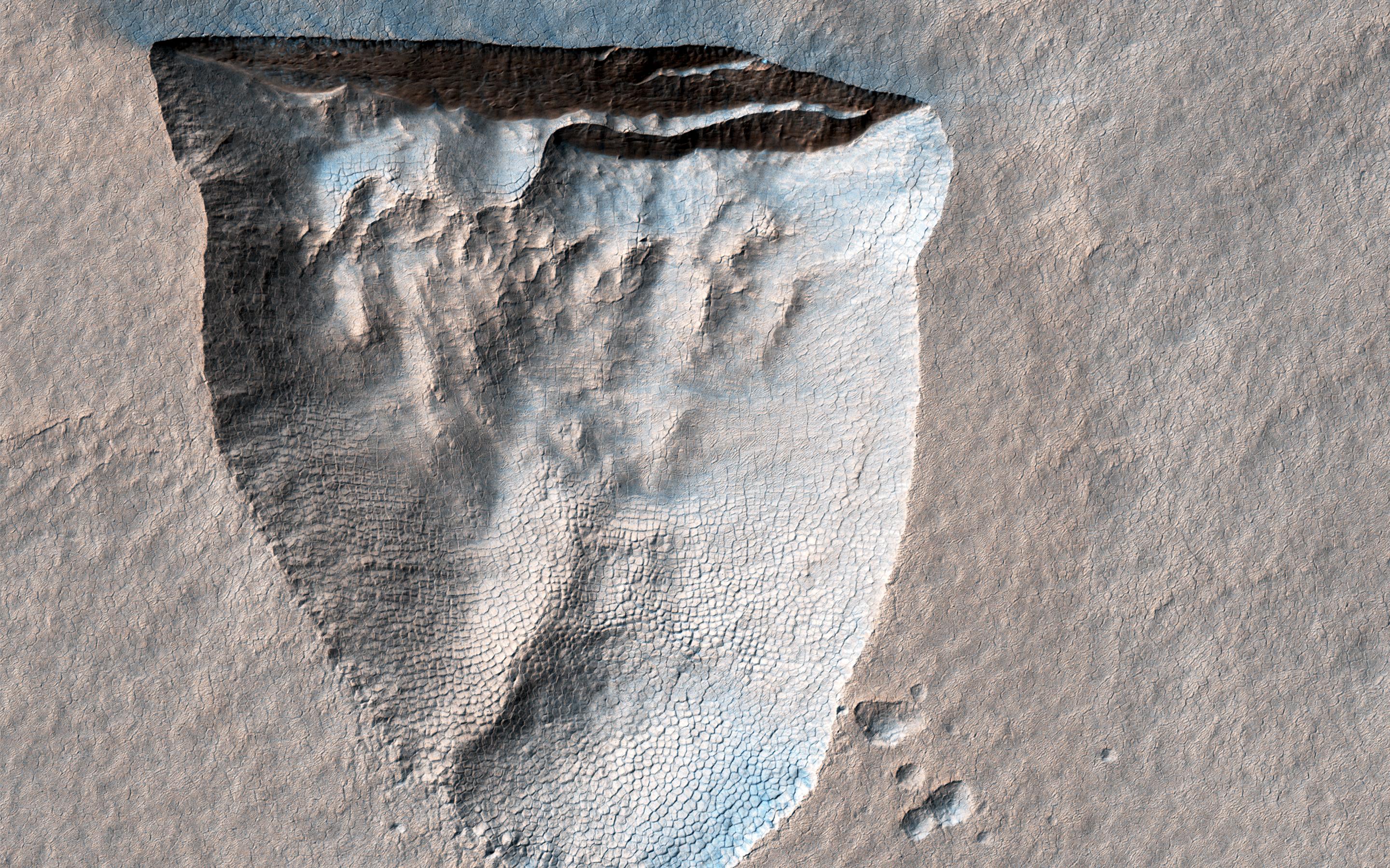
This enhanced color cutout shows a pit about 600 meters across that is bounded by a steep scarp on its northern side. Similar scarps in the southern mid-latitudes are known to expose water ice that extends to within a couple meters of the surface.
The ice appears to be slowly sublimating into the atmosphere, causing the scarps to retreat towards the equator (up in the cutout) and enlarge the pits. This is the first HiRISE image of this particular scarp, acquired as part of an ongoing campaign to monitor the evolution of these formations that may provide an easily accessible source of water for future human explorers.
The darker, bluer streaks extending away from the top of the scarp may have been caused by winds blowing sand out of the pit and/or removing brighter dust from the surface.
The map is projected here at a scale of 25 centimeters (9.8 inches) per pixel. (The original image scale is 25.3 centimeters [10.0 inches] per pixel [with 1 x 1 binning]; objects on the order of 76 centimeters [29.9 inches] across are resolved.) North is up.
Background Info:
The University of Arizona, in Tucson, operates HiRISE, which was built by Ball Aerospace & Technologies Corp., in Boulder, Colorado. NASA's Jet Propulsion Laboratory, a division of Caltech in Pasadena, California, manages the Mars Reconnaissance Orbiter Project for NASA's Science Mission Directorate, Washington.
Cataloging Keywords:
| Name | Value | Additional Values |
|---|---|---|
| Target | Mars | |
| System | ||
| Target Type | Planet | |
| Mission | Mars Reconnaissance Orbiter (MRO) | |
| Instrument Host | Mars Reconnaissance Orbiter | |
| Host Type | Orbiter | |
| Instrument | High Resolution Imaging Science Experiment (HiRISE) | |
| Detector | ||
| Extra Keywords | Atmosphere, Color, Dust, Map, Water | |
| Acquisition Date | ||
| Release Date | 2021-04-27 | |
| Date in Caption | ||
| Image Credit | NASA/JPL-Caltech/University of Arizona | |
| Source | photojournal.jpl.nasa.gov/catalog/PIA24611 | |
| Identifier | PIA24611 | |
