|
Crater Gullies at Multiple Elevations
- Click the image above for a larger view
- Full-Res JPEG (2880 x 1800) (1.4 MB)
- Full-Res TIFF (2880 x 1800) (15.6 MB)
Caption:
Map Projected Browse Image
Click on image for larger version
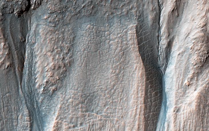
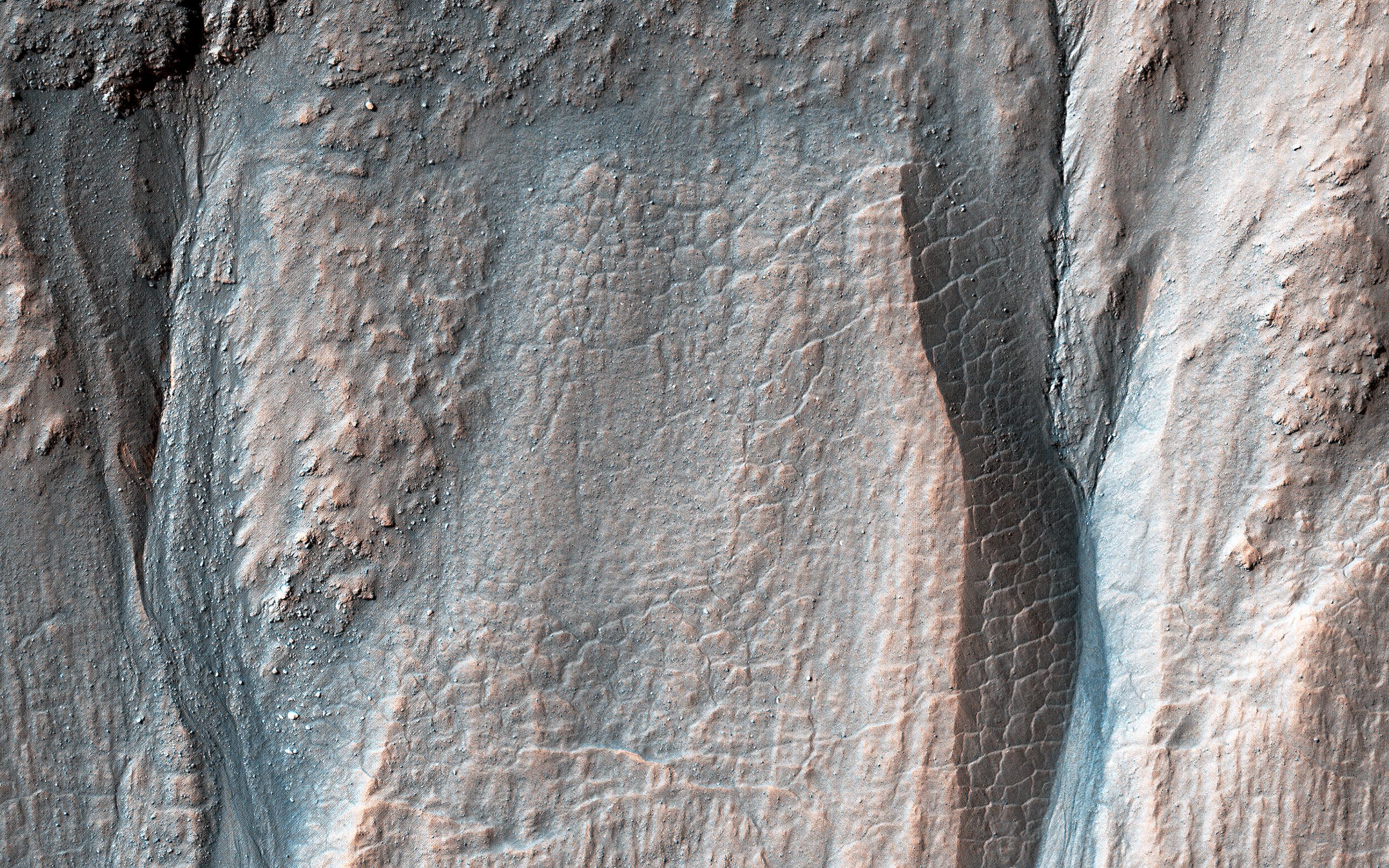
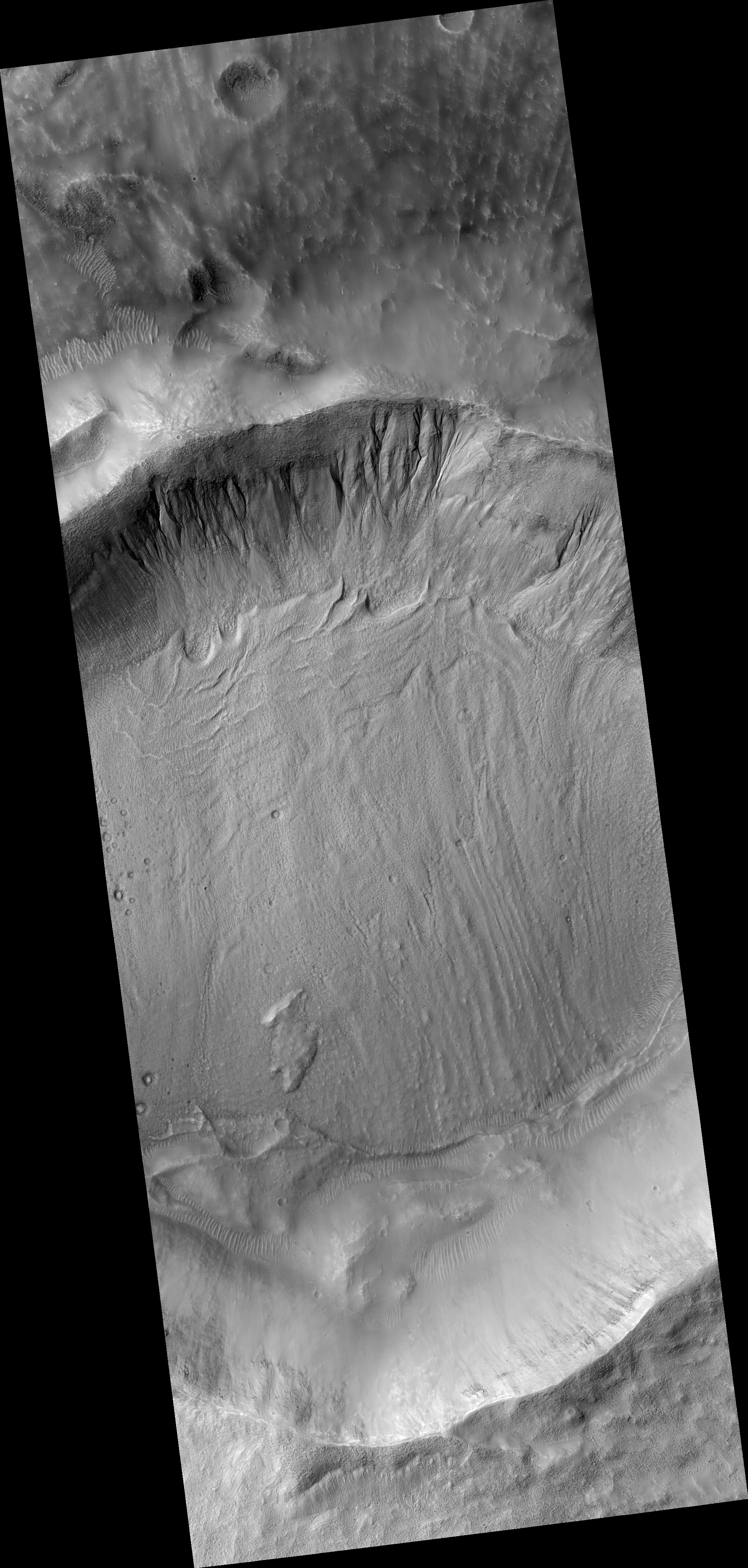
Gullies along the poleward-facing slope of this 10-kilometer diameter crater in the southern highlands of Mars originate at various elevations along the rim. The eastern gullies (right) originate at or near the crater rim while the more western gullies erode into or undercut rubbly layers along the mid-elevation slopes.
Most of the mid-slope region below these layers is composed of terrain that forms a polygonal fracture pattern. The lower part is cut by a series of fractures trending perpendicular across the slope. These features suggest that the mid-slope region once contained significant subsurface ice reserves that may have been removed during gully formation.
Mars' past climate may have permitted certain processes where water initially froze and melted seasonally, allowing for the formation of polygonal terrain and gully systems. More recent gully activity has resulted from dry flows, perhaps from the loss of sediment support by subsurface ice sublimation or simply due to gravity.
The map is projected here at a scale of 25 centimeters (9.8 inches) per pixel. (The original image scale is 25.3 centimeters [10.0 inches] per pixel [with 1 x 1 binning]; objects on the order of 76 centimeters [29.9 inches] across are resolved.) North is up.
This is a stereo pair with ESP_067708_1435 .
Background Info:
The University of Arizona, in Tucson, operates HiRISE, which was built by Ball Aerospace & Technologies Corp., in Boulder, Colorado. NASA's Jet Propulsion Laboratory, a division of Caltech in Pasadena, California, manages the Mars Reconnaissance Orbiter Project for NASA's Science Mission Directorate, Washington.
Cataloging Keywords:
| Name | Value | Additional Values |
|---|---|---|
| Target | Mars | |
| System | ||
| Target Type | Planet | |
| Mission | Mars Reconnaissance Orbiter (MRO) | |
| Instrument Host | Mars Reconnaissance Orbiter | |
| Host Type | Orbiter | |
| Instrument | High Resolution Imaging Science Experiment (HiRISE) | |
| Detector | ||
| Extra Keywords | Color, Crater, Map, Water | |
| Acquisition Date | ||
| Release Date | 2021-04-27 | |
| Date in Caption | ||
| Image Credit | NASA/JPL-Caltech/University of Arizona | |
| Source | photojournal.jpl.nasa.gov/catalog/PIA24612 | |
| Identifier | PIA24612 | |