|
Ice-Rich Terrain of the Northern Plains
- Click the image above for a larger view
- Full-Res JPEG (2880 x 1800) (1.3 MB)
- Full-Res TIFF (2880 x 1800) (5.2 MB)
Caption:
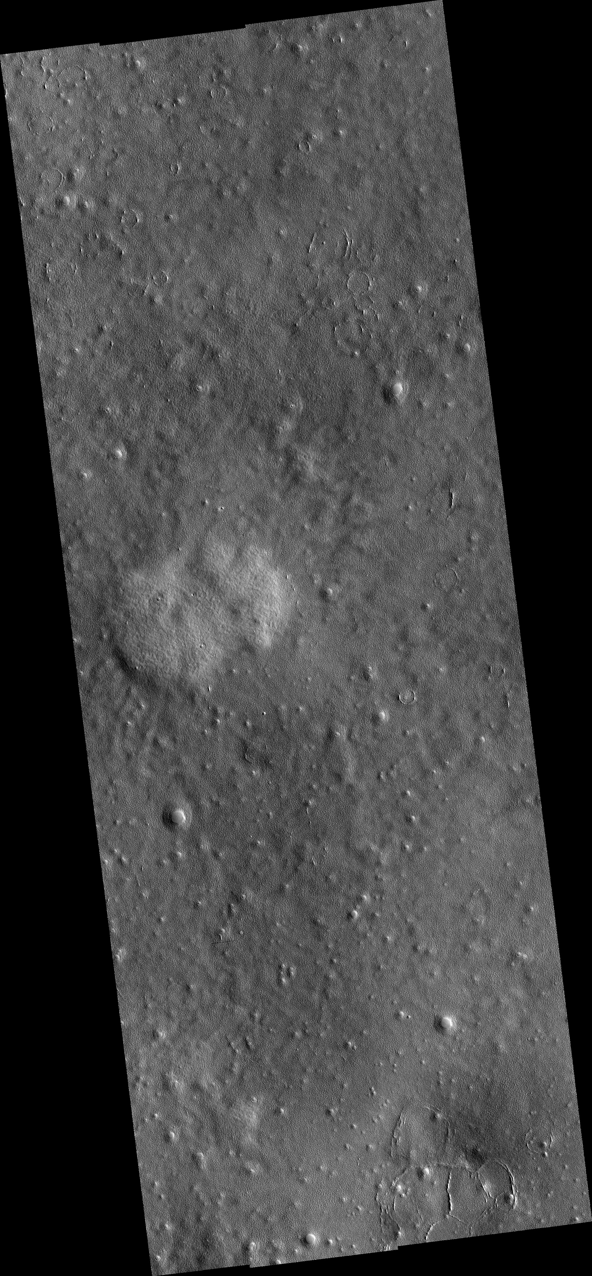
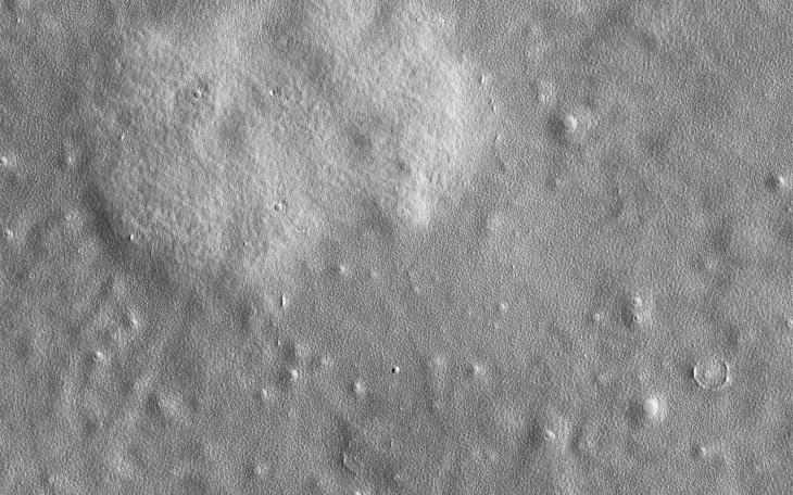
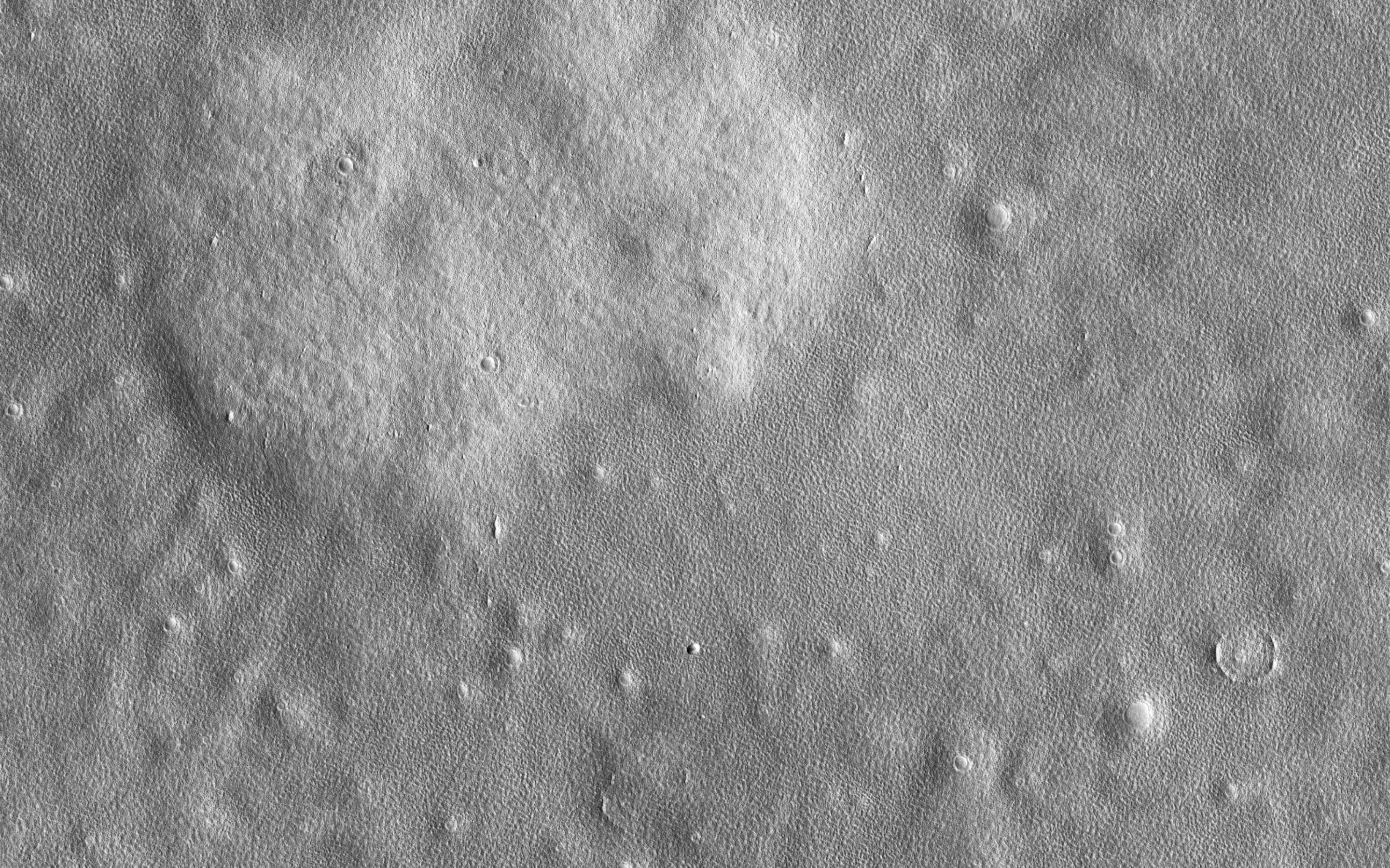
Map Projected Browse Image
Click on image for larger version
This image shows a surface shaped by ice. Funnel-shaped craters scattered throughout the image are interpreted as impacts that once had the classic bowl shape, but have now expanded via sublimation.
At high resolution the surface is divided by polygonal fractures, spaced a few meters apart. These polygons are common on the northern plains and were seen by the Phoenix Lander. They form when annual temperature cycles cause the ice to fracture as it expands and shrinks. The polygons are especially prominent and well-defined in a shallow pit in the (west-center part of the) image, which may indicate that depth or purity of the ice is different there.
The map is projected here at a scale of 25 centimeters (9.8 inches) per pixel. (The original image scale is 30.7 centimeters [12.1 inches] per pixel [with 1 x 1 binning] to 61.4 centimeters [24.2 inches] per pixel [with 2 x 2 binning]) North is up.
Background Info:
The University of Arizona, in Tucson, operates HiRISE, which was built by Ball Aerospace & Technologies Corp., in Boulder, Colorado. NASA's Jet Propulsion Laboratory, a division of Caltech in Pasadena, California, manages the Mars Reconnaissance Orbiter Project for NASA's Science Mission Directorate, Washington.
Cataloging Keywords:
| Name | Value | Additional Values |
|---|---|---|
| Target | Mars | |
| System | ||
| Target Type | Planet | |
| Mission | Mars Reconnaissance Orbiter (MRO) | Phoenix |
| Instrument Host | Mars Reconnaissance Orbiter | Phoenix Lander |
| Host Type | Orbiter | Lander |
| Instrument | High Resolution Imaging Science Experiment (HiRISE) | |
| Detector | ||
| Extra Keywords | Color, Crater, Impact, Map | |
| Acquisition Date | ||
| Release Date | 2021-05-24 | |
| Date in Caption | ||
| Image Credit | NASA/JPL-Caltech/University of Arizona | |
| Source | photojournal.jpl.nasa.gov/catalog/PIA24620 | |
| Identifier | PIA24620 | |