
|
Miranda - High Resolution Mosaic
- Click the image above for a larger view
- Full-Res JPEG (2500 x 2200) (294.4 kB)
- Full-Res TIFF (2500 x 2200) (2.8 MB)
Caption:
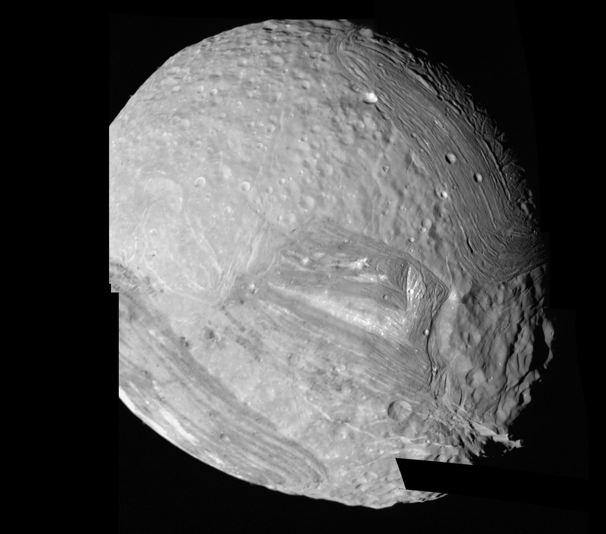
This computer-assembled mosaic of Miranda includes many of the high-resolution frames obtained by Voyager 2 during its close flyby of the Uranian moon. Miranda, roughly 500 kilometers (300 miles) in diameter, exhibits varied geologic provinces, seen in this mosaic of clear-filter, narrow-angle images from Jan. 24, 1986. The images were obtained from distances of 30,160 to 40,310 km (18,730 to 25,030 mi); resolution ranges from 560 to 740 meters (1,840 to 2,430 feet). These are among the highest-resolution pictures that Voyager has obtained of any of the new "worlds" it has encountered during its mission. On Miranda, ridges and valleys of one province are cut off against the boundary of the next province. Probable compressional (pushed-together) folded ridges are seen in curvilinear patterns, as are many extensional (pulled-apart) faults. Some of these show very large scarps, or cliffs, ranging from O.5 to 5 km (O.3 to 3 mi) in height -- that is, higher that the walls of the Grand Canyon on Earth. The missing piece of Miranda's surface will be included in a later mosaic once more complicated computer processing can be completed.
Background Info:
The Voyager project is managed for NASA by the Jet Propulsion Laboratory.
Cataloging Keywords:
| Name | Value | Additional Values |
|---|---|---|
| Target | Miranda | |
| System | Uranus | |
| Target Type | Satellite | |
| Mission | Voyager | |
| Instrument Host | Cassini Orbiter | Voyager 2 |
| Host Type | Orbiter | Flyby Spacecraft |
| Instrument | Imaging Science Subsystem (ISS) | |
| Detector | Narrow Angle Camera | |
| Extra Keywords | Grayscale, Visual | |
| Acquisition Date | ||
| Release Date | 1996-08-01 | |
| Date in Caption | 1986-01-24 | |
| Image Credit | NASA/JPL | |
| Source | photojournal.jpl.nasa.gov/catalog/PIA00043 | |
| Identifier | PIA00043 | |