|
Miranda High Resolution of Large Fault
- Click the image above for a larger view
- Full-Res JPEG (1016 x 1002) (75.8 kB)
- Full-Res TIFF (1016 x 1002) (330.8 kB)
Caption:
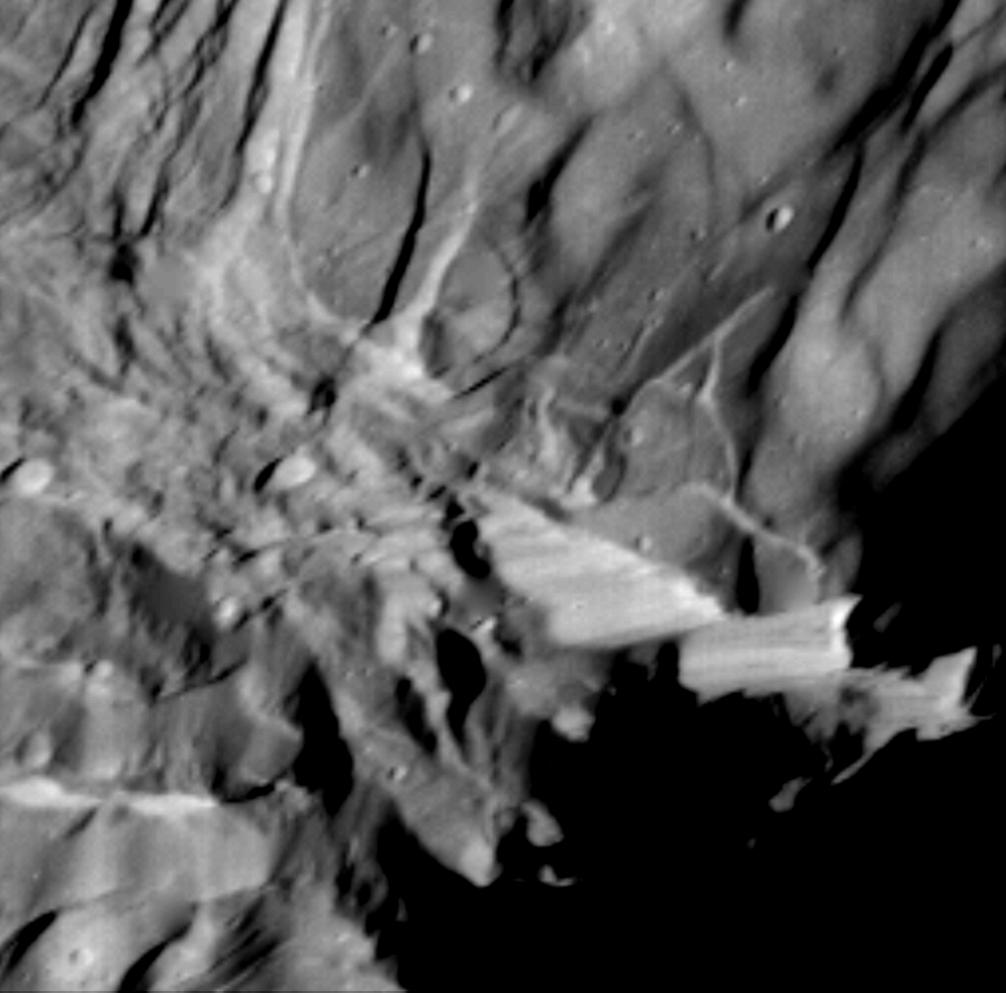
This high-resolution image of Miranda was acquired by Voyager 2 on Jan. 24, 1986, when the spacecraft was 36,250 kilometers (22,500 miles) from the Uranian moon. In this clear-filter, narrow-angle image, Miranda displays a dramatically varied surface. Well shown at this resolution of 660 meters (2,160 feet) are numerous ridges and valleys -- a topography that was probably produced by compressional tectonics. Cutting across the ridges and valleys are many faults. The largest fault scarp, or cliff, is seen below and right of center; it shows grooves probably made by the contact of the fault blocks as they rubbed against each other (leaving what are known as slickensides). Movement of the down-dropped block is shown by the offset of the ridges. The fault may be 5 km (3 mi) high, or higher than the walls of the Grand Canyon on Earth.
Background Info:
The Voyager project is managed for NASA by the Jet Propulsion Laboratory.
Cataloging Keywords:
| Name | Value | Additional Values |
|---|---|---|
| Target | Miranda | |
| System | Uranus | |
| Target Type | Satellite | |
| Mission | Voyager | |
| Instrument Host | Cassini Orbiter | Voyager 2 |
| Host Type | Orbiter | Flyby Spacecraft |
| Instrument | Imaging Science Subsystem (ISS) | |
| Detector | Narrow Angle Camera | |
| Extra Keywords | Grayscale, Visual | |
| Acquisition Date | ||
| Release Date | 1996-01-29 | |
| Date in Caption | 1986-01-24 | |
| Image Credit | NASA/JPL | |
| Source | photojournal.jpl.nasa.gov/catalog/PIA00044 | |
| Identifier | PIA00044 | |