skip to navigation

|
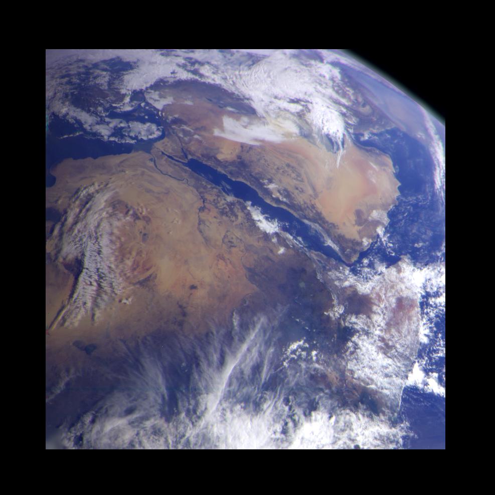
Earth - Northeast Africa and the Arabian Peninsula
- Click the image above for a larger view
- Full-Res JPEG (987 x 987) (94.2 kB)
- Full-Res TIFF (987 x 987) (1.9 MB)
Caption:
This image of northeast Africa and the Arabian Peninsula was taken from an altitude of about 500,000 kilometers (300,000 miles) by the Galileo spacecraft on December 9, 1992, as it left Earth en route to Jupiter. Visible are most of Egypt (left of center), including the Nile Valley; the Red Sea (slightly above center); Israel; Jordan, and the Arabian Peninsula. In the center, below the coastal cloud, is Khartoum, at the confluence of the Blue Nile and the White Nile. Somalia (lower right) is partly covered by clouds.
Cataloging Keywords:
| Name | Value | Additional Values |
|---|---|---|
| Target | Earth | Jupiter |
| System | Jupiter | |
| Target Type | Planet | |
| Mission | Galileo | |
| Instrument Host | Galileo Orbiter | |
| Host Type | Orbiter | |
| Instrument | Solid-State Imaging (SSI) | |
| Detector | ||
| Extra Keywords | Color | |
| Acquisition Date | ||
| Release Date | 1996-01-29 | |
| Date in Caption | 1992-12-09 | |
| Image Credit | NASA/JPL | |
| Source | photojournal.jpl.nasa.gov/catalog/PIA00127 | |
| Identifier | PIA00127 | |