Earth - False Color Mosaic of the Andes
Caption:
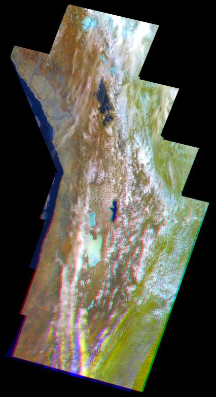
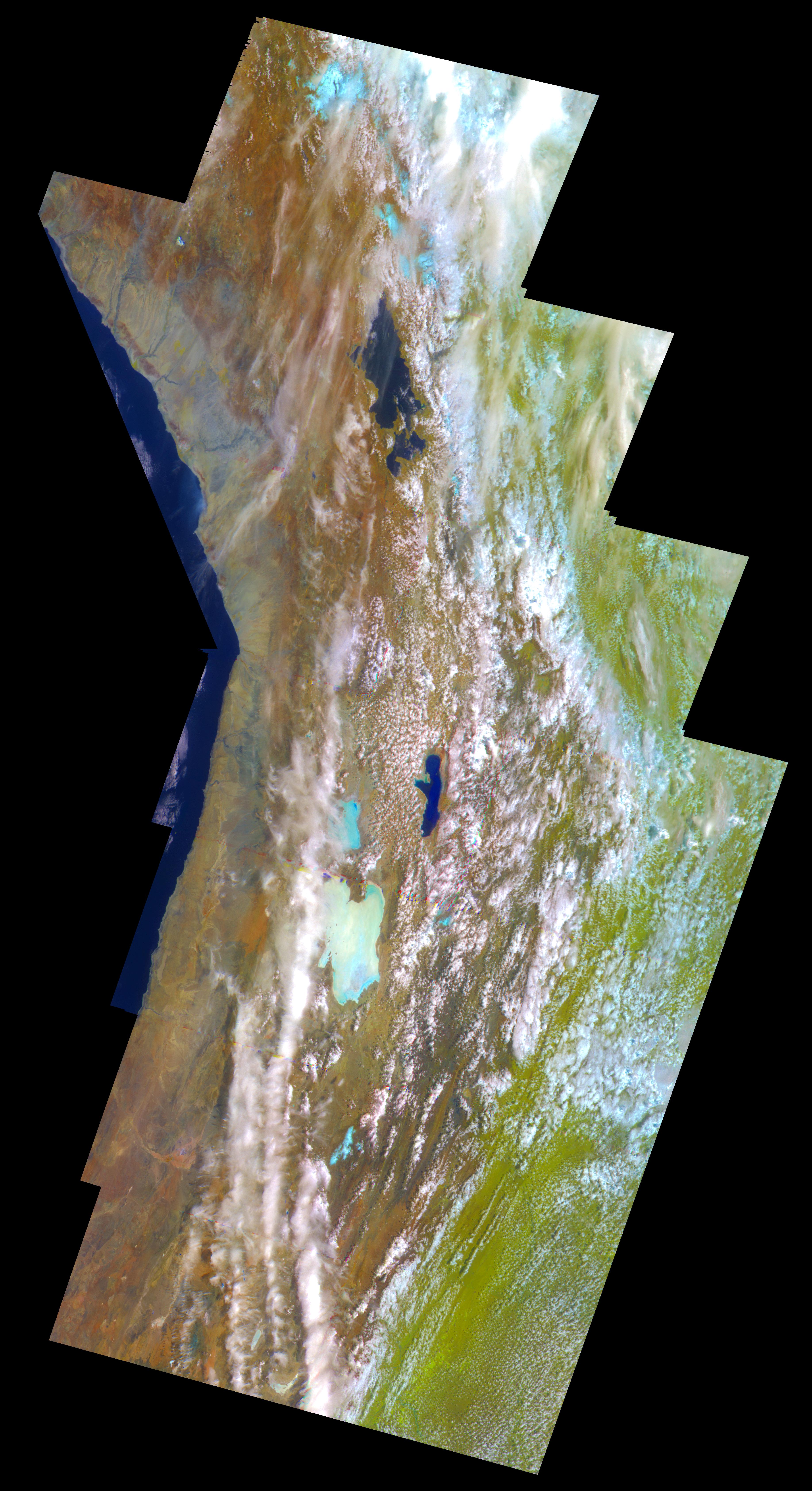
This false-color mosaic of the central part of the Andes mountains of South America (70 degrees west longitude, 19 degrees south latitude) is made up of 42 images acquired by the Galileo spacecraft from an altitude of about 25,000 kilometers (15,000 miles). A combination of visible (green) and near-infrared (0.76 and 1.0-micron) filters was chosen for this view to separate regions with distinct vegetation and soil types. The mosaic shows the area where Chile, Peru and Bolivia meet. The Pacific Coast appears at the left of the image-- Galileo captured this view as it traveled west over the Pacific Ocean, looking back at the Andes. Lakes Titicaca and Poopo are nearly black patches at the top and center, respectively; a large light-blue area below and to the left of Lake Poopo is Salar de Uyuni, a dry salt lake some 120 kilometers (75 miles) across. These lakes lie in the Altiplano, a region between the western and eastern Andes, which are covered by clouds. The vegetation-bearing Gran Chaco plains east of the Andes appear pale green. Light-blue patches in the mountains to the north are glaciers.
Cataloging Keywords:
| Name |
Value |
Additional Values |
| Target |
Earth |
|
| System |
Earth |
|
| Target Type |
Earth |
|
| Mission |
Galileo |
|
| Instrument Host |
Galileo Orbiter |
|
| Host Type |
Orbiter |
|
| Instrument |
Solid-State Imaging (SSI) |
|
| Detector |
|
|
| Extra Keywords |
Color, Infrared, Mountain |
| Acquisition Date |
|
| Release Date |
1996-08-05 |
| Date in Caption |
|
|
| Image Credit |
NASA/JPL |
| Source |
photojournal.jpl.nasa.gov/catalog/PIA00133 |
| Identifier |
PIA00133 |