skip to navigation
|
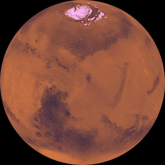
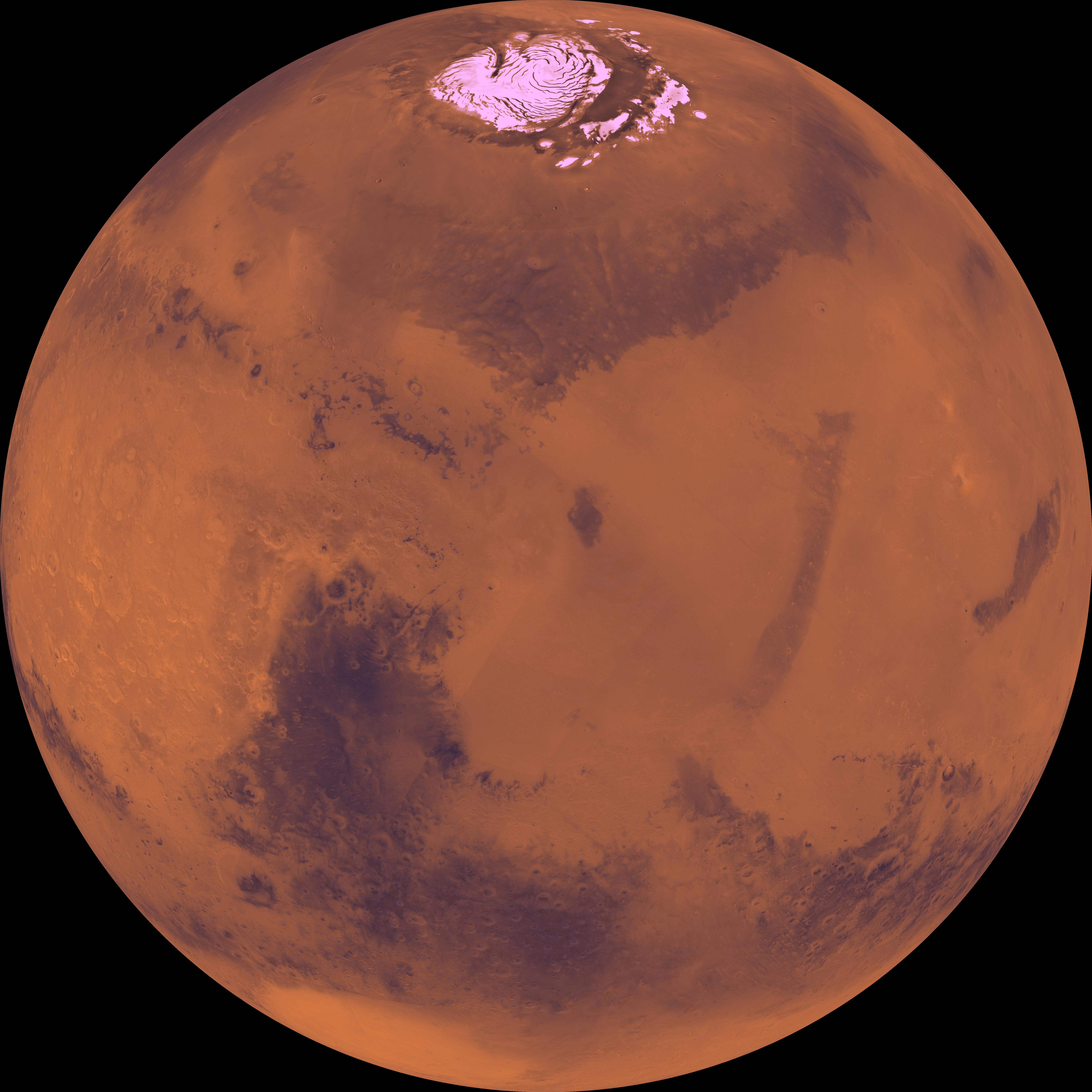
Center is at Latitude 30 Degrees North, Longitude 270 Degrees
- Click the image above for a larger view
- Full-Res JPEG (6787 x 6787) (1.9 MB)
- Full-Res TIFF (6787 x 6787) (60.1 MB)
Caption:
Center of the orthographic projection is at latitude 30 degrees N., longitude 270 degrees. The north polar residual ice cap of the Planum Boreum region, which is cut by spiral-patterned troughs, is located at top. The upper part is marked by a large depression, Isidis basin, which contains light-colored plains. The upper part also includes the light-colored smooth plains of Elysium Planitia and dark plains of Vastitas Borealis. Together, these form a vast expanse of contiguous plains. Toward the bottom, on the other hand, the southern hemisphere is almost entirely made up of heavily cratered highlands. At bottom left, a conspicuous, relatively bright circular depression marks the ancient large Hellas impact basin.
Cataloging Keywords:
| Name | Value | Additional Values |
|---|---|---|
| Target | Mars | |
| System | ||
| Target Type | Planet | |
| Mission | Viking | |
| Instrument Host | Viking 1 Orbiter | |
| Host Type | Orbiter | |
| Instrument | Visual Imaging Subsystem - Camera A | |
| Detector | ||
| Extra Keywords | Color, Crater, Impact | |
| Acquisition Date | ||
| Release Date | 1998-06-08 | |
| Date in Caption | ||
| Image Credit | NASA/JPL/USGS | |
| Source | photojournal.jpl.nasa.gov/catalog/PIA00198 | |
| Identifier | PIA00198 | |