Venus - Beta Regio
Caption:
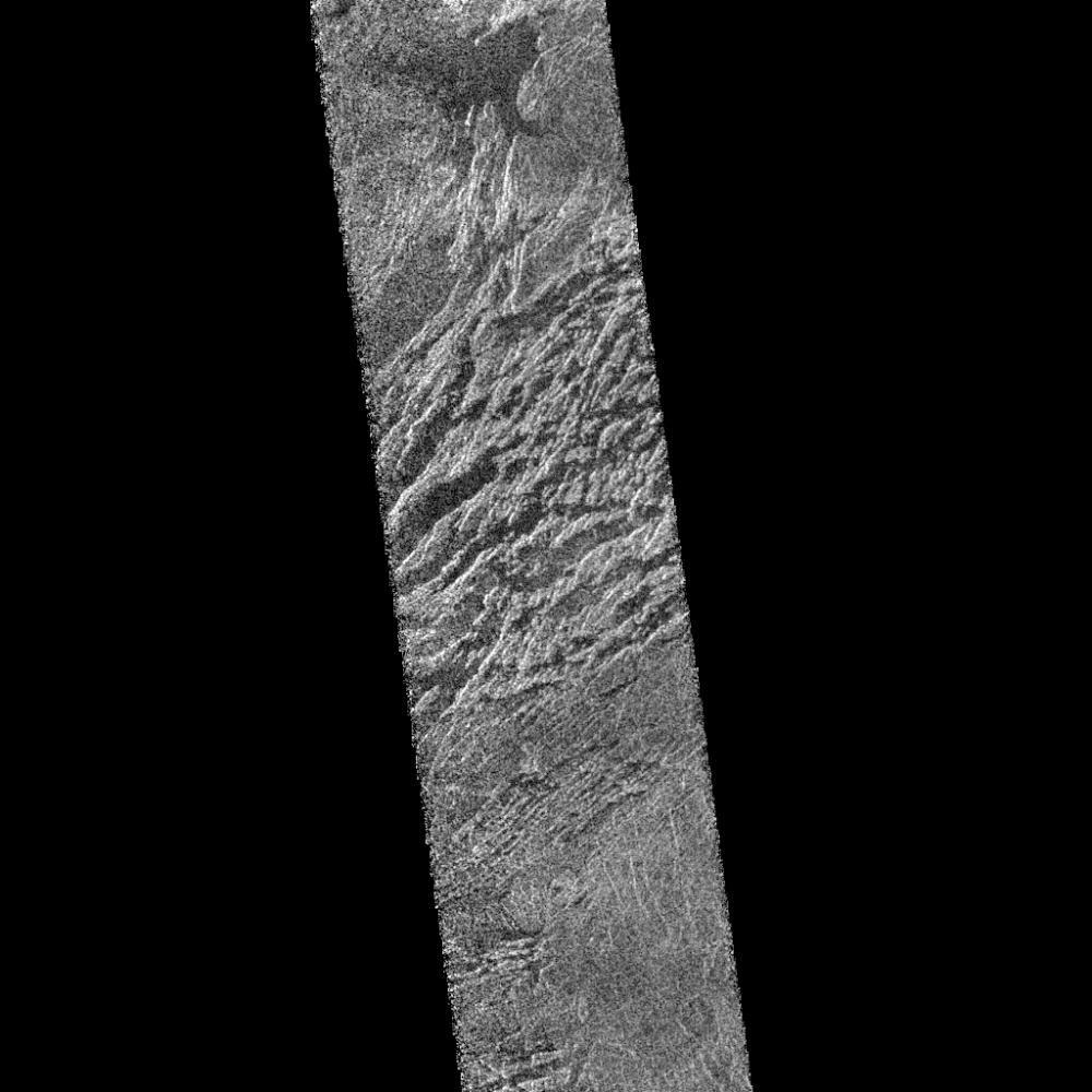
This portion of a Magellan radar image strip shows a small region on Venus 20 kilometers (12.4 miles) wide and 75 km (50 miles) long on the east flank of a major volcanic upland called Beta Regio. The image is centered at 23 degrees north latitude and 286.7 degrees east longitude. The ridge and valley network in the middle part of the image is formed by intersecting faults which have broken the Venusian crust into a complex, deformed type of surface called tessera, the Latin word for tile. The parallel mountains and valleys resemble the Basin and Range Province in the western United States. The irregular dark patch near the top of the image is a smooth surface, probably formed by lava flows in a region about 10 km (6 miles) across. Similar dark surfaces within the valleys indicate lava flows that are younger than the tessera giving an indication of the geologic time relationships of the events that formed the present surface. The image has a resolution of 120 meters (400 feet).
Cataloging Keywords:
| Name |
Value |
Additional Values |
| Target |
Venus |
|
| System |
|
|
| Target Type |
Planet |
|
| Mission |
Magellan |
|
| Instrument Host |
Magellan |
|
| Host Type |
Orbiter |
|
| Instrument |
Imaging Radar |
|
| Detector |
|
|
| Extra Keywords |
Grayscale, Mountain, Radar, Volcano |
| Acquisition Date |
|
| Release Date |
1996-02-05 |
| Date in Caption |
|
|
| Image Credit |
NASA/JPL |
| Source |
photojournal.jpl.nasa.gov/catalog/PIA00206 |
| Identifier |
PIA00206 |