|
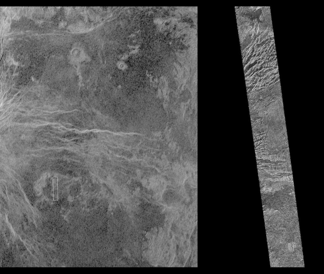
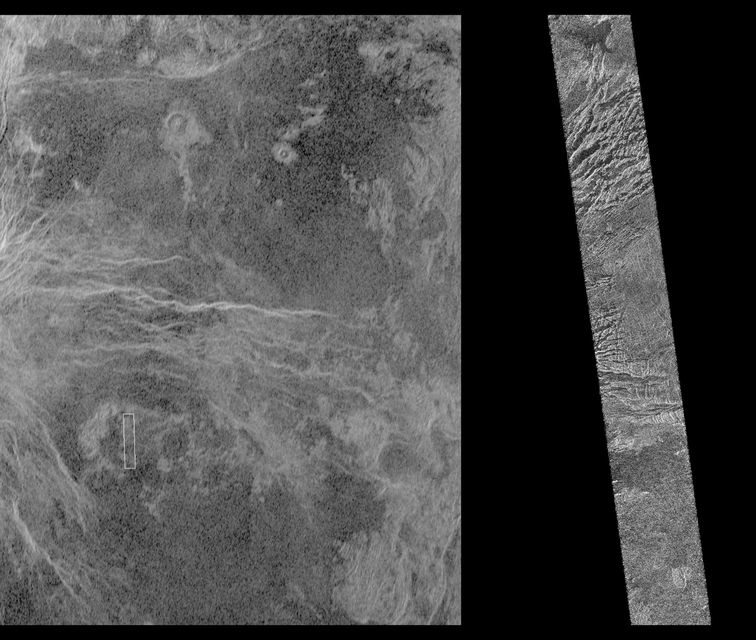
Venus - Magellan and Arecibo Comparison
- Click the image above for a larger view
- Full-Res JPEG (2538 x 2148) (660.6 kB)
- Full-Res TIFF (2538 x 2148) (3.8 MB)
Caption:
This image shows a comparison between a Magellan image (right) and the highest resolution Earth-based radar image of Venus, obtained by the U.S. National Astronomy and Ionosphere Center's Arecibo Observatory in Puerto Rico. The small white box in the Arecibo image on the left corresponds to the Magellan image. This portion of a Magellan radar image strip shows a small region on the east flank of a major volcanic upland called Beta Regio. The image is centered at 23 degrees north latitude and 286.7 degrees east longitude. The ridge and valley network in the middle part of the image is formed by intersecting faults which have broken the Venusian crust into a complex deformed type of surface called tessera, the Latin word for tile. The parallel mountains and valleys resemble the Basin and Range Province in the western United States. The irregular dark patch near the top of the image is a smooth surface, probably formed by lava flows in a region about 10 km (6 miles) across. Similar dark surfaces within the valleys indicate lava flows that are younger than the tessera. The Arecibo image contains probable impact craters, many faults, volcanic flows and tessera regions that will be mapped in detail by Magellan. The Magellan image has a resolution of 120 meters, (400 feet). The image segment is 20 km (12.4 miles) wide and 150 km (90 miles) long. The Arecibo image has a resolution of 1 3 km (0.6 1.8 miles) and is approximately 900 km (550 miles) across.
The National Astronomy and Ionosphere Center is operated by Cornell University under a management agreement with the National Science Foundation with some support from NASA.
Cataloging Keywords:
| Name | Value | Additional Values |
|---|---|---|
| Target | Venus | |
| System | ||
| Target Type | Planet | |
| Mission | Magellan | National Astronomy and Ionosphere Center (NAIC) |
| Instrument Host | Magellan | Arecibo Observatory |
| Host Type | Orbiter | Ground-Based Observatory |
| Instrument | Imaging Radar | Arecibo Radar |
| Detector | ||
| Extra Keywords | Crater, Grayscale, Impact, Mountain, Radar, Volcano | |
| Acquisition Date | ||
| Release Date | 1996-02-05 | |
| Date in Caption | ||
| Image Credit | NASA/JPL | |
| Source | photojournal.jpl.nasa.gov/catalog/PIA00207 | |
| Identifier | PIA00207 | |