Venus - Rhea Mons Volcano
Caption:
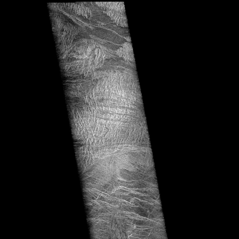
Two mosaiced pieces of Magellan image strips display the area east of the Rhea Mons volcano on Venus. This image is centered at about 32.5 degrees north latitude and 286.6 degrees east longitude. The mosaic is 47 kilometers (28 miles) wide and 135 km (81 miles) long. This region has been previously identified as "tessera" from Earth-based radar (Arecibo) images. The center of the image is dominated by a network of intersecting ridges and valleys. The radar bright north south trending features in this image range from 1 km (0.6 mile) to 3 km (1.8 miles) in length. The average spacing between these ridges is about 1.5 km (0.9 mile). The dark patches at the top of the image are smooth surfaces and may be lava flows located in lowlands between the higher ridge and the valley terrain. This image is a mosaic of two orbits obtained in the first Magellan radar test and played back to Earth to the Deep Space Network stations near Goldstone, Calif. and Canberra, Australia, respectively. The resolution of this image is approximately 120 meters (400 feet).
Cataloging Keywords:
| Name |
Value |
Additional Values |
| Target |
Venus |
|
| System |
|
|
| Target Type |
Planet |
|
| Mission |
Magellan |
Deep Space Network (DSN), National Astronomy and Ionosphere Center (NAIC) |
| Instrument Host |
Magellan |
Arecibo Observatory, Canberra Deep Space Communications Complex (CDSCC), Goldstone Deep Space Communications Complex (GDSCC) |
| Host Type |
Orbiter |
Ground-Based Observatory |
| Instrument |
Imaging Radar |
Arecibo Radar, Goldstone Solar System Radar |
| Detector |
|
|
| Extra Keywords |
Grayscale, Mountain, Radar, Radio, Volcano |
| Acquisition Date |
|
| Release Date |
1996-02-05 |
| Date in Caption |
|
|
| Image Credit |
NASA/JPL |
| Source |
photojournal.jpl.nasa.gov/catalog/PIA00208 |
| Identifier |
PIA00208 |