|
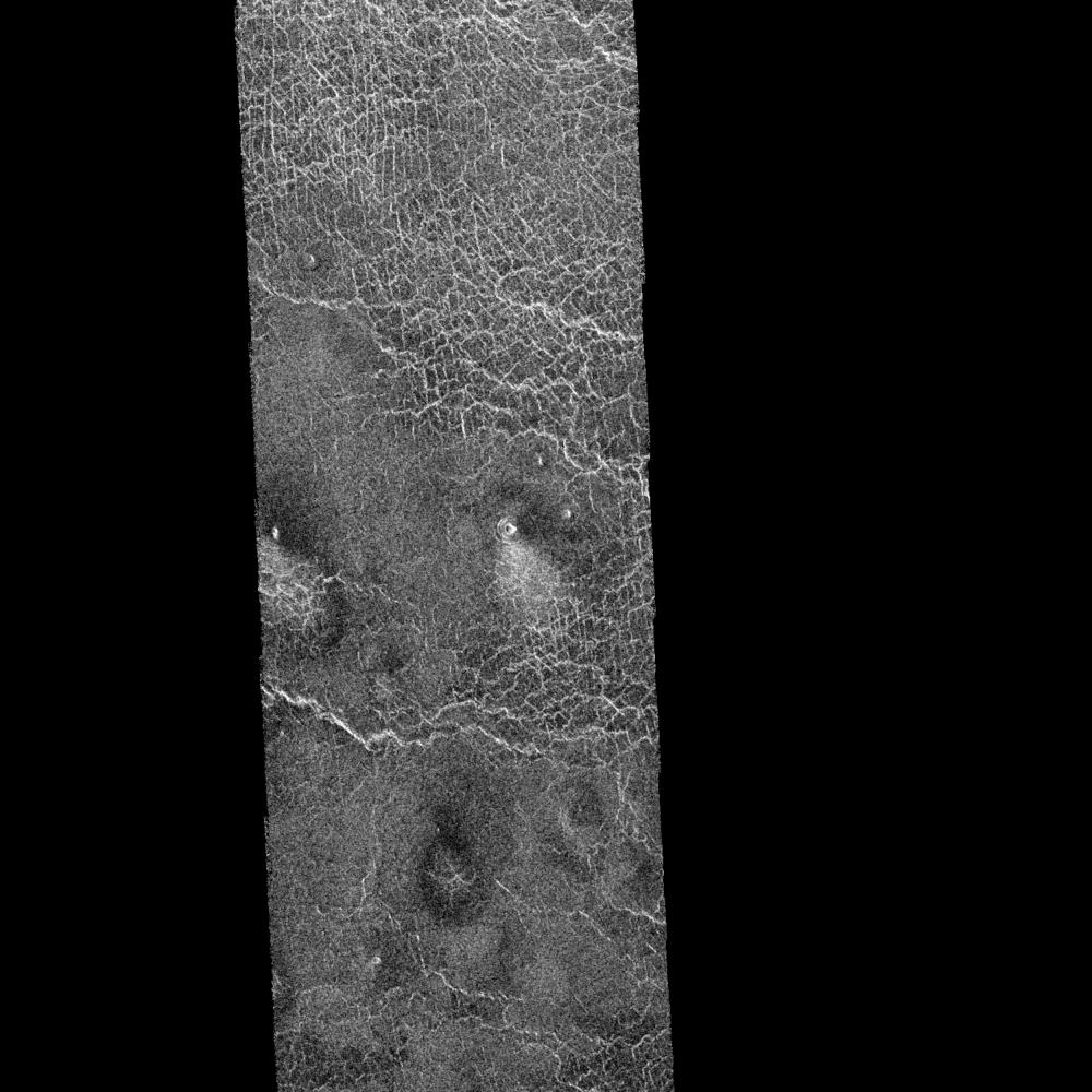
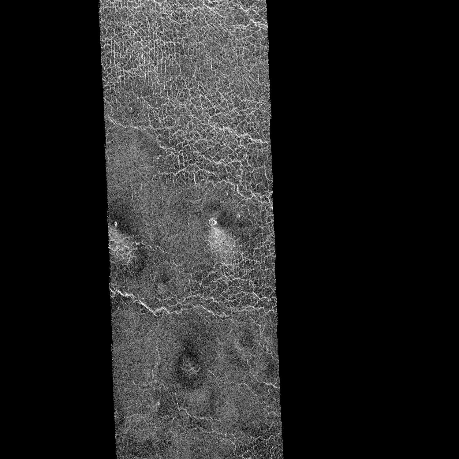
Venus - Ushas Mons
- Click the image above for a larger view
- Full-Res JPEG (1500 x 1500) (319.1 kB)
- Full-Res TIFF (1500 x 1500) (792.9 kB)
Caption:
This area of Venus northeast of Ushas Mons measures 40 by 112 kilometers (25 by 70 miles) and shows evidence of possible explosive volcanism. A surface deposit that shows brightly in radar extends and broadens away from the 1 kilometer diameter (0.6 mile diameter) crater in the middle of the image. The deposit is brighter near the crater, fades gradually into the plains and ends about 10 kilometers (6 miles) from the crater. The underlying crisscross pattern becomes more visible away from the crater as the covering deposit thins out. These characteristics are typical of deposits on Earth formed by fallout from volcanic explosion plumes. A similar but darker deposit extends to the right of the crater. The crater on the western edge of the image also shows similar deposits. North is at the top of the image.
The Magellan Mission Magellan is a NASA spacecraft mission to map the surface of Venus with imaging radar. The basic scientific instrument is a synthetic aperture radar, or SAR, which can look through the thick clouds perpetually shielding the surface of Venus. Magellan is in orbit around Venus which completes one turn around its axis in 243 Earth days. That period of time, one Venus day, is the length of Magellan's primary mission. During that time Magellan will map about 80 percent of the Venus surface. Subsequent missions of equal duration will provide complete mapping of the planet. Magellan was launched May 4, 1989, aboard the space shuttle Atlantis and went into orbit around Venus August 10, 1990. The spacecraft completes one orbit every three hours and 15 minutes, passing as close to the planet as 294 kilometers (183 miles) and as far away from Venus as 8,472 kilometers (5,265 miles). The smallest objects seen in this image measure approximately 120 meters (400 feet).
Cataloging Keywords:
| Name | Value | Additional Values |
|---|---|---|
| Target | Venus | |
| System | ||
| Target Type | Planet | |
| Mission | Magellan | |
| Instrument Host | Magellan | |
| Host Type | Orbiter | |
| Instrument | Imaging Radar | |
| Detector | ||
| Extra Keywords | Crater, Grayscale, Map, Mountain, Plume, Radar, Volcano | |
| Acquisition Date | ||
| Release Date | 1996-02-01 | |
| Date in Caption | 1989-05-04 | 1990-08-10 |
| Image Credit | NASA/JPL | |
| Source | photojournal.jpl.nasa.gov/catalog/PIA00213 | |
| Identifier | PIA00213 | |