Venus - Lakshmi Planum
Caption:
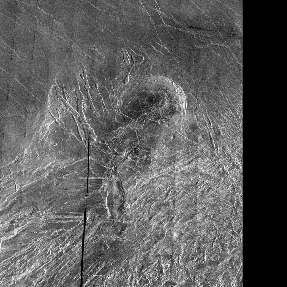
This image is a full-resolution mosaic of several Magellan images and is centered at 61 degrees north latitude and 341 degrees east longitude. The image is 250 kilometers wide (150 miles). The radar smooth region in the northern part of the image is Lakshmi Planum, a high plateau region roughly 3.5 kilometers (2.2 miles) above the mean planetary radius. Lakshmi Planum is ringed by intensely deformed terrain, some of which is shown in the southern portion of the image and is called Clotho Tessera. The 64-kilometer (40 mile) diameter circular feature in the image is a depression called Siddons and may be a volcanic caldera. This view is supported by the collapsed lava tubes surrounding the feature. By carefully studying this and other surrounding images scientists hope to discover what tectonic and volcanic processes formed this complex region. The solid black parts of the image represent data gaps that may be filled in by the Magellan extended mission.
Cataloging Keywords:
| Name |
Value |
Additional Values |
| Target |
Venus |
|
| System |
|
|
| Target Type |
Planet |
|
| Mission |
Magellan |
|
| Instrument Host |
Magellan |
|
| Host Type |
Orbiter |
|
| Instrument |
Imaging Radar |
|
| Detector |
|
|
| Extra Keywords |
Grayscale, Radar, Volcano |
| Acquisition Date |
|
| Release Date |
1996-03-07 |
| Date in Caption |
|
|
| Image Credit |
NASA/JPL |
| Source |
photojournal.jpl.nasa.gov/catalog/PIA00240 |
| Identifier |
PIA00240 |