Venus - Volcanic Domes East of Beta Regio
Caption:
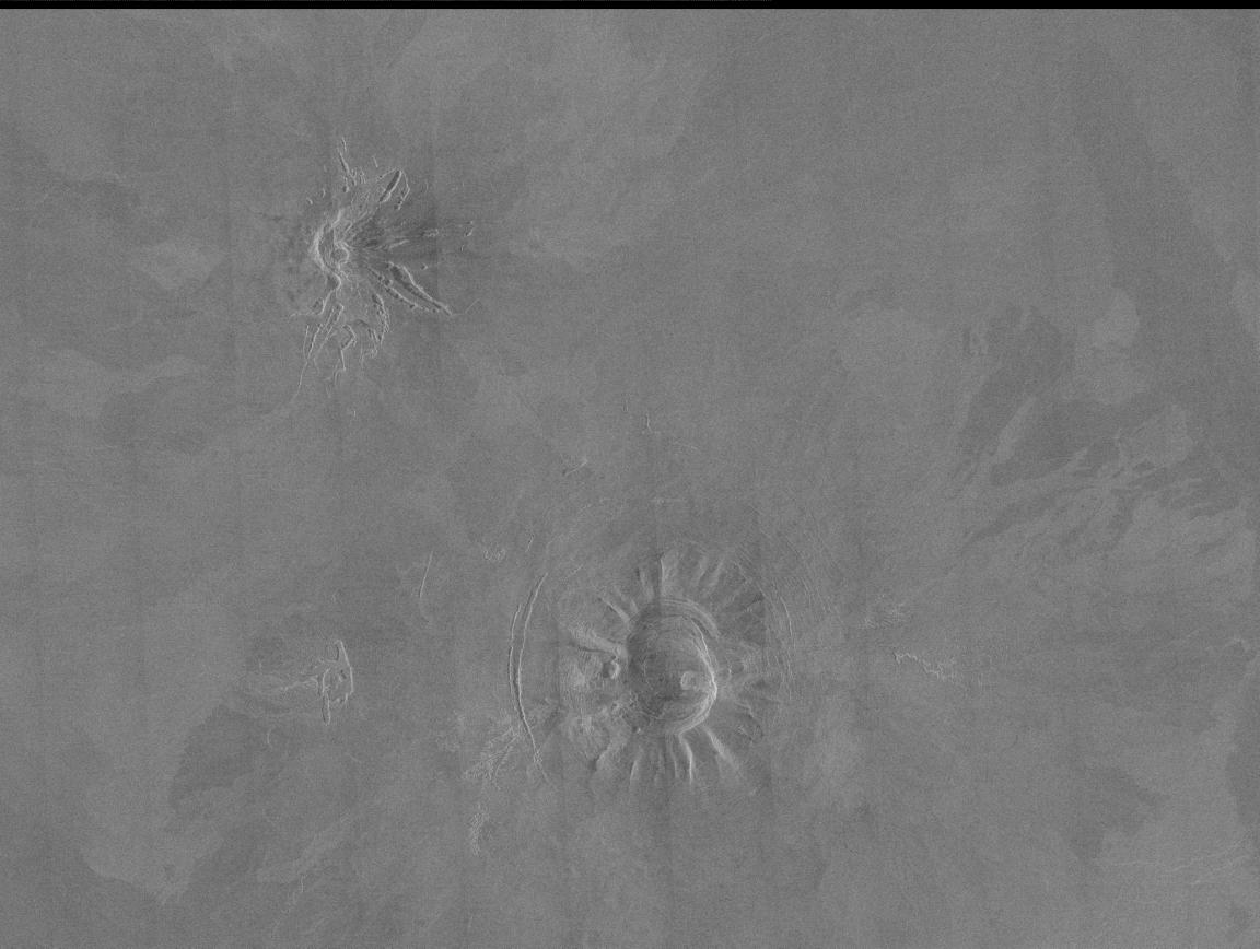
Two unusual volcanic domes are shown in this Magellan full-resolution mosaic. The image covers an area 180 by 240 kilometers (120 by 160 miles) centered at 18 degrees north latitude, 303.5 degrees east longitude, just east of Beta Regio. The dome in the south center of the image is about 45 kilometers (30 miles) across, with a 20 kilometer (13 mile) caldera, or volcanic collapse crater, in the center. The dome in the northwest corner of the image is about 30 kilometers (20 miles) across with a small (5 kilometer or 3 mile) summit crater. The very bright radar return from the western flank of this dome indicates that it has steep slopes. The flanks of the volcanoes display prominent gullies which may have been formed by slumping of surface material or thermal erosion by lava flows. Variations in the brightness with the surrounding plains show the extent of lava flows which originated at these volcanoes. Curved or bowed fractures surrounding the southern structure indicate that there has been subsidence, or sinking, of the dome following eruptive activity.
Cataloging Keywords:
| Name |
Value |
Additional Values |
| Target |
Venus |
|
| System |
|
|
| Target Type |
Planet |
|
| Mission |
Magellan |
|
| Instrument Host |
Magellan |
|
| Host Type |
Orbiter |
|
| Instrument |
Imaging Radar |
|
| Detector |
|
|
| Extra Keywords |
Crater, Grayscale, Radar, Thermal, Volcano |
| Acquisition Date |
|
| Release Date |
1996-03-13 |
| Date in Caption |
|
|
| Image Credit |
NASA/JPL |
| Source |
photojournal.jpl.nasa.gov/catalog/PIA00244 |
| Identifier |
PIA00244 |