Venus - Aphrodite Terra
Caption:
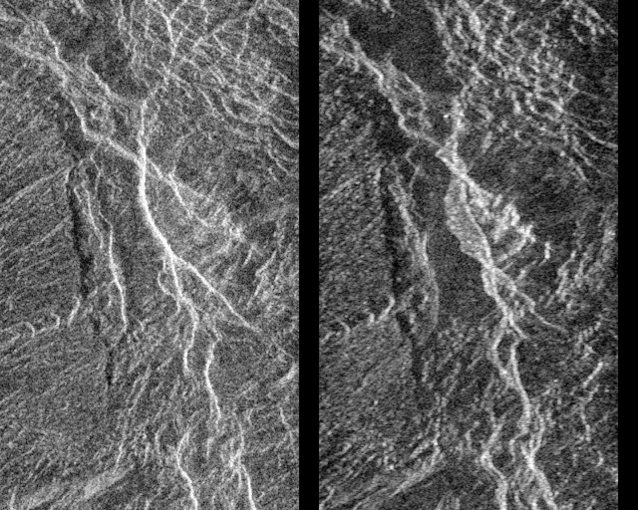
Landslides on Venus! The image on the left was taken in late November of 1990 during Magellan's first trip around Venus. The image on the right was taken July 23, as the Magellan spacecraft passed over the region for the second time. Each image is 24 kilometers (14.4 miles) across and 38 kilometers (23 miles) long, and is centered at 2 degrees south latitude and 74 degrees east longitude. This pair of Magellan images shows a region in Aphrodite Terra, within a steeply sloping valley that is cut by many fractures. In the center of the image on the right, a bright, flow-like area can be seen extending to the west (left) of a bright fracture. The bright, rough area has appeared and the fracture has changed position in the 8 months since the first image was made. A 'Venusquake' may have occurred, producing a new scarp and causing a landslide (the bright area) to form. This is the first evidence of active tectonics occurring on other planets in the solar system. Resolution of the Magellan data is 120 meters (400 feet).
Cataloging Keywords:
| Name |
Value |
Additional Values |
| Target |
Venus |
|
| System |
|
|
| Target Type |
Planet |
|
| Mission |
Magellan |
|
| Instrument Host |
Magellan |
|
| Host Type |
Orbiter |
|
| Instrument |
Imaging Radar |
|
| Detector |
|
|
| Extra Keywords |
Grayscale |
| Acquisition Date |
|
| Release Date |
1996-03-14 |
| Date in Caption |
|
|
| Image Credit |
NASA/JPL |
| Source |
photojournal.jpl.nasa.gov/catalog/PIA00248 |
| Identifier |
PIA00248 |
