skip to navigation
|
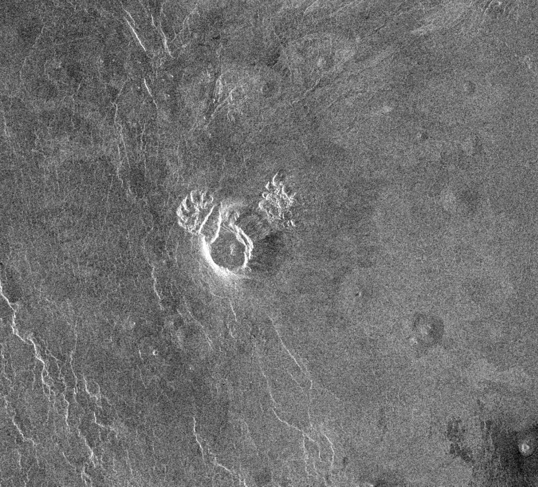
Venus - Landslide in Navka Region
- Click the image above for a larger view
- Full-Res JPEG (1452 x 1314) (587.3 kB)
- Full-Res TIFF (1452 x 1314) (1.6 MB)
Caption:
The Magellan spacecraft has observed remnant landslide deposits apparently resulting from the collapse of volcanic structures. This Magellan radar image is centered about 25.4 degrees south latitude and 308 degrees east longitude in the southwestern Navka Region of Venus. The image shows a 17.4 kilometer (10.8 mile) diameter volcanic dome on the plains. The dome is approximately 1.86 kilometers (1.2 mile) in height and it has a slope of about 23 degrees. The northwest and northeast flanks of the dome have collapsed to form landslides that have deposited debris on the plains. The image shows an area 110 kilometers (68 miles) across and 100 kilometers (62 miles) in length.
Cataloging Keywords:
| Name | Value | Additional Values |
|---|---|---|
| Target | Venus | |
| System | ||
| Target Type | Planet | |
| Mission | Magellan | |
| Instrument Host | Magellan | |
| Host Type | Orbiter | |
| Instrument | Imaging Radar | |
| Detector | ||
| Extra Keywords | Grayscale, Radar, Volcano | |
| Acquisition Date | ||
| Release Date | 1996-03-14 | |
| Date in Caption | ||
| Image Credit | NASA/JPL | |
| Source | photojournal.jpl.nasa.gov/catalog/PIA00262 | |
| Identifier | PIA00262 | |