skip to navigation
|
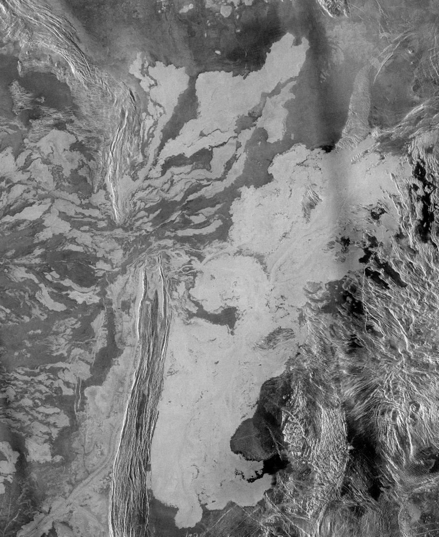
Venus - System of Lava Flows and Ridge Belt
- Click the image above for a larger view
- Full-Res JPEG (2510 x 3072) (2.2 MB)
- Full-Res TIFF (2510 x 3072) (6.3 MB)
Caption:
This is a 225 meter per pixel Magellan radar image mosaic of Venus, centered at 47 degrees south latitude, 25 degrees east longitude in the Lada region. The scene is approximately 550 kilometers (341 miles) east-west by 630 kilometers (391 miles) north-south. The mosaic shows a system of east-trending radar-bright and dark lava flows encountering and breaching a north-trending ridge belt (left of center). Upon breaching the ridge belt, the lavas pool in a vast, radar-bright deposit (covering approximately 100,000 square kilometers [right side of image]). The source caldera for the lava flows, named Ammavaru, lies approximately 300 kilometers (186 miles) west of the scene.
Cataloging Keywords:
| Name | Value | Additional Values |
|---|---|---|
| Target | Venus | |
| System | ||
| Target Type | Planet | |
| Mission | Magellan | |
| Instrument Host | Magellan | |
| Host Type | Orbiter | |
| Instrument | Imaging Radar | |
| Detector | ||
| Extra Keywords | Grayscale, Radar | |
| Acquisition Date | ||
| Release Date | 1996-11-14 | |
| Date in Caption | ||
| Image Credit | NASA/JPL | |
| Source | photojournal.jpl.nasa.gov/catalog/PIA00486 | |
| Identifier | PIA00486 | |