
|
Context of Europa images from Galileo
- Click the image above for a larger view
- Full-Res JPEG (1024 x 1024) (105.3 kB)
- Full-Res TIFF (1024 x 1024) (1.1 MB)
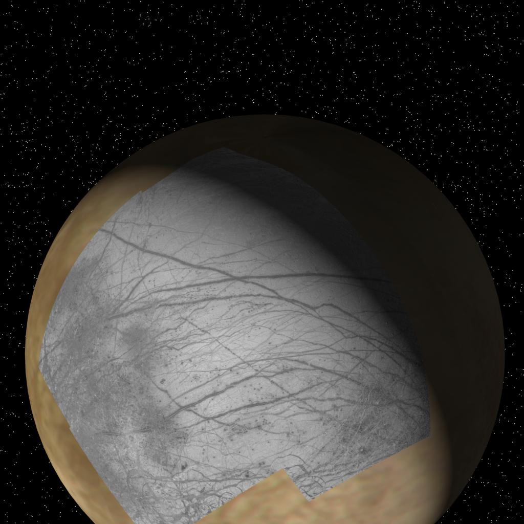
Caption:
This global view of Europa shows the location of a four-frame mosaic of images taken by NASA's Galileo spacecraft, set into low-resolution data obtained by the Voyager spacecraft in 1979. Putting new data into its surrounding context is a technique that allows scientists to better understand features observed on planetary surfaces. The Galileo spacecraft obtained these images during its first orbit of Jupiter at a distance of 156,000 km (96,300 miles) on June 27, 1996. The finest details that can discerned in this picture are about 1.6 kilometers (1 mile) across. North is to the top. For details on the Galileo images in this release, click here .
Background Info:
The Jet Propulsion Laboratory, Pasadena, CA manages the mission for NASA's Office of Space Science, Washington, DC.
This image and other images and data received from Galileo are posted on the World Wide Web, on the Galileo mission home page at URL http://www.jpl.nasa.gov/galileo/sepo .
Cataloging Keywords:
| Name | Value | Additional Values |
|---|---|---|
| Target | Europa | Jupiter |
| System | Jupiter | |
| Target Type | Satellite | Planet |
| Mission | Galileo | Voyager |
| Instrument Host | Galileo Orbiter | |
| Host Type | Orbiter | Flyby Spacecraft |
| Instrument | Solid-State Imaging (SSI) | |
| Detector | ||
| Extra Keywords | Color | |
| Acquisition Date | ||
| Release Date | 1997-09-07 | |
| Date in Caption | 1996-06-27 | |
| Image Credit | NASA/JPL | |
| Source | photojournal.jpl.nasa.gov/catalog/PIA00723 | |
| Identifier | PIA00723 | |