|
Mosaic of Io
- Click the image above for a larger view
- Full-Res JPEG (3711 x 2569) (1.0 MB)
- Full-Res TIFF (3711 x 2569) (6.4 MB)
Caption:
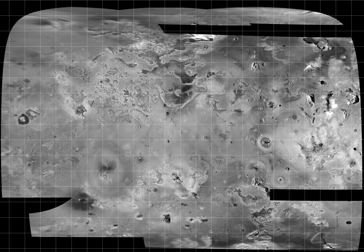
Mosaic of images of Io acquired during orbit C3, showing more than half of Io's surface. These are the best images available to show topographic features over most of this region. The map projection is called Simple Cylindrical, and the grid lines mark 10 degree intervals of latitude and longitude.
The mosaic covers an area of about 8 million square kilometers, and the finest details that can discerned are about 2.5 kilometers in size. North is to the top of the picture and the sun illuminates the surface from the left. The images which form this mosaic were obtained through the clear filter of the Solid State Imaging (CCD) system aboard NASA's Galileo spacecraft on Nov. 6, 1996 (Universal Time) at a range which varied from 245,719 kilometers to 403,100 kilometers.
Background Info:
The Jet Propulsion Laboratory, Pasadena, CA manages the mission for NASA's Office of Space Science, Washington, DC.
This image and other images and data received from Galileo are posted on the World Wide Web, on the Galileo mission home page at URL http://galileo.jpl.nasa.gov. Background information and educational context for the images can be found at http://www.jpl.nasa.gov/galileo/sepo .
Cataloging Keywords:
| Name | Value | Additional Values |
|---|---|---|
| Target | Io | |
| System | Jupiter | |
| Target Type | Satellite | |
| Mission | Galileo | |
| Instrument Host | Galileo Orbiter | |
| Host Type | Orbiter | |
| Instrument | Solid-State Imaging (SSI) | |
| Detector | ||
| Extra Keywords | Grayscale, Map | |
| Acquisition Date | ||
| Release Date | 1997-12-18 | |
| Date in Caption | 1996-11-06 | |
| Image Credit | NASA/JPL/University of Arizona | |
| Source | photojournal.jpl.nasa.gov/catalog/PIA01108 | |
| Identifier | PIA01108 | |