|
MOC View of Mars98 Landing Zone - 12/24/97
- Click the image above for a larger view
- Full-Res JPEG (2048 x 2048) (534.9 kB)
- Full-Res TIFF (2048 x 2048) (2.7 MB)
Caption:
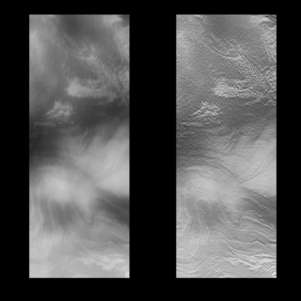
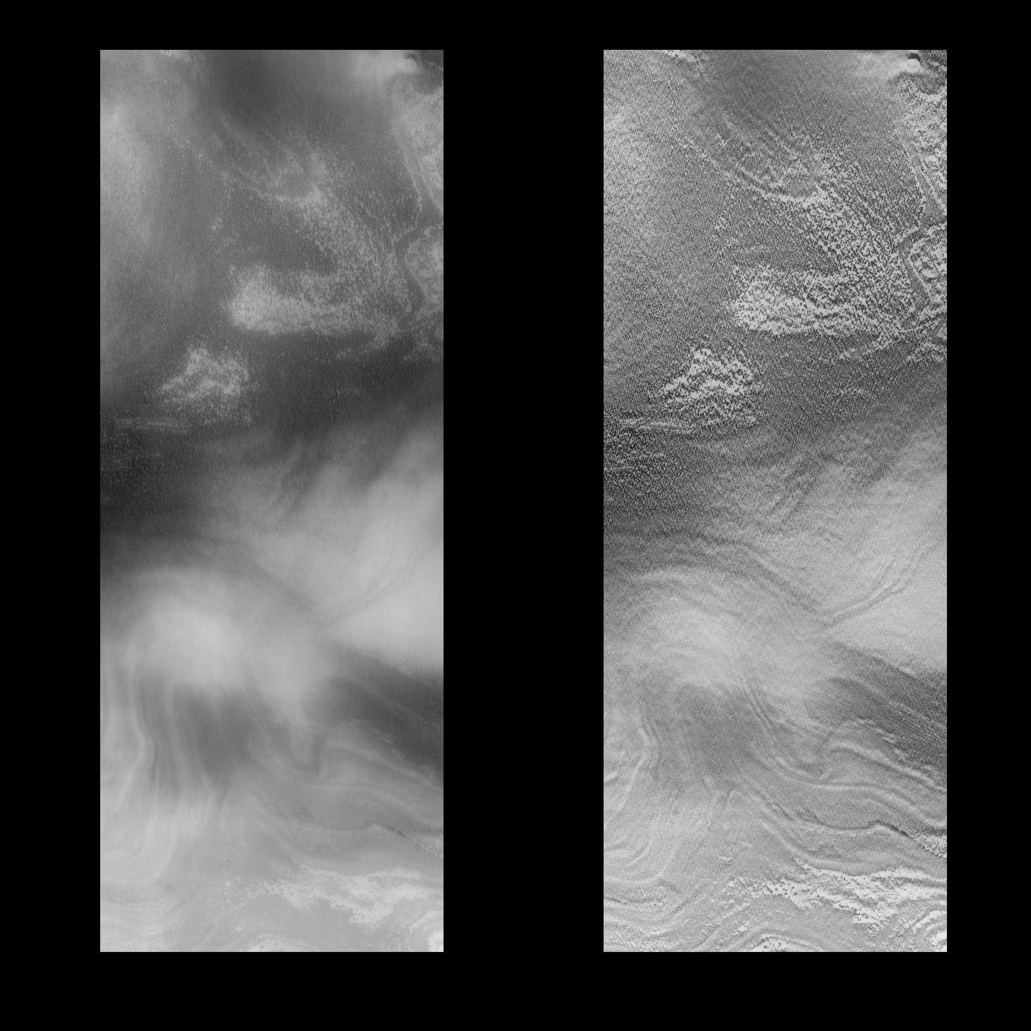
On 12/24/1997 at shortly after 08:17 UTC SCET, the Mars Global Surveyor Mars Orbiter Camera (MOC) took this high resolution image of a small portion of the potential Mars Surveyor '98 landing zone. For the purposes of planning MOC observations, this zone was defined as 75 +/- 2 degrees S latitude, 215 +/- 15 degrees W longitude. The image ran along the western perimeter of the Mars98 landing zone (e.g., near 245°W longitude). At that longitude, the layered deposits are farther south than at the prime landing longitude. The images were shifted in latitude to fall onto the layered deposits. The location of the image was selected to try to cover a range of possible surface morphologies, reliefs, and albedos.
This image is approximately 83.3 km long by 31.7 km wide. It covers an area of about 2750 sq. km. The center of the image is at 81.97 degrees S, 246.74 degrees W. The viewing conditions are: emission angle 58.23 degrees, incidence angle 60.23 degrees, phase of 30.34 degrees, and 15.49 meters/pixel resolution. North is to the top of the image.
The effects of ground fog, which obscures the surface features(left), has been minimize by filtering (right).
Background Info:
Malin Space Science Systems (MSSS) and the California Institute of Technology built the MOC using spare hardware from the Mars Observer mission. MSSS operates the camera from its facilities in San Diego, CA. The Jet Propulsion Laboratory's Mars Surveyor Operations Project operates the Mars Global Surveyor spacecraft with its industrial partner, Lockheed Martin Astronautics, from facilities in Pasadena, CA and Denver, CO.
Cataloging Keywords:
| Name | Value | Additional Values |
|---|---|---|
| Target | Mars | |
| System | ||
| Target Type | Planet | |
| Mission | Mars Global Surveyor (MGS) | |
| Instrument Host | Mars Global Surveyor | |
| Host Type | Orbiter | |
| Instrument | Mars Orbiter Camera (MOC) | |
| Detector | ||
| Extra Keywords | Dust, Grayscale | |
| Acquisition Date | ||
| Release Date | 1998-02-12 | |
| Date in Caption | 1997-12-24 | |
| Image Credit | NASA/JPL/Malin Space Science Systems | |
| Source | photojournal.jpl.nasa.gov/catalog/PIA01172 | |
| Identifier | PIA01172 | |