|
MOC View of Mars98 Landing Zone - 1/16/98
- Click the image above for a larger view
- Full-Res JPEG (2048 x 2048) (522.4 kB)
- Full-Res TIFF (2048 x 2048) (2.6 MB)
Caption:
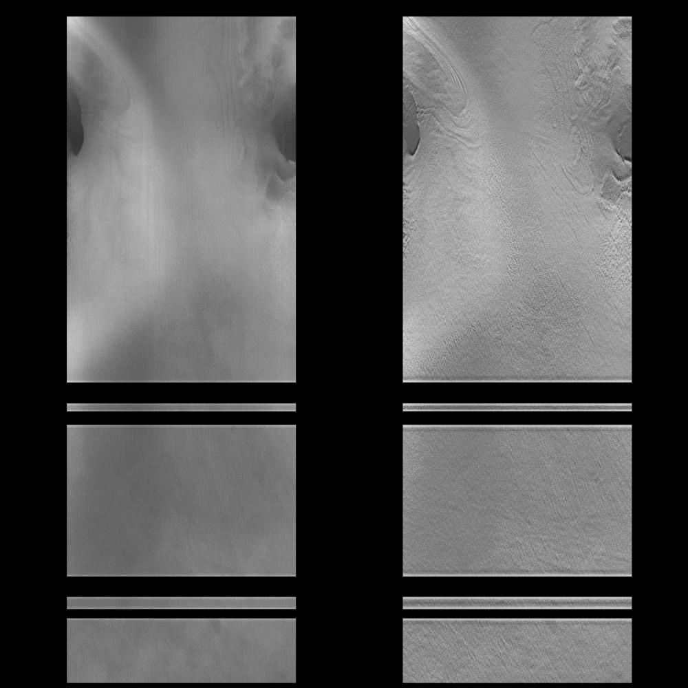
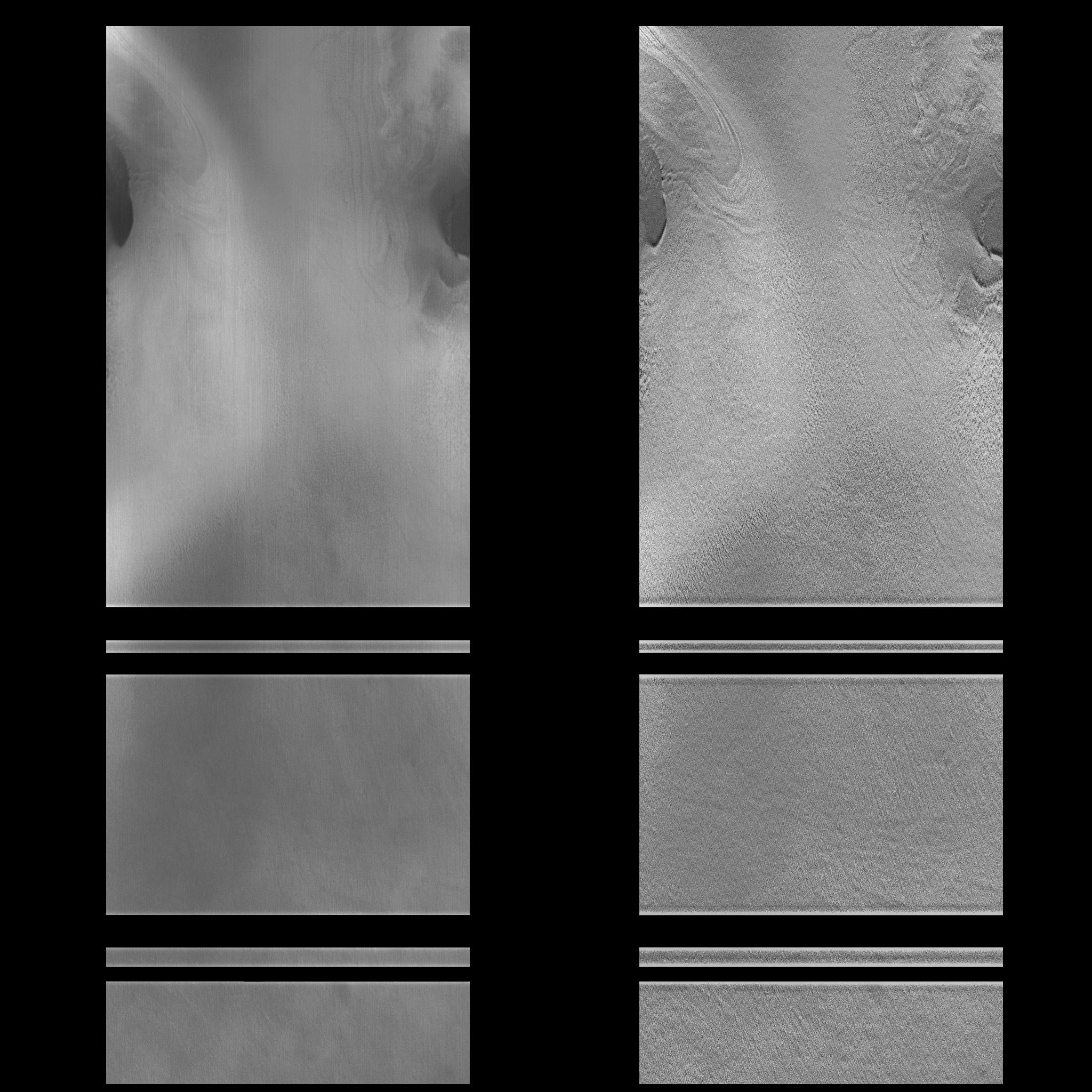
On 1/16/1998 at shortly after 12:12 UTC SCET, the Mars Global Surveyor Mars Orbiter Camera (MOC) took this high resolution image of a small portion of the potential Mars Surveyor '98 landing zone. For the purposes of planning MOC observations, this zone was defined as 75 +/- 2 degrees S latitude, 215 +/- 15 degrees W longitude. The location of the image was selected to try to cover a range of possible surface morphologies, reliefs, and albedos.
The spacecraft was observing at approximately 75 degrees S, 213 degrees W. North is to the top of the image.
The effects of ground fog, which obscures the surface features(left), has been minimize by filtering (right).
Background Info:
Malin Space Science Systems (MSSS) and the California Institute of Technology built the MOC using spare hardware from the Mars Observer mission. MSSS operates the camera from its facilities in San Diego, CA. The Jet Propulsion Laboratory's Mars Surveyor Operations Project operates the Mars Global Surveyor spacecraft with its industrial partner, Lockheed Martin Astronautics, from facilities in Pasadena, CA and Denver, CO.
Cataloging Keywords:
| Name | Value | Additional Values |
|---|---|---|
| Target | Mars | |
| System | ||
| Target Type | Planet | |
| Mission | Mars Global Surveyor (MGS) | |
| Instrument Host | Mars Global Surveyor | |
| Host Type | Orbiter | |
| Instrument | Mars Orbiter Camera (MOC) | |
| Detector | ||
| Extra Keywords | Dust, Grayscale | |
| Acquisition Date | ||
| Release Date | 1998-02-12 | |
| Date in Caption | 1998-01-16 | |
| Image Credit | NASA/JPL/Malin Space Science Systems | |
| Source | photojournal.jpl.nasa.gov/catalog/PIA01174 | |
| Identifier | PIA01174 | |