|
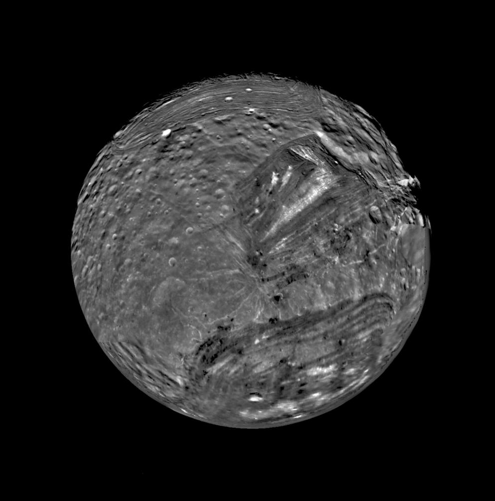
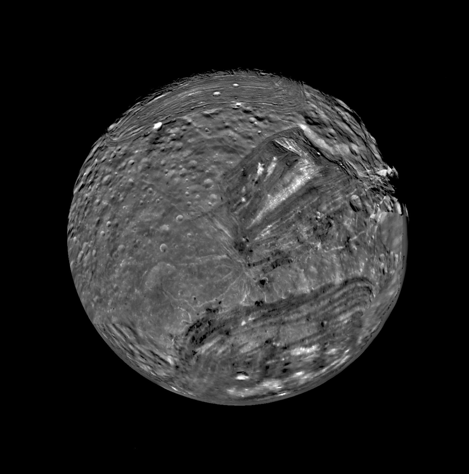
South Polar View of Miranda
- Click the image above for a larger view
- Full-Res JPEG (1581 x 1600) (160.1 kB)
- Full-Res TIFF (1581 x 1600) (955.1 kB)
Caption:
Uranus' moon Miranda is shown in a computer-assembled mosaic of images obtained Jan. 24, 1986, by the Voyager 2 spacecraft. Miranda is the innermost and smallest of the five major Uranian satellites, just 480 kilometers (about 300 miles) in diameter. Nine images were combined to obtain this full-disc, south-polar view, which shows the varying geologic provinces of Miranda. The bulk of the photo comprises seven high-resolution images from the Voyager closest-approach sequence. Data from more distant, lower-resolution images were used to fill in gaps along the limb.
Miranda's surface consists of two strikingly different major types of terrain. One is an old, heavily cratered, rolling terrain with relatively uniform albedo, or reflectivity. The other is a young, complex terrain characterized by sets of bright and dark bands, scarps and ridges features found in the ovoid regions at the top and bottom and in the distinctive "chevron" feature above and to the right of center.
Final image processing was done by the U.S. Geological Survey in Flagstaff, Ariz. Special navigational data used to improve Voyager's camera pointing were also used to "control" or register the images in the assembly of the mosaic; the data were generated by means of new techniques developed by JPL's Navigation Ancillary Information Facility. The images were projected onto a global sinusoidal map base.
Background Info:
The Voyager Project is managed for NASA by Caltech's Jet Propulsion Laboratory.
Cataloging Keywords:
| Name | Value | Additional Values |
|---|---|---|
| Target | Miranda | |
| System | Uranus | |
| Target Type | Satellite | |
| Mission | Voyager | |
| Instrument Host | Voyager 2 | |
| Host Type | Flyby Spacecraft | |
| Instrument | ||
| Detector | ||
| Extra Keywords | Crater, Grayscale, Map | |
| Acquisition Date | ||
| Release Date | 1998-10-30 | |
| Date in Caption | 1986-01-24 | |
| Image Credit | NASA/JPL/USGS | |
| Source | photojournal.jpl.nasa.gov/catalog/PIA01490 | |
| Identifier | PIA01490 | |