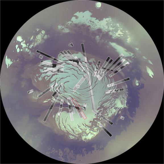
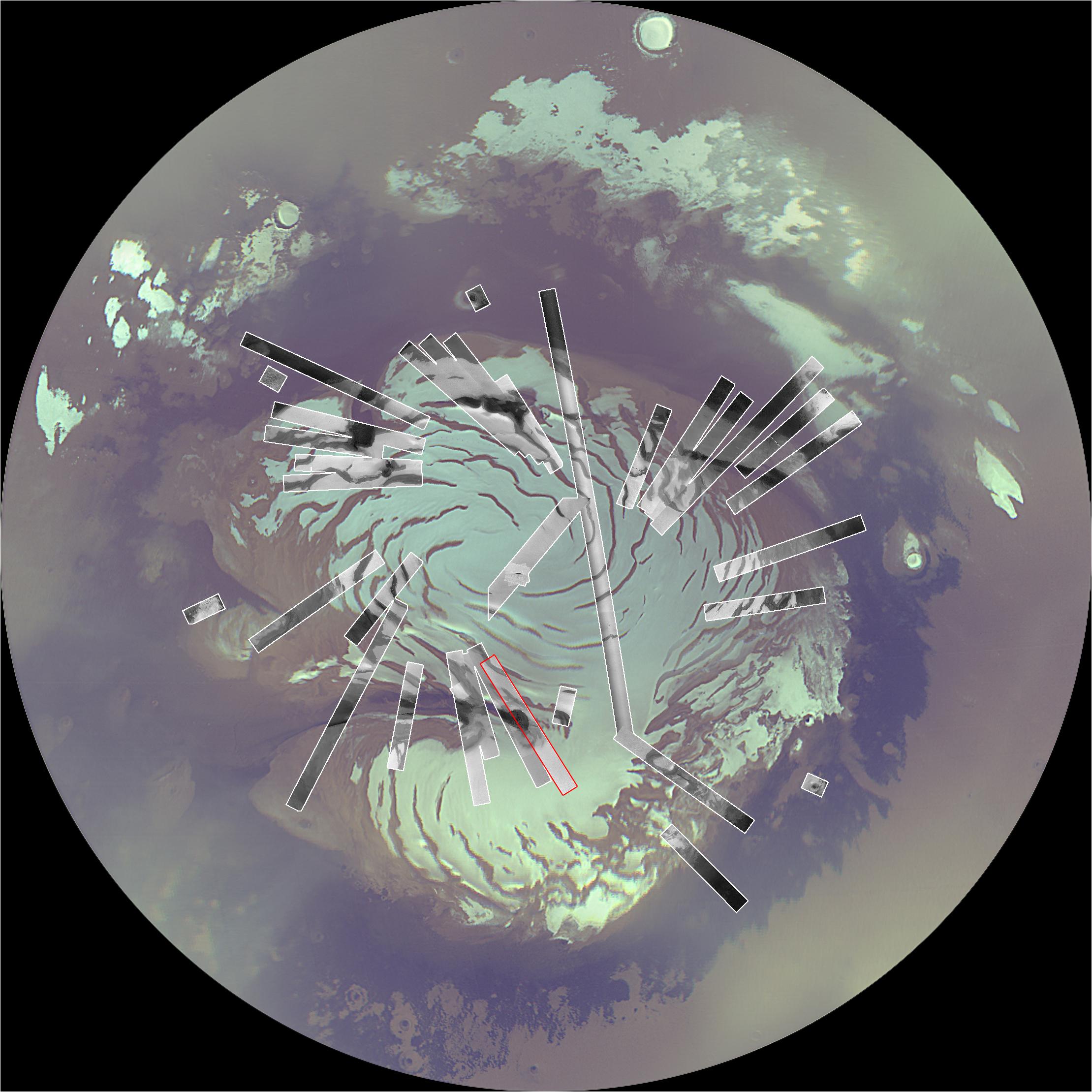
Map of Context Camera’s North Polar Coverage During Checkout
Caption:
In October 2006, Northern Mars is near the middle of its summer, and the continued southern movement of the sun will have two main impacts on imaging: The illumination will get worse as eventually the entire polar region will be in darkness during winter, and northern hemispheric dust storms and polar cloudiness will obscure the surface. Because now is the best time to be imaging the north polar region until 2008, the team using the Context Camera on NASA's Mars Reconnaissance Orbiter is devoting much of its imaging resources to acquiring images of the polar region. This image shows a north polar mosaic from the orbiter's Mars Color Imager inscribed with rectangles indicating the coverage acquired by Context Camera in less than two weeks of September and October, 2006. Following conjunction (when Mars is nearly behind the sun from Earth's perspective), the team will devote as much of November as the atmosphere permits to imaging the polar region.Marked in red on this map is the footprint of the Context Camera image shown at
PIA01930
.
Cataloging Keywords:
| Name |
Value |
Additional Values |
| Target |
Mars |
|
| System |
|
|
| Target Type |
Planet |
|
| Mission |
Mars Global Surveyor (MGS) |
Mars Reconnaissance Orbiter (MRO) |
| Instrument Host |
Mars Global Surveyor |
Mars Reconnaissance Orbiter |
| Host Type |
Orbiter |
|
| Instrument |
Context Camera (CTX) |
Mars Color Imager (MARCI) |
| Detector |
|
|
| Extra Keywords |
Atmosphere, Color, Dust, Impact, Map, Storm |
| Acquisition Date |
|
| Release Date |
2006-10-16 |
| Date in Caption |
|
|
| Image Credit |
NASA/JPL/MSSS |
| Source |
photojournal.jpl.nasa.gov/catalog/PIA01929 |
| Identifier |
PIA01929 |