skip to navigation
|
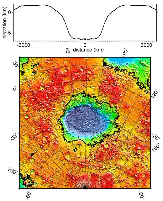
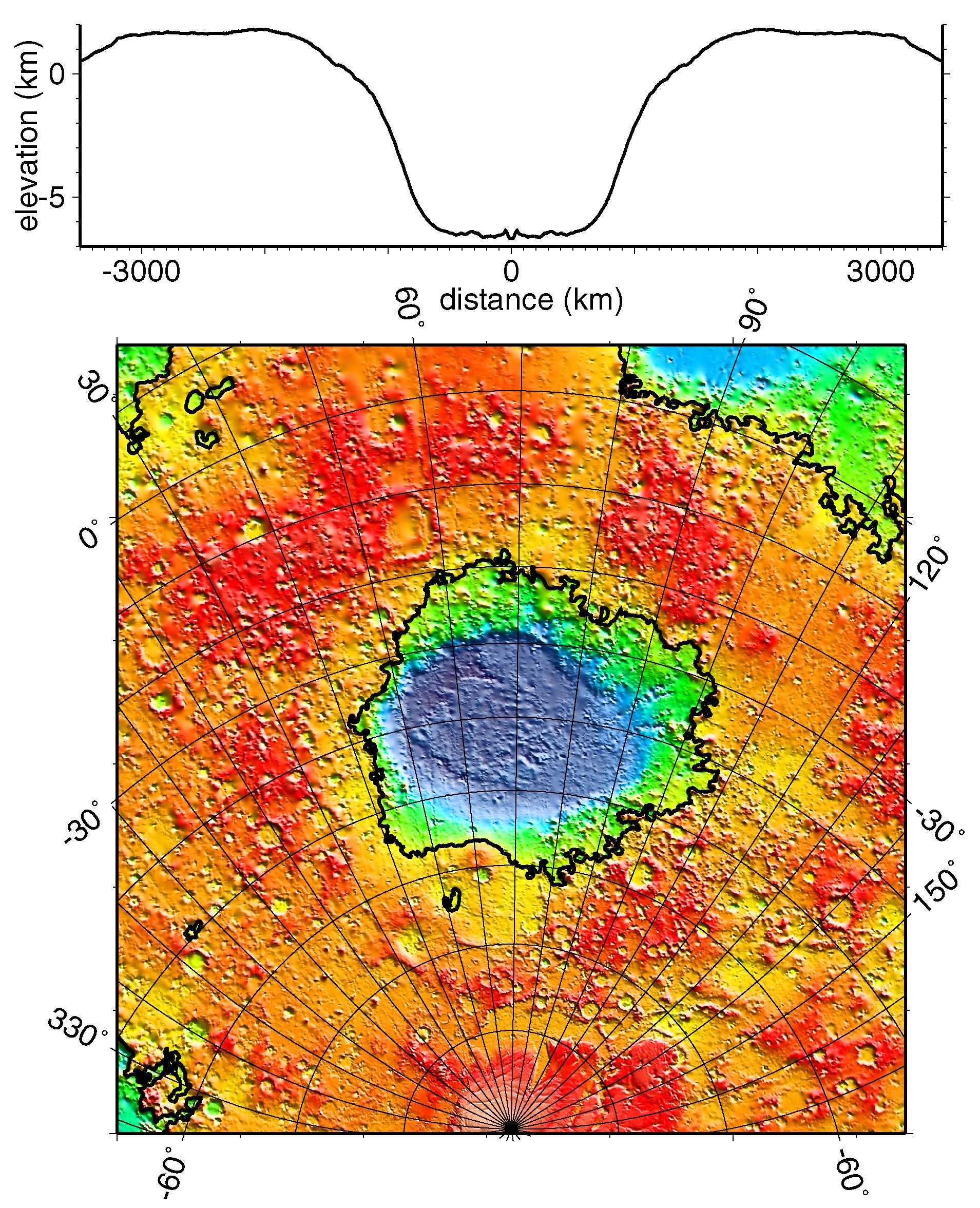
Regional Topographic Model of the Hellas Basin
- Click the image above for a larger view
- Full-Res JPEG (1909 x 2353) (901.7 kB)
- Full-Res TIFF (1909 x 2353) (8.5 MB)
Caption:
Regional topographic model of the Hellas basin. (Top) Azimuthally-averaged radial topography used in the calculation of infilling the basin with surrounding material postulated to have been excavated from it. (Bottom) Color-coded topography plotted in an equal-area projection. The black lines correspond to zero-elevation contours.
Cataloging Keywords:
| Name | Value | Additional Values |
|---|---|---|
| Target | Mars | |
| System | ||
| Target Type | Planet | |
| Mission | Mars Global Surveyor (MGS) | |
| Instrument Host | Mars Global Surveyor | |
| Host Type | Orbiter | |
| Instrument | Mars Orbiter Laser Altimeter (MOLA) | |
| Detector | ||
| Extra Keywords | Color | |
| Acquisition Date | ||
| Release Date | 1999-05-27 | |
| Date in Caption | ||
| Image Credit | NASA/JPL/GSFC | |
| Source | photojournal.jpl.nasa.gov/catalog/PIA02033 | |
| Identifier | PIA02033 | |