skip to navigation
|
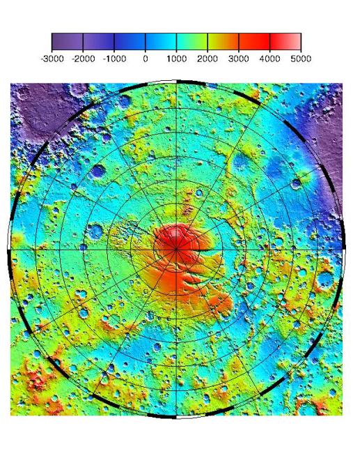
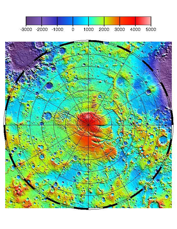
MOLA TOPOGRAPHIC MAP
- Click the image above for a larger view
- Full-Res JPEG (612 x 792) (182.1 kB)
- Full-Res TIFF (612 x 792) (1.3 MB)
Caption:
The context image shows the latest MOLA topographic map of Mars' from latitude 55° S to the south pole. Values of elevation on the color scale are in meters. The along-track resolution of MOLA profiles is 330 m. Vertical precision of individual elevations approaches 37 cm. Absolute accuracy of the grid with respect to Mars' center of mass is <10 m. Note that there is a gap in data within 2.8° of the south pole due to the inclination of the MGS orbit. This gap will be filled in later this month by tilting the MGS spacecraft to an off-nadir ranging configuration. The MPL landing site region is between latitudes 72° and 78° S and longitudes 130° to 190° E.
Cataloging Keywords:
| Name | Value | Additional Values |
|---|---|---|
| Target | Mars | |
| System | ||
| Target Type | Planet | |
| Mission | Mars Global Surveyor (MGS) | |
| Instrument Host | Mars Global Surveyor | |
| Host Type | Orbiter | |
| Instrument | Mars Orbiter Laser Altimeter (MOLA) | |
| Detector | ||
| Extra Keywords | Color, Map | |
| Acquisition Date | ||
| Release Date | 1999-07-06 | |
| Date in Caption | ||
| Image Credit | NASA/JPL/GSFC | |
| Source | photojournal.jpl.nasa.gov/catalog/PIA02088 | |
| Identifier | PIA02088 | |