|
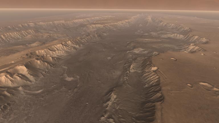
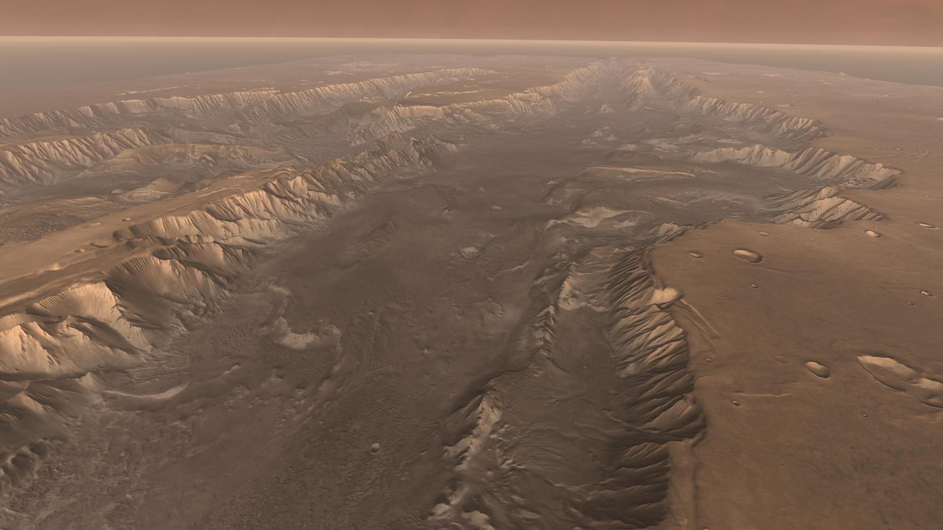
High View of Melas
- Click the image above for a larger view
- Full-Res JPEG (1920 x 1080) (172.0 kB)
- Full-Res TIFF (1920 x 1080) (6.2 MB)
Caption:
Soaring high above Valles Marineris, the "Grand Canyon of Mars," viewers look down and catch a sight resembling parts of the desert West of the United States, but on a vastly greater scale. Here the canyon averages over a hundred miles wide, and its floor is heaped with rocks, sediments, and landslide debris. Within the canyon walls lie possibly hundreds of layers filling many pages of Mars' geologic record.
This scene comes from " Flight Through Mariner Valley ," an exciting video produced for NASA by the Jet Propulsion Laboratory. The video takes viewers on a simulated flight into Valles Marineris, where they explore its scenic wonders as their imaginary scout ship dives low over landslides and races through winding canyons.
The video features high-resolution images from Arizona State University's Thermal Emission Imaging System multi-band camera on NASA's Mars Odyssey. The images, which show details as small as 300 meters (1,000 feet) across, were taken at infrared wavelengths during the Martian daytime. Scientists joined hundreds of individual frames from the camera into a giant mosaic, then colored the mosaic to approximate how Mars would appear to the human eye.
To give the mosaic depth and height, moviemakers fitted it to a computerized topographic model for Valles Marineris. This was developed using hundreds of thousands of altitude measurements by the Mars Orbiter Laser Altimeter, an instrument on NASA's Mars Global Surveyor spacecraft.
Cataloging Keywords:
| Name | Value | Additional Values |
|---|---|---|
| Target | Mars | |
| System | ||
| Target Type | Planet | |
| Mission | 2001 Mars Odyssey | Mariner, Mars Global Surveyor (MGS) |
| Instrument Host | Mars Odyssey | Mars Global Surveyor |
| Host Type | Orbiter | Flyby Spacecraft |
| Instrument | Thermal Emission Imaging System (THEMIS) | |
| Detector | ||
| Extra Keywords | Color, Infrared, Thermal | |
| Acquisition Date | ||
| Release Date | 2006-03-13 | |
| Date in Caption | ||
| Image Credit | NASA/JPL/Arizona State University | |
| Source | photojournal.jpl.nasa.gov/catalog/PIA02893 | |
| Identifier | PIA02893 | |