
|
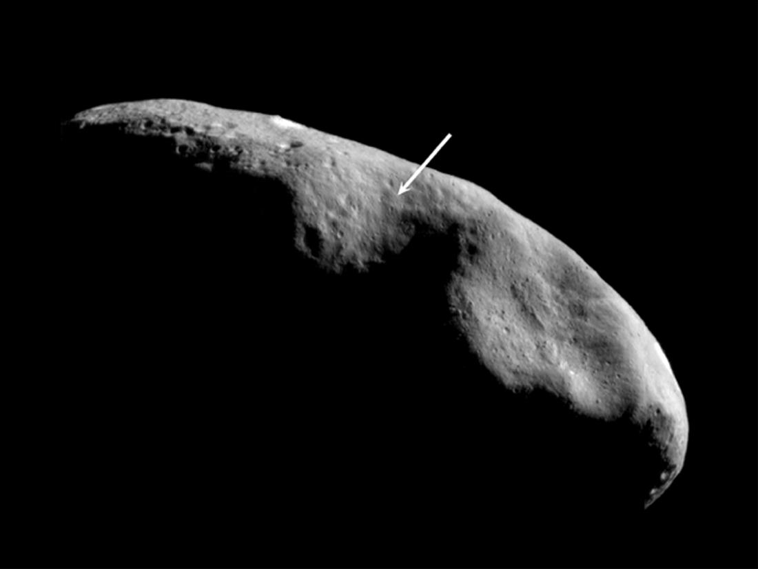
Location of the NEAR Shoemaker Landing Site
- Click the image above for a larger view
- Full-Res JPEG (1100 x 825) (31.7 kB)
- Full-Res TIFF (1100 x 825) (168.2 kB)
Caption:
The location of NEAR Shoemaker's planned landing site is shown in this image mosaic taken on December 3, 2000, from an orbital altitude of 200 kilometers (124 miles). In this view, south is to the top and the terminator (the imaginary line dividing day from night) lies near the equator. The landing site (at the tip of the arrow) is near the boundary of two distinctly different provinces, both of which the spacecraft will photograph as it descends. To the south and east (above and to the left) lies older, cratered terrain, while to the north (down) is the saddle-shaped feature Himeros, whose lesser density of superposed craters indicates relatively recent resurfacing by geologic processes.
Background Info:
Built and managed by The Johns Hopkins University Applied Physics Laboratory, Laurel, Maryland, NEAR was the first spacecraft launched in NASA's Discovery Program of low-cost, small-scale planetary missions. See the NEAR web page at http://near.jhuapl.edu/ for more details.
Cataloging Keywords:
| Name | Value | Additional Values |
|---|---|---|
| Target | 433 Eros | |
| System | Near Earth Objects | |
| Target Type | Asteroid | |
| Mission | NEAR Shoemaker | |
| Instrument Host | NEAR Shoemaker | |
| Host Type | Orbiter | |
| Instrument | Multi-Spectral Imager (MSI) | |
| Detector | ||
| Extra Keywords | Crater, Grayscale | |
| Acquisition Date | ||
| Release Date | 2001-02-17 | |
| Date in Caption | 2000-12-03 | |
| Image Credit | NASA/JPL/JHUAPL | |
| Source | photojournal.jpl.nasa.gov/catalog/PIA03143 | |
| Identifier | PIA03143 | |