
|
Titan’s Rain Drains to the Plains
- Click the image above for a larger view
- Full-Res JPEG (1287 x 1516) (609.6 kB)
- Full-Res TIFF (1287 x 1516) (2.0 MB)
Caption:
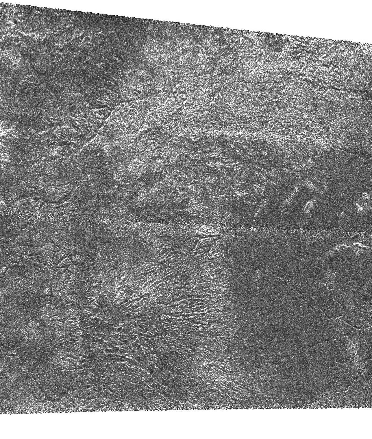
In contrast to ( PIA03564 ), this bright terrain is cut by channels that are variable in width; they form both radial and branching networks. Such patterns are reminiscent of networks formed by rainfall on Earth.
At the bottom of the frame, the channels radiate from a possible source into a dark, smooth region that seems flatter and more plains-like. One interpretation is that the higher, rougher terrain has been cleansed of organic debris and eroded by methane rainfall. The removed material has then been deposited into the lower plains.
This Cassini Synthetic Aperture Radar image of Titan was taken on Sept. 7, 2005, at a distance of 2,000 kilometers (1,250 miles) from Titan. It is located near 48 degrees south latitude, 14 degrees west longitude and extends about 240 kilometers (150 miles) right to left.
Background Info:
The Cassini-Huygens mission is a cooperative project of NASA, the European Space Agency and the Italian Space Agency. The Jet Propulsion Laboratory, a division of the California Institute of Technology in Pasadena, manages the mission for NASA's Science Mission Directorate, Washington, D.C. The Cassini orbiter was designed, developed and assembled at JPL. The radar instrument was built by JPL and the Italian Space Agency, working with team members from the United States and several European countries.
For more information about the Cassini-Huygens mission visit http://saturn.jpl.nasa.gov .
Cataloging Keywords:
| Name | Value | Additional Values |
|---|---|---|
| Target | Titan | |
| System | Saturn | |
| Target Type | Satellite | |
| Mission | Cassini-Huygens | |
| Instrument Host | Cassini Orbiter | |
| Host Type | Orbiter | |
| Instrument | Radar Mapper | |
| Detector | ||
| Extra Keywords | Grayscale, Methane, Radar | |
| Acquisition Date | ||
| Release Date | 2005-09-16 | |
| Date in Caption | ||
| Image Credit | NASA/JPL-Caltech/ASI | |
| Source | photojournal.jpl.nasa.gov/catalog/PIA03565 | |
| Identifier | PIA03565 | |