|
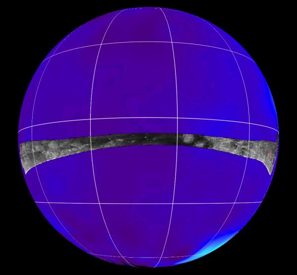
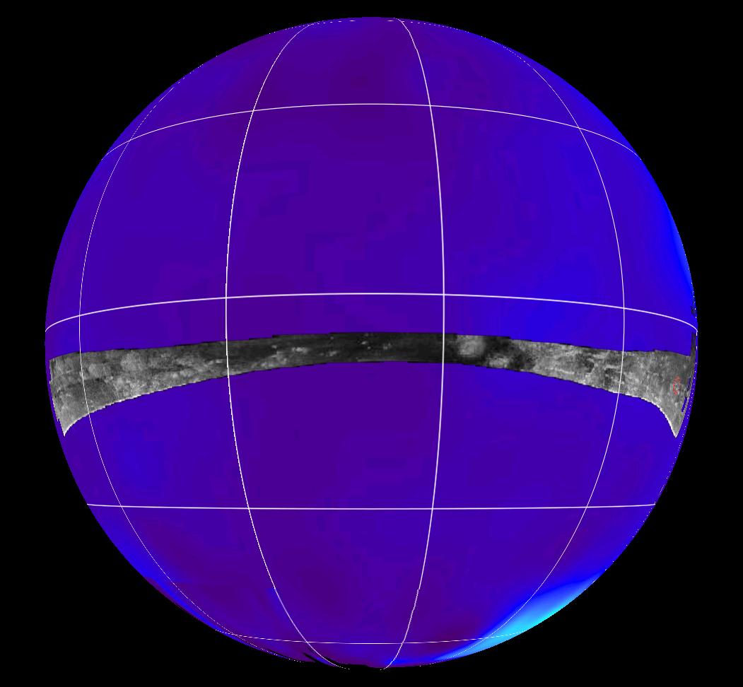
Radar Swath of Oct. 28, 2005, Titan Flyby
- Click the image above for a larger view
- Full-Res JPEG (1051 x 972) (65.0 kB)
- Full-Res TIFF (1051 x 972) (3.1 MB)
Caption:
This map of Saturn's moon Titan shows the location mapped with the Cassini radar mapper using its synthetic aperture radar imaging mode during the Oct. 28, 2005, flyby.
The radar swath is superimposed on a false-color image made from observations by NASA's Hubble Space Telescope.
The location of the Huygens landing site is marked in red on the far right. The overlap between the Huygens data and the radar data will give new clues to the nature of the surface seen by the Huygens probe, which landed on Titan in January 2005.
The Oct. 28 swath is about 6,150 kilometers long (3,821 miles), extending from 7 degrees north to 18 degrees south latitude and 179 degrees west to 320 degrees west longitude. The spatial resolution of the radar images ranges from about 300 meters (980 feet) per pixel to about 1.5 kilometers (0.93 miles) per pixel.
Cassini's four radar passes revealed a variety of geologic features, including impact craters, wind-blown deposits, channels and cryovolcanic features.
Background Info:
The Cassini-Huygens mission is a cooperative project of NASA, the European Space Agency and the Italian Space Agency. The Jet Propulsion Laboratory, a division of the California Institute of Technology in Pasadena, manages the mission for NASA's Science Mission Directorate, Washington, D.C. The Cassini orbiter was designed, developed and assembled at JPL. The radar instrument was built by JPL and the Italian Space Agency, working with team members from the United States and several European countries.
For more information about the Cassini-Huygens mission visit http://saturn.jpl.nasa.gov .
Cataloging Keywords:
| Name | Value | Additional Values |
|---|---|---|
| Target | Titan | |
| System | Saturn | |
| Target Type | Satellite | |
| Mission | Cassini-Huygens | Hubble Space Telescope (HST) |
| Instrument Host | Cassini Orbiter | Hubble Space Telescope, Huygens Probe |
| Host Type | Orbiter | Lander, Probe, Space Telescope |
| Instrument | Radar Mapper | |
| Detector | ||
| Extra Keywords | Color, Crater, Impact, Map, Radar, Volcano | |
| Acquisition Date | ||
| Release Date | 2005-11-16 | |
| Date in Caption | 2005-10-28 | |
| Image Credit | NASA/JPL-Caltech/ASI | |
| Source | photojournal.jpl.nasa.gov/catalog/PIA03570 | |
| Identifier | PIA03570 | |