skip to navigation

|
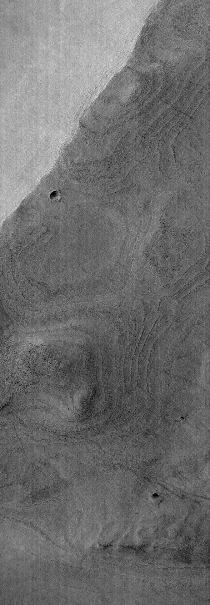
Banded Argyre
- Click the image above for a larger view
- Full-Res JPEG (672 x 1934) (213.6 kB)
- Full-Res TIFF (672 x 1934) (1.3 MB)
Caption:
12 December 2005
This Mars Global Surveyor (MGS) Mars Orbiter Camera (MOC) image shows a banded surface in Argyre Planitia, the second largest impact basin in the martian southern hemisphere. The bands are the erosional expression of layered, perhaps sedimentary, rock.
Location near
: 55.8°S, 45.4°W
Image width
: width: ~3 km (~1.9 mi)
Illumination from
: upper left
Season
: Southern Summer
Cataloging Keywords:
| Name | Value | Additional Values |
|---|---|---|
| Target | Mars | |
| System | ||
| Target Type | Planet | |
| Mission | Mars Global Surveyor (MGS) | |
| Instrument Host | Mars Global Surveyor | |
| Host Type | Orbiter | |
| Instrument | Mars Orbiter Camera (MOC) | |
| Detector | ||
| Extra Keywords | Grayscale, Impact | |
| Acquisition Date | ||
| Release Date | 2005-12-12 | |
| Date in Caption | 2005-12-12 | |
| Image Credit | NASA/JPL/Malin Space Science Systems | |
| Source | photojournal.jpl.nasa.gov/catalog/PIA03631 | |
| Identifier | PIA03631 | |