skip to navigation
|
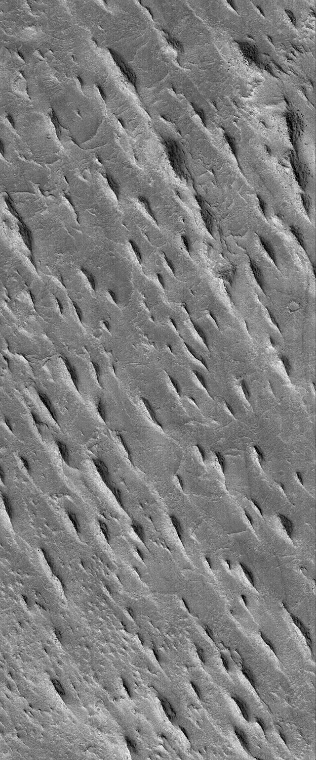
Aeolis Yardangs
- Click the image above for a larger view
- Full-Res JPEG (640 x 1536) (267.4 kB)
- Full-Res TIFF (640 x 1536) (984.3 kB)
Caption:
12 January 2006
This Mars Global Surveyor (MGS) Mars Orbiter Camera (MOC) image shows a group of tapered ridges, known as yardangs, which formed by wind erosion of a relatively easily-eroded material, most likely sedimentary rock or volcanic ash deposits containing some fraction of sand-sized grains.
Location near
: 6.1°S, 210.8°W
Image width
: ~2 km (~1.2 mi)
Illumination from
: lower left
Season
: Southern Summer
Cataloging Keywords:
| Name | Value | Additional Values |
|---|---|---|
| Target | Mars | |
| System | ||
| Target Type | Planet | |
| Mission | Mars Global Surveyor (MGS) | |
| Instrument Host | Mars Global Surveyor | |
| Host Type | Orbiter | |
| Instrument | Mars Orbiter Camera (MOC) | |
| Detector | ||
| Extra Keywords | Grayscale, Volcano | |
| Acquisition Date | ||
| Release Date | 2006-01-12 | |
| Date in Caption | 2006-01-12 | |
| Image Credit | NASA/JPL/Malin Space Science Systems | |
| Source | photojournal.jpl.nasa.gov/catalog/PIA03661 | |
| Identifier | PIA03661 | |