skip to navigation

|
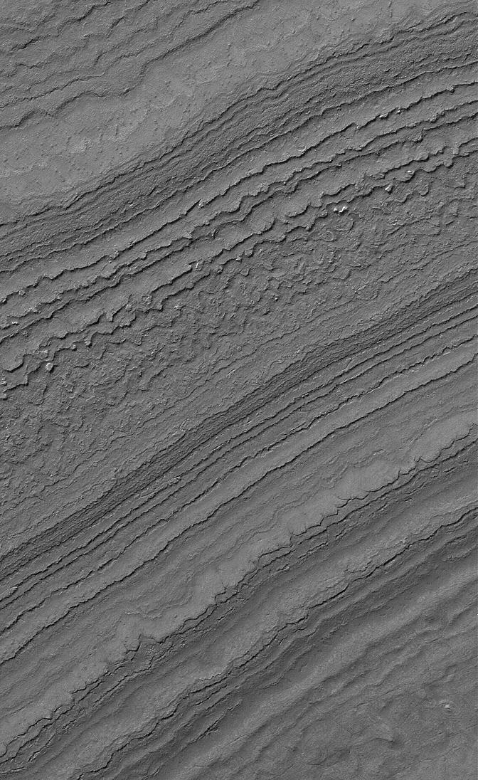
South Polar Terrain
- Click the image above for a larger view
- Full-Res JPEG (672 x 1096) (191.3 kB)
- Full-Res TIFF (672 x 1096) (737.5 kB)
Caption:
15 January 2006
This Mars Global Surveyor (MGS) Mars Orbiter Camera (MOC) image shows layers exposed by erosion on a slope in the martian south polar region. Both polar caps on Mars are underlain by a complex stratigraphy of layered material; the Mars Polar Lander -- lost in December 1999 -- was designed to have provided some insight as to the nature and composition of the layers in the southern hemisphere.
Location near
: 86.9°S, 180.5°W
Image width
: ~3 km (~1.9 mi)
Illumination from
: upper left
Season
: Southern Summer
Cataloging Keywords:
| Name | Value | Additional Values |
|---|---|---|
| Target | Mars | |
| System | ||
| Target Type | Planet | |
| Mission | Mars Global Surveyor (MGS) | |
| Instrument Host | Mars Global Surveyor | |
| Host Type | Orbiter | |
| Instrument | Mars Orbiter Camera (MOC) | |
| Detector | ||
| Extra Keywords | Grayscale | |
| Acquisition Date | ||
| Release Date | 2006-01-15 | |
| Date in Caption | 2006-01-15 | |
| Image Credit | NASA/JPL/Malin Space Science Systems | |
| Source | photojournal.jpl.nasa.gov/catalog/PIA03673 | |
| Identifier | PIA03673 | |