Mangala Fossa
Caption:
(Released 29 May 2002)
The Science
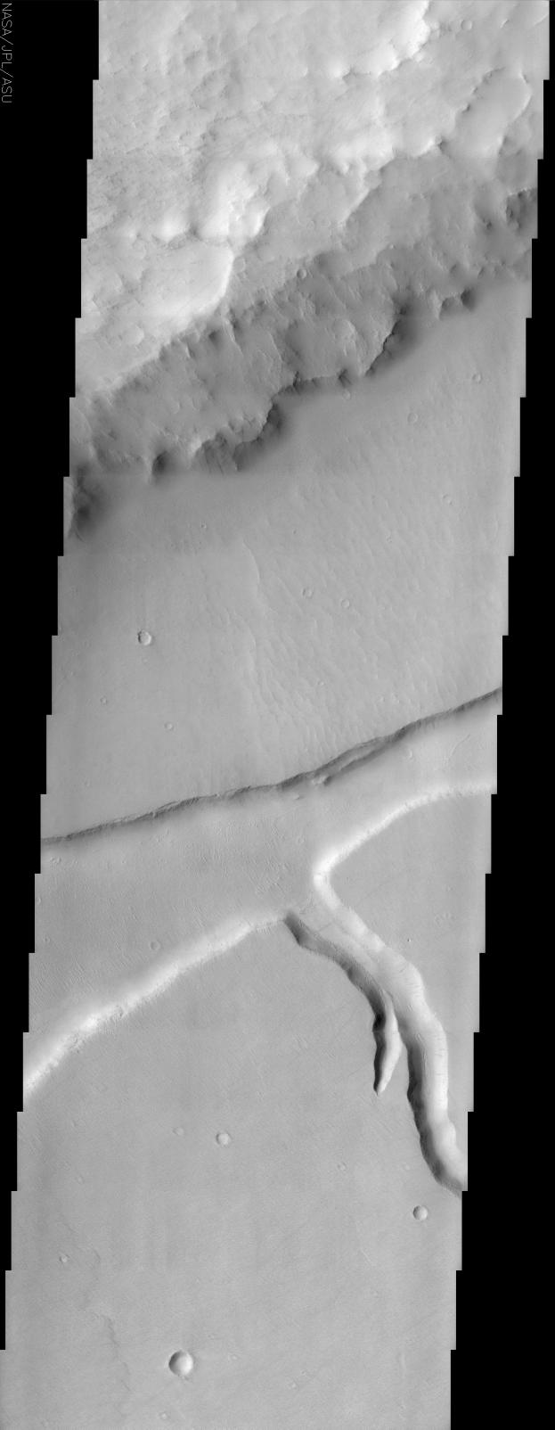
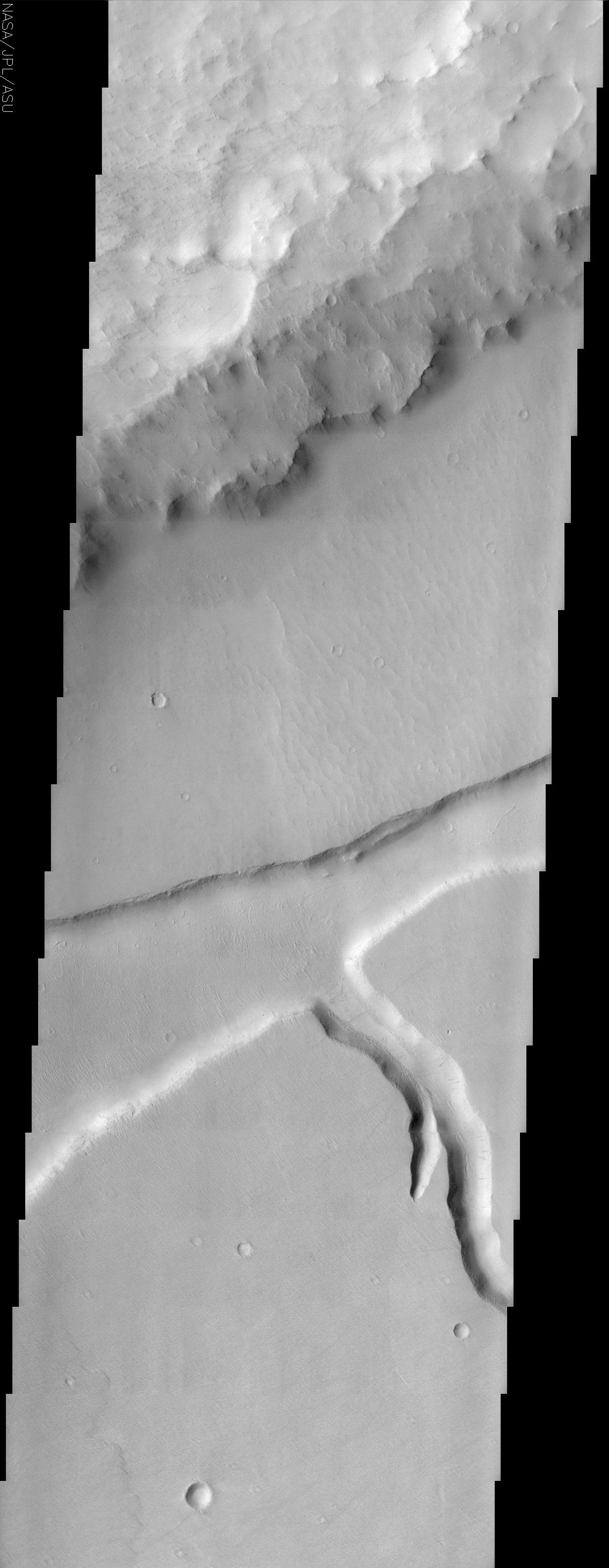
Today's THEMIS release captures Mangala Fossa. Mangala Fossa is a graben, which in geologic terminology translates into a long parallel to semi-parallel fracture or trough. Grabens are dropped or downthrown areas relative to the rocks on either side and these features are generally longer than they are wider. There are numerous dust devil trails seen in this image. In the lower portion of this image several dust devil tracks can be seen cutting across the upper surface then down the short stubby channel and finally back up and over to the adjacent upper surface. Some dust avalanche streaks on slopes are also visible. The rough material in the upper third of the image contains a portion of the rim of a 90 km diameter crater located in Daedalia Planum. The smooth crater floor has a graben (up to 7 km wide) and channel (2 km wide) incised into its surface. In the middle third and right of this image one can see ripples (possibly fossil dunes) on the crater floor material just above the graben. The floor of Mangala Fossa and the southern crater floor surface also have smaller linear ridges trending from the upper left to lower right. These linear ridges could be either erosional (yardangs) or depositional (dunes) landforms. The lower third of the scene contains a short stubby channel (near the right margin) and lava flow front (lower left). The floor of this channel is fairly smooth with some linear crevasses located along its course. One gets the impression that the channel floor is mantled with some type of indurated material that permits cracks to form in its surface.
The Story
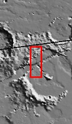
In the Daedalia Plains on Mars, the rim of an old eroded crater rises up, a wreck of its former self (see context image at right). From the rough, choppy crater rim (top of the larger THEMIS image), the terrain descends to the almost smooth crater floor, gouged deeply by a trough, a channel, and the occasional dents of small, scattered craters.
The deep trough running from southwest to northeast across the middle of this image is called "Mangala Fossa." Mangala Fossa is a graben, a land feature created by tectonic processes that worked to create a depression in the landscape. This graben is a little more than 4 miles wide at its maximum, but like most grabens, is much longer than it is wide. You can see from the context image that it runs across much of the width of the crater.
Running southward from the graben (lower right-hand side of the larger THEMIS image) is a branching channel a little over a mile wide. The floor of this channel is fairly smooth with some linear crevasses along its course. These features suggest that the channel floor might be layered with some type of cemented material that permits cracks to form in its surface.
Between the rough crater rim and the depressed graben, tiny crackles on the otherwise smooth surface appear. They might be the ripples of fossil dunes, hardened remains from a more active time. The floor of Mangala Fossa and the southern crater floor surface also feature small lines that seem to crease the surface. We know that they are ridges on the surface, but how did they form? Were higher surfaces carved away in grooves by the wind and scouring sand, forming ridges called yardangs? Or were dunes deposited on the smooth, lower terrain? No one knows for sure.
Look closely for faint details as well. Do you see the subtle, scalloped pattern that laps at the lower left of the image, almost too muted to be seen? That's the sign of an ancient lava flow that stopped just there. And the shadowy gray streaks? Some are smudges caused by dust avalanches running down the slopes of the channel. Others are the tracks of dust devils that pass across the land, lifting and carrying away brighter dust to reveal the darker surface beneath. For a good example of a dust devil track, check out the faint gray line that cuts across the upper part of the channel, just below the point where it meets the graben.
Cataloging Keywords:
| Name |
Value |
Additional Values |
| Target |
Mars |
|
| System |
|
|
| Target Type |
Planet |
|
| Mission |
2001 Mars Odyssey |
|
| Instrument Host |
Mars Odyssey |
|
| Host Type |
Orbiter |
|
| Instrument |
Thermal Emission Imaging System (THEMIS) |
|
| Detector |
|
|
| Extra Keywords |
Crater, Dune, Dust, Grayscale, Shadow |
| Acquisition Date |
|
| Release Date |
2002-06-17 |
| Date in Caption |
2002-05-29 |
|
| Image Credit |
NASA/JPL/Arizona State University |
| Source |
photojournal.jpl.nasa.gov/catalog/PIA03815 |
| Identifier |
PIA03815 |