skip to navigation

|
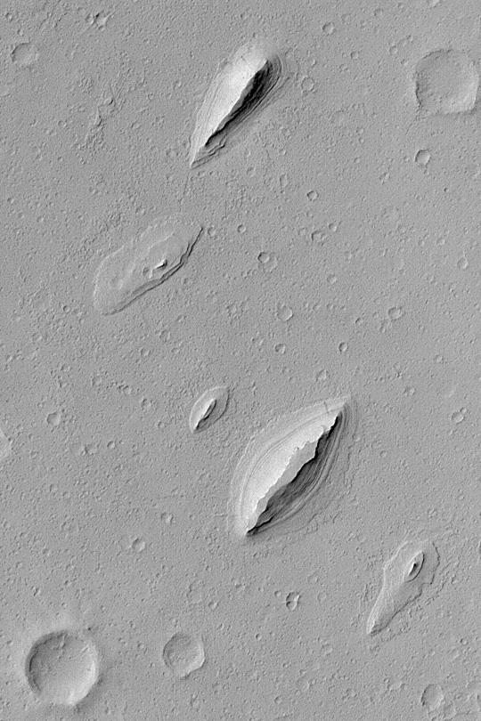
Layered Yardangs in Henry Crater
- Click the image above for a larger view
- Full-Res JPEG (540 x 810) (83.3 kB)
- Full-Res TIFF (540 x 810) (438.1 kB)
Caption:
MGS MOC Release No. MOC2-389, 12 June 2003
This Mars Global Surveyor (MGS) Mars Orbiter Camera (MOC) image shows wind-sculpted remnants of layered sedimentary rock that once completely covered the northwestern floor of Henry Crater, an ancient impact basin located at 11.7°N, 336.4°W. These landforms, shaped somewhat like inverted boat hulls, are "textbook examples" of a wind erosion form known as a yardang . The image covers an area 2.3 km (1.4 mi) wide; sunlight illuminates the scene from the left.
Cataloging Keywords:
| Name | Value | Additional Values |
|---|---|---|
| Target | Mars | |
| System | ||
| Target Type | Planet | |
| Mission | Mars Global Surveyor (MGS) | |
| Instrument Host | Mars Global Surveyor | |
| Host Type | Orbiter | |
| Instrument | Mars Orbiter Camera (MOC) | |
| Detector | ||
| Extra Keywords | Crater, Grayscale, Impact | |
| Acquisition Date | ||
| Release Date | 2003-06-12 | |
| Date in Caption | 2003-06-12 | |
| Image Credit | NASA/JPL/Malin Space Science Systems | |
| Source | photojournal.jpl.nasa.gov/catalog/PIA04571 | |
| Identifier | PIA04571 | |