
|
Reconstructing the Scene of Landing
- Click the image above for a larger view
- Full-Res JPEG (1446 x 1084) (240.2 kB)
- Full-Res TIFF (1446 x 1084) (1.5 MB)
Caption:

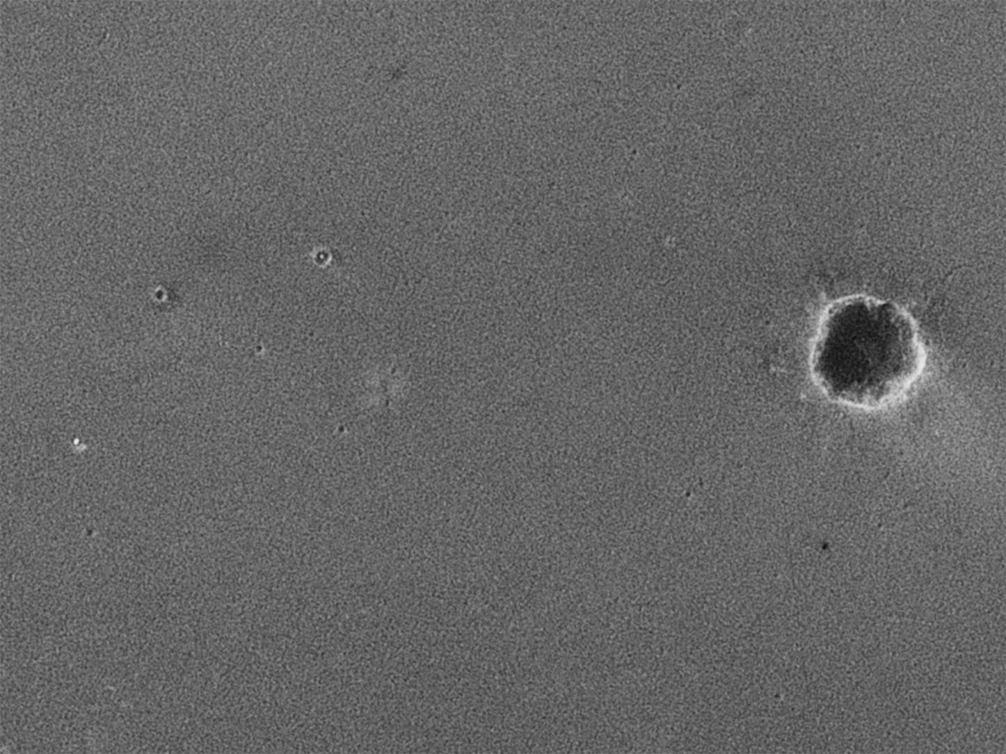
Figure 2
Meridiani Destinations
April 8, 2004
The starting point and planned destinations for surface travels of NASA's Mars Exploration Rover Opportunity are indicated on this image of territory within Mars' Meridiani Planum region (Figure 2). Opportunity landed on Jan. 24, 2004, (Universal Time) in the small bowl later nicknamed "Eagle Crater." After about two months of examining rocks and soils within that crater, the rover set out toward a larger crater informally named "Endurance." During an extended mission following its three-month prime mission, Opportunity may finish examining Endurance, then head for a type of landscape to the southeast called "etched terrain." There, additional deposits of layered bedrock may lie exposed. The underlying image for the map was taken from orbit by the camera on NASA's Mars Global Surveyor.
Cataloging Keywords:
| Name | Value | Additional Values |
|---|---|---|
| Target | Mars | |
| System | ||
| Target Type | Planet | |
| Mission | Mars Global Surveyor (MGS) | Mars Exploration Rover (MER) |
| Instrument Host | Mars Global Surveyor | Opportunity (MER-B) |
| Host Type | Orbiter | Rover |
| Instrument | Mars Orbiter Camera (MOC) | |
| Detector | ||
| Extra Keywords | Crater, Grayscale, Map | |
| Acquisition Date | ||
| Release Date | 2004-02-09 | |
| Date in Caption | 2004-01-24 | 2004-04-08 |
| Image Credit | NASA/JPL/MSSS | |
| Source | photojournal.jpl.nasa.gov/catalog/PIA05229 | |
| Identifier | PIA05229 | |