Opportunity Site: Before and After
Caption:
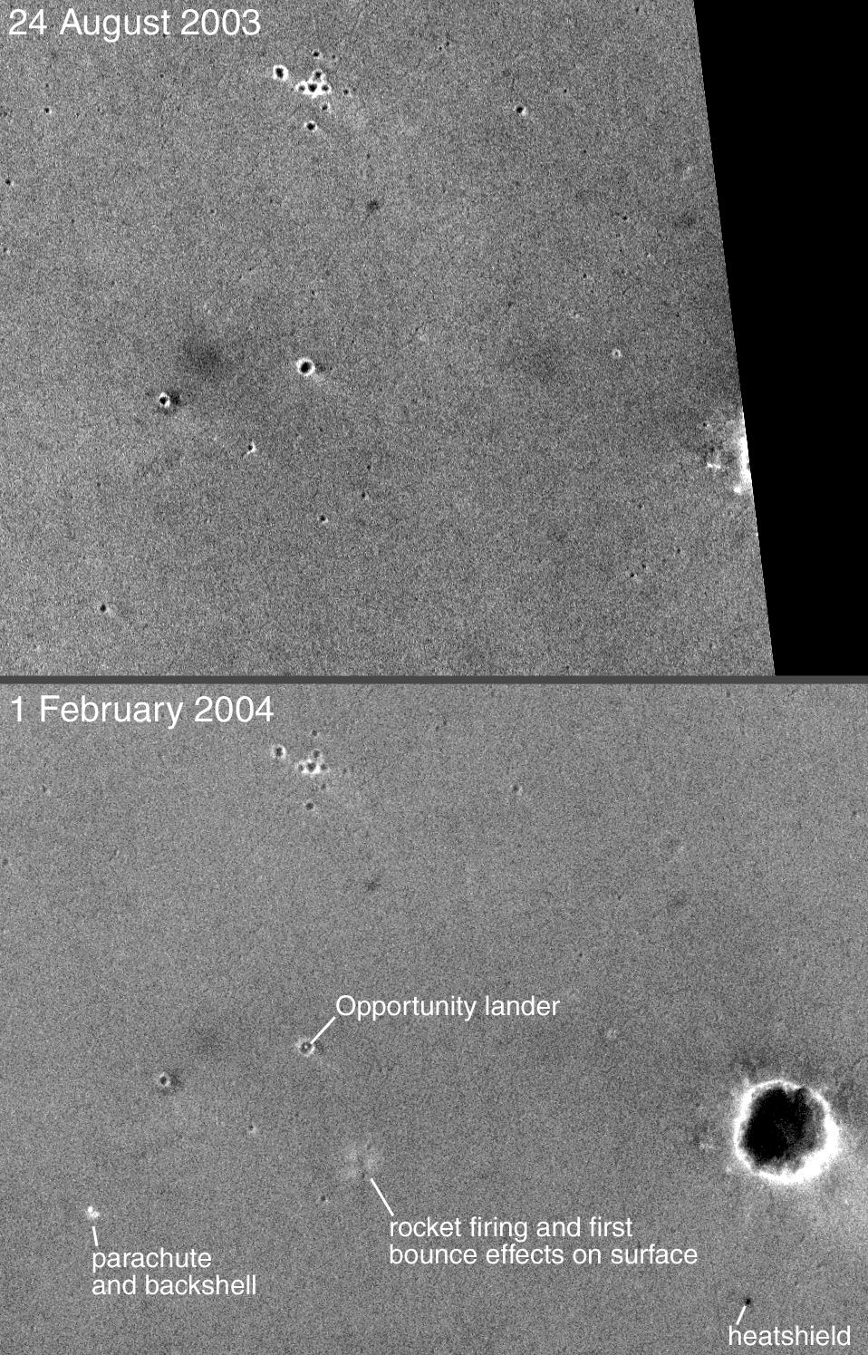
13 February 2004
This pair of Mars Global Surveyor (MGS) Mars Orbiter Camera (MOC) narrow angle images shows the landing site of the Mars Exploration Rover (MER-B), Opportunity, before and after the landing. The first image was acquired on 24 August 2003, five months prior to the 25 January 2004 landing. The second picture, obtained on 1 February 2004, shows the lander--located within a ~20 meter (~66 feet) diameter crater--and other features that resulted from the landing. The Opportunity landing site is located in Meridiani Planum near 2.0°S, 5.6°W. Both images are simple cylindrical map projections with north up and east to the right; the lower image is about 1.4 kilometers (0.9 miles) wide. The dark area on the right side of the upper picture was not imaged by MOC until after the landing. Sunlight illuminates each scene from the lower left.
Cataloging Keywords:
| Name |
Value |
Additional Values |
| Target |
Mars |
|
| System |
|
|
| Target Type |
Planet |
|
| Mission |
Mars Global Surveyor (MGS) |
Mars Exploration Rover (MER) |
| Instrument Host |
Mars Global Surveyor |
Opportunity (MER-B) |
| Host Type |
Orbiter |
Rover |
| Instrument |
Mars Orbiter Camera (MOC) |
|
| Detector |
|
|
| Extra Keywords |
Crater, Grayscale, Map |
| Acquisition Date |
|
| Release Date |
2004-02-13 |
| Date in Caption |
2003-08-24 |
2004-01-25, 2004-02-01, 2004-02-13 |
| Image Credit |
NASA/JPL/Malin Space Science Systems |
| Source |
photojournal.jpl.nasa.gov/catalog/PIA05295 |
| Identifier |
PIA05295 |
