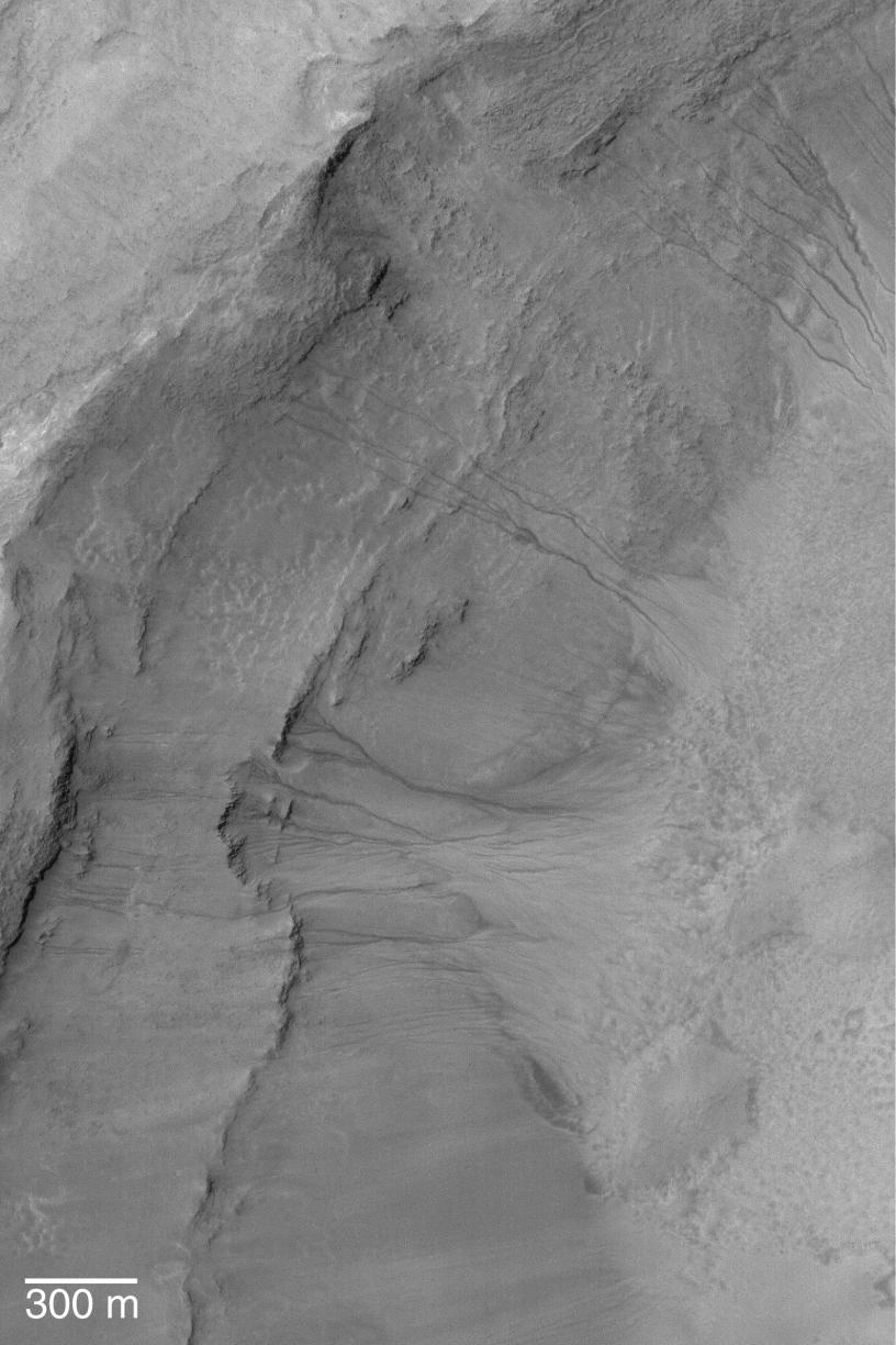
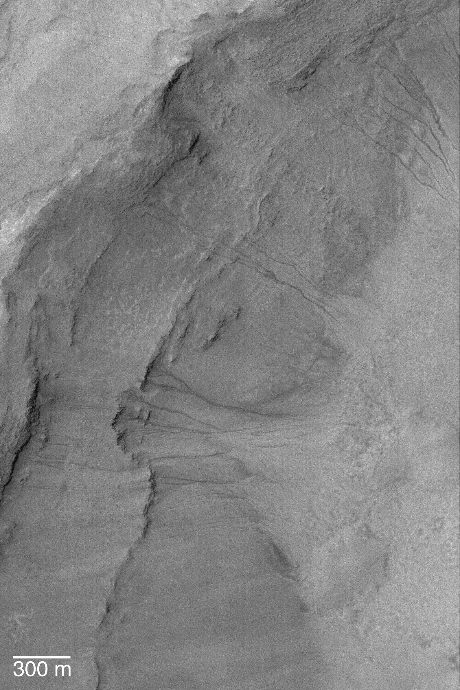
Mid-Latitude Gullies
Caption:
17 March 2004
This Mars Global Surveyor (MGS) Mars Orbiter Camera (MOC) image shows gullies in the wall of a crater near 39.1°S, 200.7°W. Discussion among Mars scientists as to how martian middle-and polar-latitude gullies formed continues to this day. They were first observed in MGS MOC images and reported in June 2000. Most investigators agree that gullies, such as those shown here, were formed by running water, but disagree on whether the liquid came from snowmelt, groundwater, or melting ground ice. Still others argue that the fluid was carbon dioxide, and a few suggest that the gullies formed "dry"--that is, by landsliding processes involving no liquid or gas. This January 2004 MOC full-resolution (1.5 m/pixel; 5 ft./pixel) image is illuminated by sunlight from the upper left. The 300 m scale bar is approximately 984 ft. long.
Cataloging Keywords:
| Name |
Value |
Additional Values |
| Target |
Mars |
|
| System |
|
|
| Target Type |
Planet |
|
| Mission |
Mars Global Surveyor (MGS) |
|
| Instrument Host |
Mars Global Surveyor |
|
| Host Type |
Orbiter |
|
| Instrument |
Mars Orbiter Camera (MOC) |
|
| Detector |
|
|
| Extra Keywords |
Crater, Grayscale, Water |
| Acquisition Date |
|
| Release Date |
2004-03-17 |
| Date in Caption |
2004-03-17 |
|
| Image Credit |
NASA/JPL/Malin Space Science Systems |
| Source |
photojournal.jpl.nasa.gov/catalog/PIA05643 |
| Identifier |
PIA05643 |