skip to navigation

|
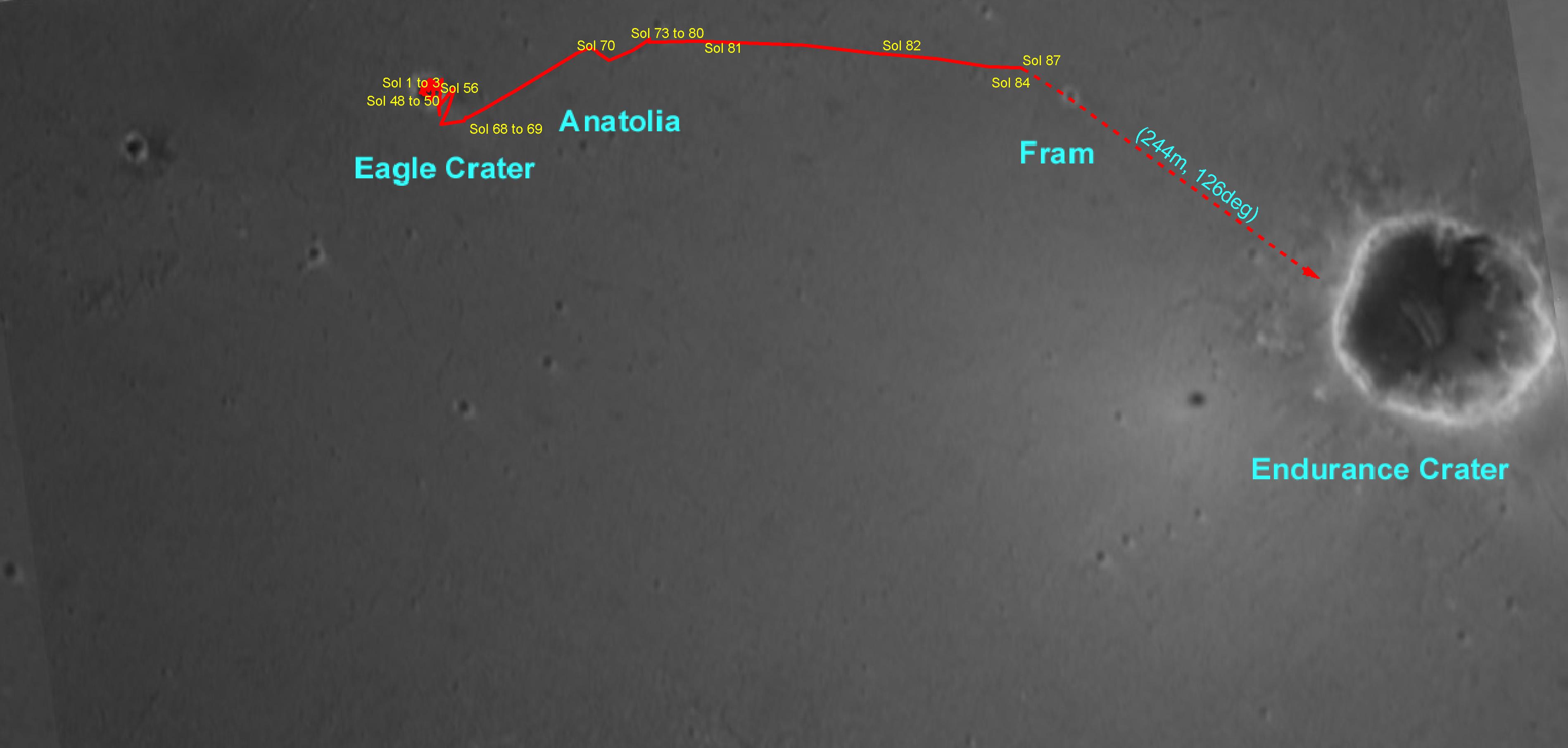
Opportunity’s Travels
- Click the image above for a larger view
- Full-Res JPEG (3796 x 1812) (249.2 kB)
- Full-Res TIFF (3796 x 1812) (4.5 MB)
Caption:
This overview map made from Mars Orbiter camera images illustrates the path that the Mars Exploration Rover Opportunity has taken from its first sol on the red planet through its 87th sol. After thoroughly examining its "Eagle Crater" landing-site, the rover moved onto the plains of Meridiani Planum, stopping to examine a curious trough and a target within it called "Anatolia." Following that, Opportunity approached and remotely studied the rocky dish called "Fram Crater." As of its 91st sol (April 26, 2004), the rover sits 160 meters (about 525 feet) from the rim of "Endurance Crater."
Cataloging Keywords:
| Name | Value | Additional Values |
|---|---|---|
| Target | Mars | |
| System | ||
| Target Type | Planet | |
| Mission | Mars Global Surveyor (MGS) | Mars Exploration Rover (MER) |
| Instrument Host | Mars Global Surveyor | Opportunity (MER-B) |
| Host Type | Orbiter | Rover |
| Instrument | Mars Orbiter Camera (MOC) | |
| Detector | ||
| Extra Keywords | Color, Crater, Map | |
| Acquisition Date | ||
| Release Date | 2004-04-27 | |
| Date in Caption | 2004-04-26 | |
| Image Credit | NASA/JPL/Cornell/OSU/MSSS | |
| Source | photojournal.jpl.nasa.gov/catalog/PIA05822 | |
| Identifier | PIA05822 | |