skip to navigation

|
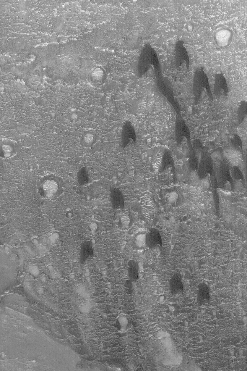
Barchan Dunes
- Click the image above for a larger view
- Full-Res JPEG (836 x 1254) (211.7 kB)
- Full-Res TIFF (836 x 1254) (1.1 MB)
Caption:
28 April 2004
One of the simplest forms a sand dune can take is the
barchan
. The term, apparently, comes from the Arabic word for crescent-shaped dunes. They form in areas with a single dominant wind direction that are also not overly-abundant in sand. The barchan dunes shown here were imaged in March 2004 by the Mars Global Surveyor (MGS) Mars Orbiter Camera (MOC) as it passed over a crater in western Arabia Terra near 21.1°N, 17.6°W. The horns and steep slope on each dune, known as the
slip face
, point toward the south, indicating prevailing winds from the north (top). The picture covers an area about 3 km (1.9 mi) across and is illuminated by sunlight from the lower left.
Cataloging Keywords:
| Name | Value | Additional Values |
|---|---|---|
| Target | Mars | |
| System | ||
| Target Type | Planet | |
| Mission | Mars Global Surveyor (MGS) | |
| Instrument Host | Mars Global Surveyor | |
| Host Type | Orbiter | |
| Instrument | Mars Orbiter Camera (MOC) | |
| Detector | ||
| Extra Keywords | Crater, Dune, Grayscale | |
| Acquisition Date | ||
| Release Date | 2004-04-30 | |
| Date in Caption | 2004-04-28 | |
| Image Credit | NASA/JPL/Malin Space Science Systems | |
| Source | photojournal.jpl.nasa.gov/catalog/PIA05844 | |
| Identifier | PIA05844 | |