skip to navigation
|
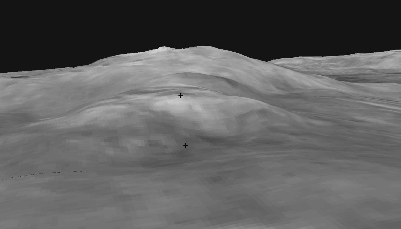
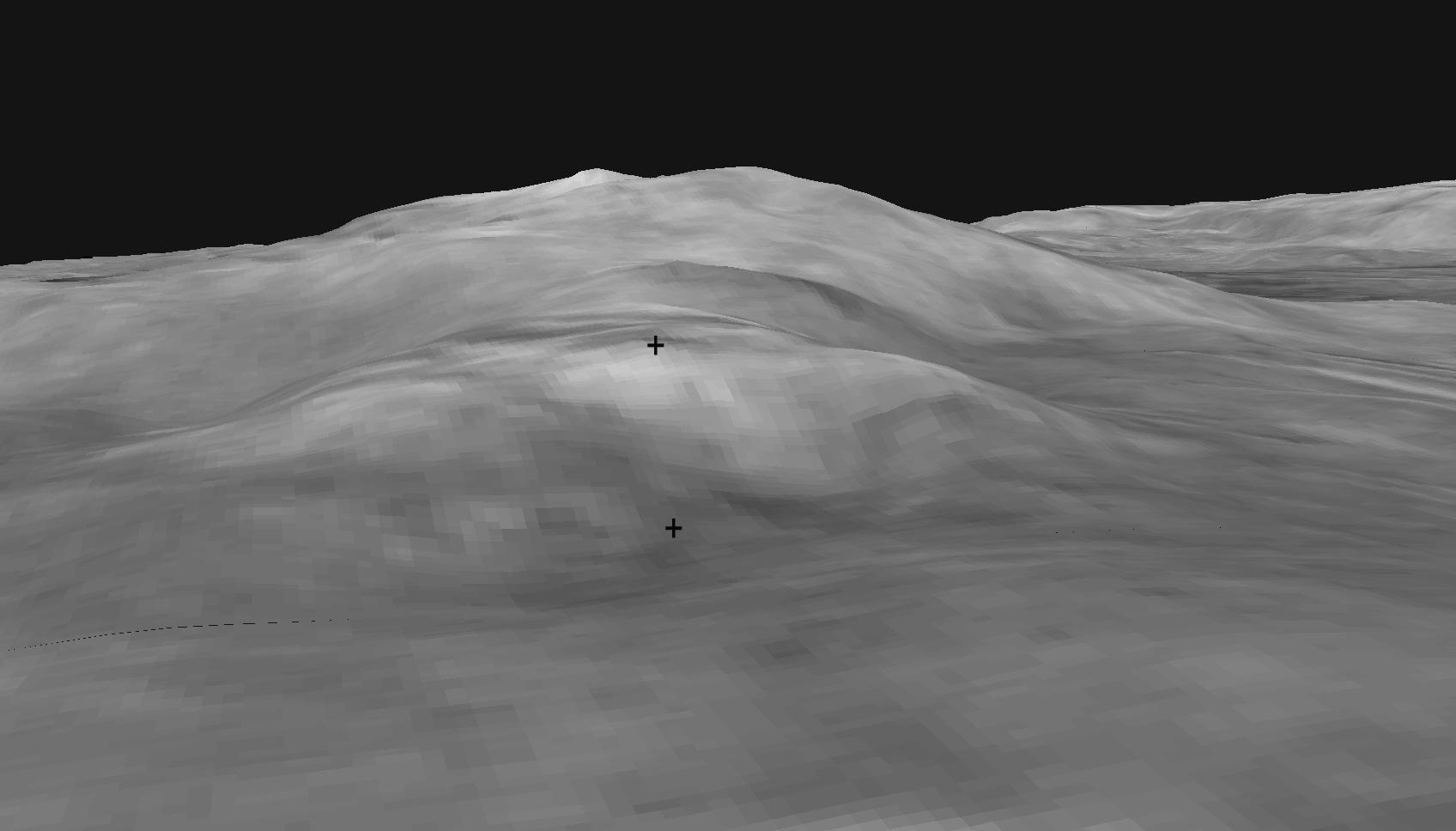
Slippery Slope?
- Click the image above for a larger view
- Full-Res JPEG (1696 x 968) (68.1 kB)
- Full-Res TIFF (1696 x 968) (499.1 kB)
Caption:
This digital elevation map shows the topography of the "Columbia Hills," just in front of the Mars Exploration Rover Spirit. Rover planners are currently plotting the safest route for Spirit to climb to the front hill, called "West Spur." The direct path from the bottom crosshatch to the top crosshatch may be too steep. Data from the Mars Orbital Camera on the orbiting Mars Global Surveyor were used to create this 3-D map.
Cataloging Keywords:
| Name | Value | Additional Values |
|---|---|---|
| Target | Mars | |
| System | ||
| Target Type | Planet | |
| Mission | Mars Global Surveyor (MGS) | Mars Exploration Rover (MER) |
| Instrument Host | Mars Global Surveyor | Spirit (MER-A) |
| Host Type | Orbiter | Rover |
| Instrument | Mars Orbiter Camera (MOC) | |
| Detector | ||
| Extra Keywords | Grayscale, Map | |
| Acquisition Date | ||
| Release Date | 2004-06-16 | |
| Date in Caption | ||
| Image Credit | NASA/JPL/USGS/MSSS | |
| Source | photojournal.jpl.nasa.gov/catalog/PIA06274 | |
| Identifier | PIA06274 | |